Curated OER
Mexico Map
In this blank outline map worksheet, students study the political boundaries of the North American country of Mexico. This map may be used in a variety of classroom activities.
Curated OER
Mexico Map
In this blank outline map worksheet, students study the political boundaries of the North American country of Mexico. The capital cities of each state are denoted with stars.
Curated OER
Mexico and Central America Map
In this outline map worksheet, students study the political boundaries of Mexico and the Central American countries. This map is labeled with the country names.
Curated OER
United States Map
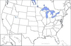
In this United States outline map instructional activity, students make note of the political divisions of 50 states of the nation. This map may be used in a variety of classroom activities.
Curated OER
United States Map: Capitals
In this United States outline map worksheet, students make note of the political divisions of 50 states of the nation. This map is labeled with the 50 state capitals.
Curated OER
Early European Explorers Map
Fifth graders create an explorer's map. In this explorers lesson students use a map of the world as reference to draw their own map of Europe, North America, Central America, and the Caribbean Islands. The students use their maps to show...
Curated OER
World Map Labels
In this geography skills worksheet, students identify the countries and bodies of water labelled on the maps of the world, Africa, Asia, Canada, Europe, the Caribbean, the Middle East, North America, Australia, and South America.
Curated OER
Food on the Map
Students work together to examine the tastiest towns in the United States. After discovering the names of the equipment, they identify the seven continents. They take a survey and locate the cities and states of the foods mentioned.
Curated OER
Rivers, Maps, and Math
Students use maps to locate and label the major rivers of North and South America. Using the internet, they identify forests, grasslands, mountain ranges and other landforms on the continents as well. They compare and contrast the...
SeaWorld
Animal Migrations
Here is a fabulous set of activities for your young scientists. Each lesson contains map, hands-on, and game activities that will help the class understand why and how animals migrate from one place to another. First they'll examine the...
Curated OER
"We're Back ... Eagles Soar!"
Students use information from Internet websites to create a map of where Bald Eagle habitats can be found after being familiarized with the map by the instructor.
Curated OER
Mapping Population Changes In The United States
Students create a choropleth map to illustrate the population growth rate of the United States. They explore how to construct a choropleth map, and discuss the impact of population changes for the future.
Curated OER
United States Map- Continent, Country, State
Young scholars identify their continent, country, and state on a globe. In this geography lesson plan, students use a globe to identify the seven continents, the United States, and the state which they live in. Young scholars define key...
Curated OER
Natural History of Costa Rica
Students use outline maps to become acquainted with Costa Rica. They see how it was formed and how its origin has created very diverse environments. Students then use atlases and compare their physical maps with maps of climate and the...
Curated OER
United States Map
Students compare the United States on a globe and on a map. In this map lesson, students relate the sizes of the continents and locate the United States. Students identify the location of the continental US as well as Alaska and Hawaii.
Curated OER
The Early Peoples
Young scholars, after studying The Early Peoples, explain and give examples of how Native Americans and Europeans adapted to living in certain environments. They give examples of early cultures and settlements that existed in North...
Curated OER
Mapping La Salle's Travels
Students use the internet to create a map showing the path of La Salle through North America and the Caribbean. They identify the main geographic features of the two areas and the main French forts. They also complete a timeline.
Curated OER
The Bear Facts
Students explore various kinds of bears and gather information about them. In this research and habitats lesson plan, students chart their bear information on large posters with illustrations of their bears. Students map the...
California Academy of Science
Kinesthetic Astronomy: Earth's Rotation
After completing the activity, "Kinesthetic Astronomy: The Meaning of a Year," zoom in on Earth's rotation using the same simulation setup and this outline. Each class member dons a map of the Western Hemisphere and plays the part of...
Curated OER
What They Left Behind: Early Multi-National Influences in the United States
Students examine how the European voyages of discovery influence American culture even today. They map eighteenth century Europe's impact on the United States.
Curated OER
It Bears Repeating!!!
Students research bears and their characteristics with a specific study on North American bears and polar bears. For this bear study lesson, students read books about polar bears and wild bears. Students complete activities to further...
Curated OER
Continents
Young scholars investigate World Geography by researching the different continents. In this Asian Geography lesson, students discuss the continent of Pangaea and color a worksheet of the continents. Young scholars locate China on the map...
Curated OER
Our States, My State
Here is a very nice instructional activity on the shape of the United States, and the shapes of the individual states for your young geographers. They utilize worksheets embedded in the plan to color in a variety of states and to become...
Curated OER
Our States, My State
Students examine the Louisiana state quarter and locate Louisiana on a map of the U.S. They relate the location of Louisiana to other states (and vise versa) using directions and the compass rose.


