VIF Learning Center
Languages as Reflection of Cultures and Civilizations: French Speaking Countries
Expand your class's vision of the French-speaking world by conducting this research project. Pupils focus on building 21st-century skills while they look up information about a French country and put together presentations.
Curated OER
Cave Men to Cave Painting
Students explore the Ice Age. In this geology and social studies lesson, students read the book Eyewitness Books Early Humans and create a KWL chart about the Ice Age. Students locate Asia and North America on the World Map and...
Curated OER
People of the Plains: Roles of Men And Women
Fourth graders study the geography of North America and the indigenous people who lived there. They read about rules, games, toys and dolls, and education. They fill out Venn Diagrams comparing the roles of men and women during the videos.
Curated OER
Internet Hunt at the "Fact Monster" Web Site- May #3
In this Internet fact hunt worksheet, learners access the "Fact Monster" web site to find the answers to 5 multiple choice questions. They answer science, history, and geography questions.
Curated OER
Old World and New World - Why Contact Took So Long
Students use a globe to determine why contact between the old world and the new world took a long time. In this map skills lesson, students analyze routes between regions to determine why it took so long for the old world and the new...
Curated OER
We've got the whole world in our hands
Students explore spatial sense in regards to maps about the globe. In this maps lesson plan, students label oceans, locate the continents and poles, follow directions, and explain the symbols on a map.
Curated OER
Cacao Tree Geography
Students use a map to learn about where chocolate comes from. In this lesson on the cacao tree, students locate various regions where the cacao tree grows. They will discuss why the cacao tree grows more favorably in particular climates...
Curated OER
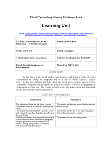
A Visit to Mexico City: An Introduction to World Communities
Third graders complete a variety of activities as they take an imaginary trip to Mexico City, complete with passports, maps, and Spanish dictionaries. They write postcards to send home and create items to sell at the market. The unit...
Curated OER
Passport to Stories Around the World
Students read stories from various cultures and create a passport indicating the completion and comprehension of the story. The template for the passport is included. The instructional activity can be used for a broad range of ages...
Curated OER
Mayan History
Students examine Mayan contributions to the world. In this Mesoamerican culture instructional activity, students view a slideshow about the Maya and then peruse books about the accomplishments of the...
Curated OER
Compare and Contrast Culture
Fifth graders compare and contrast the cultures of American culture with that of the other cultures of North America. Using traditional and Internet research, 5th graders gather data on one element of culture for comparison. Data...
Curated OER
Regions of South America
Students explore facts about South America in the four lessons of this unit. Booklets are created from the materials produced as the class delves into the topic.
Curated OER
North African and Southwest Asian Architecture
Seventh graders search online for current and historic images of North African and Southwest Asian architecture. They compare North African and Southwest Asian architecture to North American, European, Russian/Eurasian, and South...
Curated OER
Landforms and Resources of the United States and Canada
For this North American geography worksheet, students read about the physical features and resources of the United States and Canada. Students take notes and answer 3 short answer comprehension questions as they read the selection.
Curated OER
World Cities
Young scholars examine the settlement patterns of world cities. In groups, they are given a region of the world and asked to create a city in the location. They are given a set of characteristics of the city and determine what would be...
Curated OER
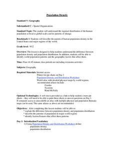
Population Density
Students examine world population density and population distribution. They create pie charts showing population distribution and analyze population patterns in the United States and major regions of the world. They identify...
Curated OER
South Asian Architecture
Seventh graders review and discuss architecture from South Asia. They then study images of various buildings from North Africa/Southwest Asia, and make comparisons
Curated OER
Getting to Know My World
Students participate in hands-on activities using maps and globes to identify geographical features. Students use map legends to identify direction. Students locate oceans, continents, countries, states and cities. Handouts and...
Curated OER
Identifying Continents and Oceans
Students locate and identify the four major oceans and the seven continents on a world map. They use an unlabeled world map and compass rose to describe relative locations of the continents and oceans.
Curated OER
African Architecture
Seventh graders investigate cultural influences on architecture in Africa south of the Sahara. They compare the architecture to that in North America, Europe, Russia, and North Africa, Asia, and South America.
Curated OER
Chinese Classroom Internet Activity
Students use the internet to complete an online activity in Chinese. Using the weather section, they research the weather conditions in Hong Kong and other popular cities in China. They answer Chinese questions in Chinese about the...
Curated OER
Tracing Our Own Family Pilgrimages
Students observe a world map and are introduced to vocabulary like: cities, continents, rivers, lakes, and oceans. They discuss the names of the cities they live in and locate them on the map; then using a colored pushpin indicate: the...
Curated OER
Off to the Future
Students read a handout and predict the position of the San Andreas Fault far in the future. In this future world lesson, students use a map worksheet to demonstrate the path of the Pacific Plate millions of years from now.


