Curated OER
The Biggest Plates on Earth
The best part about teaching guides is all the great information you can use to inform your class. They infer what type of boundary exists between two tectonic plates. Then, using given information on earthquakes and volcanism they'll...
Curated OER
Searching for Stars
Positive character traits in literature are explored in this character development and literacy lesson plan. Learners listen to Cinderella by Charles Perrault and Little Gold Star by Robert D. San Souci, followed by a discussion...
National Park Service
Civil War to Civil Rights: From Pea Ridge to Central High
Explore how the Civil War impacted the Civil Rights Movement. Class members complete a series of projects for a unit that uses a layered curriculum approach to learning.
Smithsonian Institution
Comparing Confederate and Union Soldiers
The Civil War, a war that divided a nation. Comparing and contrasting the Confederate and Union soldiers is not always an easy task, but the eighth of 15 resources makes it easy to teach the concepts. Exercises include watching videos in...
Curated OER
Trekking to Timbuktu: The Geography of Mali -Teacher Version
Learners investigate the geography of Mali. They locate Mali on a satellite map, explore various websites, describe the landscape and climate, label a map, and write an essay about the Niger Riger.
Charlesbridge
Under the Freedom Tree: A Readers Theater
Susan VanHecke's Under the Freedom Tree is transformed into a 12-part readers theatre script appropriate for a performance by upper-elementary classes.
Jeopardy Labs
Third Grade Social Studies Review
In this interactive JeopardyLab game, with the assistance of a teacher, students can play against each other or in teams to review the content of Third Grade Social Studies. Allow the first team to choose a topic and a point value for a...
Curated OER
Plate Tectonics
Students simulate the three types of plate boundaries using robots. In this earth science lesson plan, students explain how earthquakes and volcanoes are formed. They collect real-world earthquake data and plot them on the map.
Curated OER
Reading Comprehension Skills: The Atlantic Ocean
In this reading comprehension learning exercise, students read a 2-page article regarding the Atlantic Ocean. Students respond to 10 true or false questions regarding the article.
Curated OER
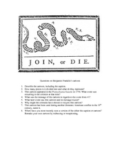
Questions on Benjamin Franklin’s Cartoon
For this primary source analysis worksheet, students examine Benjamin Franklin's "Join or Die" political cartoon and then respond to 8 short answer questions based on their analysis of it.
Curated OER
Birds and Migration
Students actively simulate bird migration. In this animal migration lesson, students participate in an activity that simulates the migration of birds. The teacher discusses with the class the hazards and difficulties birds face during...
Curated OER
Retain or Abandon, Adapt or Convert? The Immigrant's Dilemma
Middle schoolers read and discuss a narrative exploring how immigrants retain their own cultures or assimilate into the host country. They examine the emigrant's experience in Liberia and write a position paper.
Curated OER
Gray Whales on the Move
Students study whale migration and their natural history. In this migration lesson students plot whale migration on a map and describe their ecosystems.
Curated OER
Indian Removal: The Cherokees, Jackson, and the “Trail of Tears”
Students examine executive power. In this Indian Removal lesson, students listen to their instructor present a lecture regarding the "Trail of Tears". Students respond to discussion questions regarding the lecture.
Curated OER
Give Me Some Latitude
In this latitude worksheet, students use an atlas or other reference to respond to 4 multiple choice questions about the equator and the poles.
Curated OER
Chapter 25 – The Vietnam War
In this U.S. history worksheet, students read assigned textbook pages regarding the Vietnam War and respond to 56 short answer questions.
Curated OER
Natural History of Costa Rica
Young scholars use outline maps to become acquainted with Costa Rica. They see how it was formed and how its origin has created very diverse environments. Students then use atlases and compare their physical maps with maps of climate and...
Curated OER
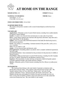
AT HOME ON THE RANGE
The student will learn how ranchers on the western frontier helped saved the bison from extinction.Hand out student worksheets. Have students read the information about bison on Student Worksheet A before completing Student Worksheet...
Curated OER
World Map and Globe - Lesson 15 Mountains of the World
Students locate major world mountain ranges. In this geography lesson, students identify major mountain ranges on 6 on of the 7 continents on a large world physical map.
Curated OER
World Map and Globe - Lesson 15 (K-3)
Students discover mountain ranges and their locations in the world. In this physical map lesson, students locate and identify major mountain ranges of the world on a large physical map.
Curated OER
By Land or by Sea...or Both?
High schoolers research a video and participate in a discussion. In this watercraft lesson students review material and answer questions about what they learned.
Curated OER
We Arrived 10,000 Years Ago...
Students explain ways that humans migrated from Asia and settle in the Americas. In this investigative lesson students participate in a brief archaeological demonstration and review what they learned.
Curated OER
History and Government of the United States
In this U.S. worksheet, students take notes in a graphic organizer as they read several passages, then answer four comprehension questions.
Curated OER
Underground Railroad
Fourth graders use internet cites to explore the Underground Railroad. They also learn the importance of the Emancipation Proclamation. Focus questions are included.


