Curated OER
Missouri Time Scale
Learners plot events that happened years ago beginning with volcano activity. In this investigative lesson students are introduced to the different eras and plot them on a map.
Curated OER
Global Perceptions: How Your Students View the World
Learners examine their own perceptions and attitudes about places around the world. Using their mental maps, they compare and contrast it with a world map from different periods in history. They review the various types of map...
Curated OER
The Splendor of Canada's Provinces and Territories
Sixth graders use a map of Canada to label all provinces and territories as well as write information about each location. Using books, they read about each province and territory and write down adjectives describing them. They paint a...
Curated OER
Sharing The Land
Students investigate different geographical terms and concepts. This is done with practicing with maps of the United States to find major coasts, lakes, and rivers. They also put together a floor map of the United States. Students create...
Curated OER
Reading Around the World
Students use the internet to identify the seven continents. Using maps, they locate and identify major physical features of Earth. They are read different books by various authors on the Earth and answer questions related to it. They...
Curated OER
Climate and Topography, What Is the Connection?
Fourth graders study Neumann's world continent map and explore topography and climate.
Curated OER
CURRENT AND CLIMATE
Students study currents and how they have been used to plot courses for travel. They examine the ocean currents in both the Atlantic and Pacific and discuss their effect on local weather.
Curated OER
Landforms All Around
Students create a "Landform Dictionary". They develop an overlay map and participate in hands-on activities to identify the key characteristics of landforms. They discuss the plant and animal life of these areas. Handouts for the lessons...
Curated OER
Testing the Waters
Students explore water in depth through discussion, research, and experiment. Students apply map skills to locating particular regions of the world as they relate to water. Students predict water quality based on information researched...
Curated OER
Social Studies and Children's Literature
Young scholars write a journal in response to literature. The story that is read is about prairies. The subject of prairies becomes an object for research. The culminating activity is the making of a map where prairies exist in the...
Curated OER
VAcations in Northern California
Students explore the natural resources and National Parks of Northern California that are commonly visited by people traveling in the United States. They use maps to locate various sites, plan a highway travel route and use the internet...
Curated OER
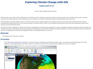
Exploring Climate Change with GIS
Students investigate climatological changes that are occurring to the Earth. In this climate change lesson, students access an assigned web site to view maps and lessons that show how climate change makes a difference to life on Earth.
Curated OER
Finding the Mother Lode
Learners engage in a paper treasure hunt to find a lode deposit of gold using the placer deposit concentrations of metals found in stream sediments. They use topographic maps and metal concentrations to assist them. Students discuss the...
Curated OER
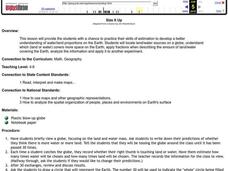
Size It Up
Students practice their math skills in determining the water/land proportions of the Earth. Using globes, they locate the seven continents and oceans and determine which covers more space. They use this information to participate in...
Curated OER
Biome Web Quest
Third graders create paper mache globes, paint them and label the oceans and the continents. In groups, they research a biome, write about it and create an artistic visual representation of the biome and present it to the class.
Curated OER
Amos and Boris: Text Study
Twenty insightful questions follow a read aloud of the story, Amos and Boris by William Steig. Scholars then show what they know through completion of a cause and effect chart, reading fluency assessment, and a written explanatory or...
Curated OER
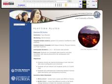
Plotting Plates
Middle schoolers investigate plate tectonics and their correlation with natural phenomena like earthquakes and volcanoes. They use the internet to see real-time data about earthquakes and volcanoes. Students plot latitude and longitude...
Curated OER
Sea Secrets
Students study the following: For centuries, people have been challenged by the mysteries that lie beneath the blue depths of our ocean planet. Very little was known about the ocean until late in the nineteenth century, although nearly...
Curated OER
Ocean Floor
Students identify ocean floor features. In this earth science lesson, students predict the object inside a close box to make them realize the difficulties scientists faced then. They label the different zones of the ocean floor after the...
Curated OER
Science: Hurricanes As Heat Engines
Pupils conduct Internet research to track the path of Hurricane Rita. They record the sea surface temperature of the Gulf of Mexico during and after the hurricane and draw conclusions about how hurricanes extract heat energy from the...
Curated OER
Coral Bleaching in the Caribbean
Learners use authentic satellite data on the NASA website to determine when the sea surface temperature meets the criteria to induce coral bleaching.
Curated OER
Secrets in a Grain of Sand
Students working in small groups examine beach sand to discover signs of erosion, weathering, ocean currents and waves. They present their findings to the class.
Curated OER
Observing Lava Flows
Students examine the difference between fast and slow spreading lava flows. They identify various types of lava flow and determine the factors that cause them to form. Viewing photographs of lava flows, students working in groups,...
Curated OER
Recent Volcanoes And Earthquakes:
Students investigate the current model for the structure of the Earth. On a world map, they mark areas where they think earthquakes and volcanoes occur and compare those areas with earthquake and volcano location patterns.


