Curated OER
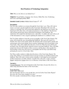
Who Are the Aliens in Our Inland Seas?
Students work in teams to research specific landforms in Great Lakes Watershed, compile information into data table, and write legend explaining landform for children's book. Students then research area surrounding landform, compile...
Curated OER
Asia Rivers Map Quiz
For this online interactive geography quiz worksheet, learners examine the map that includes 18 Asian rivers. Students match the names of the rivers to the appropriate locations on the interactive map.
Curated OER
Europe Rivers Map Quiz
For this online interactive geography quiz worksheet, students examine the map that includes 14 European rivers. Students match the names of the rivers to the appropriate locations on the interactive map.
Curated OER
Of Maps and Worldviews
Students explore Ptolemy's world map as an expression of the Renaissance view of the world.
Curated OER
Identifying Continents and Oceans
Learners locate and identify the four major oceans and the seven continents on a world map. They use an unlabeled world map and compass rose to describe relative locations of the continents and oceans.
Curated OER
World Oceans
Students locate the world's oceans. In this geography skills lesson, students chart the locations of the Indian, Arctic, Pacific, and Atlantic Oceans on world maps.
Curated OER
Mapping West Virginia
Fourth graders explore West Virginia. In this Unites States geography lesson, 4th graders discuss the type of land and the cities in West Virginia. Students create two overlays, with transparencies, that show the natural land and the...
Curated OER
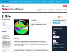
El Nino
Explore the properties of water and the affects of El Nino. Middle schoolers will learn about the devastation an El Nino can cause as well as the definition of El Nino. Additionally, they will discover the cause of El Nino along with the...
Consortium for Ocean Science Exploration and Engagement (COSEE)
Climate Change Impacts on Blue King Crabs
Carbon dioxide is not only causing global temperatures to increase, it causes the oceans to become more acidic. Lesson focuses on the blue king crab and the fragility of the habitat due to climate change. Scholars create a concept map...
California Academy of Science
Tropical Belt
Where in the world is the equator? Explore a world map with your class, coloring in oceans, continents, and rainforests while locating the three major lines of latitude: the equator, Tropic of Cancer, and Tropic of Capricorn. Discuss how...
Curriculum Corner
Earth Day Book
This Earth Day, celebrate our beautiful planet with an activity book that challenges scholars to show off their map skills, complete a crossword puzzle, write acrostic poems, alphabetize, and reflect on their personal Earth-friendly habits.
Curated OER
Follow Your Dreams: Career Goals
It is so important for impending high school graduates to start thinking about their potential careers. Here, they discuss the persistence of Blondie Hasler and his impressive transatlantic trip. They follow various routes on a map and...
Curated OER
Tracking Ocean Ecology
Students look at the data maps given to them about how chlorophyll affects the algae blooms and make predictions about the harm they will cause. In this data maps lesson plan, students manipulate data sets from the website.
Curated OER
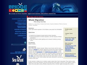
Whale Migration - The Long Journey
Marine biology learners examine right whale sighting data from the WhaleNet website. They plot the data on a map and write down the number of adults and calves spotted. Questions accompany the data analysis activity, making this a...
Centers for Ocean Sciences
Ocean and Great Lakes Literacy: Principle 1
Is your current lesson plan for salt and freshwater literacy leaving you high and dry? If so, dive into part one of a seven-part series that explores the physical features of Earth's salt and freshwater sources. Junior hydrologists...
Curated OER
Mapping The Ocean Floor
Young scholars explore and analyze the bottom structure of underwater habitats. They describe and explain what can't see through the collection and correlation of accurate data. Learners assess that technology is utilized as a tool for...
Curated OER
Ocean Animals - A Kindergarten Research Project
Something’s fishy! Assign each of your pupils an individual sea creature and investigate the oceans. Young oceanographers utilize Kidspiration software to research a creature, illustrate an image, and create fact cards about their...
Curated OER
Ancient Greece Map Worksheet
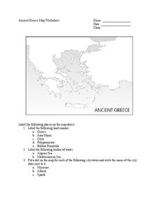
Since the beginning of time, geography has shaped the development of human civilization, and ancient Greece is no exception. This activity supports young historians with exploring this relationship as they first identify key land masses,...
Curated OER
Regents High School Examination: Physical Setting Earth Science 2006
Test your class on earth science with this extensive resource. This test, created by The University of the State of New York Regents, is made up of 50 multiple choice questions and 32 short answer questions that cover the branches of...
NOAA
Community Ecology and Sampling
Seamounts in the Coral and Tasman Seas are home to more than 850 different species. Groups explore hydrothermal vents, researching the organisms found there and their energy source. They also learn about seamounts, exploring their unique...
Library of Congress
Treasure Island
For 30 years, Long John Silver has sailed the seas. An eBook version of Treasure Island introduces readers to the tales Long John Silver has to tell. This 1883 version of the text includes an introduction to encourage critical thinking...
Curated OER
Introduction to the United States Map
Students identify the United States of America and it's states on a map. In this mapping instructional activity, students examine a globe and find the United States as well as a few land marks (Florida and the Great Lakes). Students...
Curated OER
Name That Continent
Pupils practice locating the seven continents, four hemispheres, and four oceans using a large world map and a review song. They also import a world map to the Kid Pix computer program then type in proper labels on the map. There are...
Curated OER
World Map and Globe - Lesson 1 Introduction to the Globe
Learners explore the earth with maps and globes. In this map lesson, students use maps and globes to locate oceans and continents.


