Wild BC
Greenhouse Gas Guzzlers
Teams of six to eight players imagine that they are driving in a vehicle and collect balls that represent carbon dioxide emissions based on their different activities. "Greenhouse Gas Guzzler" cards tell teams how many balls to collect...
Midnight Martian
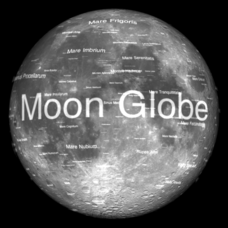
Moon Globe
Not just a simple globe of the moon, this interactive version allows you to choose lighting according to the location of the sun, views from different positions on Earth, and more! Satellite images and topographic data have been combined...
American Museum of Natural History
Earthquakes Tremors From Below
Earthquakes are really no one's fault. A thorough lesson explains the different types of earthquakes how they happen. Learners interact with the online lesson to simulate earthquakes and examine their results. The lesson is appropriate...
Curated OER
Plate Tectonics: Fourth Grade Lesson Plans and Activities
The pre-lab portion of the lesson introduces emerging geologists to the various layers that make up Earth. After completing a sheet on the identification of the layers, class members simulate plate boundaries and their...
Montana State University
Sea Floor to Summit
Who knew that mountain formation could be so entertaining? Leanr how mountains form with a resource on Mount Everest. Activities to guide learning include a simulation, project, videos, coloring activities, and worksheets.
Chicago Botanic Garden
Micro-GEEBITT Climate Activity
A truly hands-on and inquiry based learning activity bridges all the lessons in the series together. Beginning with a discussion on average global temperatures, young meteorologists use real-world data to analyze climate trends in order...
Curated OER
Identifying Watersheds with Topographic Maps
Middle schoolers model a watershed and delineate one using topographic maps. For this hydrology lesson, students use aluminum foil to model a landscape and observe how water moves on it. They also observe the features of a topographic...
Teach Engineering
Earthquakes Living Lab: Designing for Disaster
Build and design to rock and roll. Pairs research building design in earthquake areas and use computer simulations to see the effects of earthquakes on buildings,. They then sketch and explain a building design that would withstand...
National Park Service
The Water Cycle Game
Take young scientists on a trip through the water cycle with this interactive science activity. After setting up a series of ten stations representing the different places water can be found, children use the included printable dice...
Curated OER
Structure of the Earth
Sixth graders investigate earthquakes and volcanoes. They demonstrate fault lines with a folded piece of paper, conduct an erosion experiment, and construct a volcano using clay, baking soda and vinegar.
Virginia Department of Education
Hurricanes: An Environmental Concern
Hurricanes, typhoons, and tropical cyclones are the same type of storm, but their names change based on where they happen. Scholars use a computer simulation to learn about hurricanes. Then they hypothesize ideas to prevent hurricanes...
Science Matters
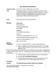
Up and Down Fault Blocks
The Sierra Mountains in Nevada and the Tetons in Wyoming originally formed as fault block mountains. In order to visualize these fault blocks, pupils use construction paper to create layers of earth. They cut the paper models and form...
Curated OER
Terrabagga Activity Using a Magnetometer
Clever! Earth science learners construct a model of a planet containing a magnetic core. The planet, Terrabagga, is made out of a paper grocery bag, magnets, a dead D battery, and rubber bands. Pictures of each step of the construction...
Curated OER
Erosion in Different Soils
Fourth graders observe and identify the effects of weathering and geological activities. They take part in an excellent hands-on group activity called "Erosion Race," in which each group tries to simulate erosion of soil in the quickest...
Curated OER
Earthquakes
Students inspect the causes and effects of earthquakes and examine how seismic waves travel. In this earthquake lesson, students determine where earthquakes happen and why, before determining how to build an earthquake resistant...
Curated OER
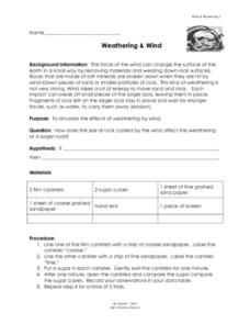
Weathering and Wind
In this weathering and wind worksheet, students simulate the effects of weathering by wind using 2 canisters, 2 types of sandpaper and 2 sugar cubes. Students swirl the sugar cubes inside the canisters lined with fine and course...
Curated OER
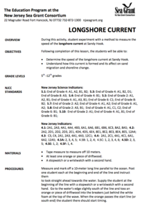
Longshore Current
Learners are posted at the beginning and end of a 10-meter long line parallel to the ocean and are instructed to look straight ahead towards the water. The student at the beginning of the line uses a stopwatch, goes to the water's edge...
Curated OER
Archaeology: Digging in the Classroom
Learners explore how an archaeologist works and makes discoveries. In this archaeology lesson, students participate in a simulation in which they excavate broken pottery. Learners use measurement, geometry, and observation skills during...
Curated OER
Properties of the Ocean: Change
Students research and create a visual presentation on the seasonal salinity of the Earth's oceans. They apply the research in a simulation of a lab disaster in which they must relabel ocean samples.
Curated OER
Apparent Motion of the Sun
Demonstrate the path of the sun across the sky at different times of the year with an engaging science lesson. Learners use a series of questions and diagrams to examine the movement of the sun and appearance of the sky around...
Curated OER
Earthquake Epicenters and Magnitudes
Learners work on a virtual earthquake to increase their understanding of seismograms, earthquake epicenters, Richter Magnitude and triangulation when finding the epicenter of an earthquake.
Curated OER
Sonar Mapping
Students use a shoe box to create a seafloor model and use cardboard for layering inside of the shoe box to simulate the ocean floor. They probe the ocean floor to simulate sonar echoes. Finally, students graph their data to get a...
Curated OER
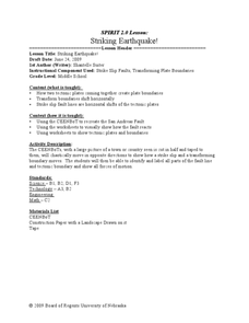
Striking Earthquake!
Students simulate strike slip faults using CEENBoTs. In this earth science lesson, students identify the fault lines and tectonic plates on a world map. They label the different parts of a fault line.
Curated OER
Normal (dip-slip) Earthquake!
Students label the fault lines and tectonic plate boundaries on the world map. In this earth science activity, students simulate ocean floor formation using CEENboTs. They explain the causes of earthquakes.


