Curated OER
"Place the State" Game
Students participate in a computer game in which they locate and place the U.S. states on a blank outline map. In small groups, they take turns dragging and dropping the states in the proper location on a map.
Curated OER
South US Region Map
In this United States regional outline map, students examine the state boundaries of the states in the Southern Region. Capital cities are denoted with stars.
Curated OER
US: Northeast Region Map
For this United States political map worksheet, students examine the state boundaries of the Northeast Region. The map also highlights each of the state capitals denoted by stars.
Curated OER
By George, I Think We Have It: Bicentennial quarter reverse
Voting is one of the major reasons the US adopted public education. Educate your class populace, they will analyze the images on a bicentennial quarter and think about the contributions George Washington made to the United States. They...
Curated OER
United States Map- Continent, Country, State
Pupils identify their continent, country, and state on a globe. In this geography lesson, students use a globe to identify the seven continents, the United States, and the state which they live in. Pupils define key terms.
Curated OER
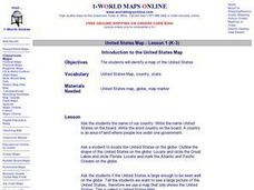
Introduction to the United States Map
Learners explore the United States using a map. In this map lesson, students discover how to use a United States map and a globe to locate places.
Curated OER
Washington, D.C. Map
Here is an outline map of Washington, DC. Some of the points of interest in the city are labeled, as are Maryland, Virginia and Arlington. There are plenty of important monuments and locations not identified, making for a good project.
Curated OER
States/capitals
Students identify the geographic locations of each state of the United States. Working cooperatively, they put togehter a giant puzzle of the United States using their individual pieces.
Curated OER
Maps
Maps, globes, and computer software aid young explorers as they locate state capitols, major cities, geographic features, and attractions for states they are researching. They then use desktop publishing software to create a map to share...
Curated OER
Mapping Population Changes In The United States
Students create a choropleth map to illustrate the population growth rate of the United States. They explore how to construct a choropleth map, and discuss the impact of population changes for the future.
Curated OER
Our Land Lesson 2: Song Mapping
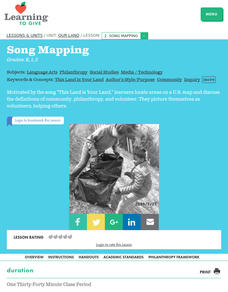
Students study the meaning of philanthropy as giving of time. talent, and treasures. They sing This Land Is Your Land while locating five of the places on a map of the United States showing that relief office are everywhere. They decide...
Curated OER
Introduction to the United States Map
Students identify the United States of America and it's states on a map. In this mapping activity, students examine a globe and find the United States as well as a few land marks (Florida and the Great Lakes). Students then look at a...
Curated OER
Mystery State #31
In this United States mystery worksheet, students determine which state is described by the 5 clues listed on the sheet and then mark it on the outline map of the United States.
Curated OER
Mystery State #23
In this United States mystery worksheet, students determine which state is described by the 5 clues listed on the sheet and then mark it on the outline map of the United States.
Curated OER
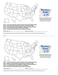
Mystery State #35
In this United States mystery worksheet, learners determine which state is described by the 5 clues listed on the sheet and then mark it on the outline map of the United States.
Curated OER
Mystery State #36
In this United States mystery worksheet, students determine which state is described by the 5 clues listed on the sheet and then mark it on the outline map of the United States.
Curated OER
U.S. Puzzle Map Bulletin Board
Students create cutouts of each state. They research different states noting their similarities and differences. They describe each state's location in relation to the state's surrounding them.
Curated OER
Blank Map: The United States of America
In this map worksheet, students use the blank outline map of the United States to label the 50 states or for any other study purpose. Each state boundary is shown with no name labels.
Curated OER
Mapping the Civil War
Students identify the locations of pivotal American Civil War battles. In this map skills lesson, students label Fort Sumter, Antietam, Vicksburg, Gettysburg, and the Battle for Atlanta on an outline map. The map is not included.
Curated OER
Mystery State #38
In this United States mystery worksheet, students determine which state is described by the 5 clues listed on the sheet and then mark it on the outline map of the United States.
Curated OER
A Soldier's View of the American Civil War
Study and research the American Civil War in this explanatory writing lesson. Middle schoolers complete six activities to learn about the American Civil War and soldiers' views of the war. The lesson includes several options to complete...
Curated OER
The Tet Offensive and the Vietnam War
High schoolers discover how the United States became involved in the Vietnam War, the importance of the Tet Offensive in turning American public opinion against the war, and how the Vietnam War is still a part of American life and culture.
Curated OER
Will There Be a White Christmas This Year?
Students examine historical weather data, and create map and color key that illustrates the likelihood of a white Christmas in different locations across the United States.
Curated OER
United States Map
Young scholars compare the United States on a globe and on a map. For this map lesson, students relate the sizes of the continents and locate the United States. Young scholars identify the location of the continental US as well as Alaska...


