Curated OER
US: Midwest Region
In this United States political map worksheet, students examine the state boundaries of the Midwestern Region. The map also highlights each of the state capitals denoted by stars.
Curated OER
US: Northeast Region: Unlabelled
In this United States political map worksheet, students examine the Northeast Region state boundaries. The map also highlights each of the state capitals denoted by stars.
Curated OER
North Carolina Salt Dough Map Social Studies Project
In this lesson, North Carolina Salt Dough Map, 4th graders create a salt dough map of North Carolina, Students use dough to form the shape of the state of North Carolina. Students label the three regions of North Carolina and all of...
Curated OER
Name the States Worksheet 4
In this name the states worksheet, students examine 6 state map outlines and identify each of them by writing the state names and postal abbreviations.
Curated OER
Name the States Worksheet 2
In this name the states worksheet, students examine 6 state map outlines and identify each of them by writing the state names and postal abbreviations.
Curated OER
Name the States Worksheet 1
For this name the states worksheet, students examine 6 state map outlines and identify each of them by writing the state names and postal abbreviations.
Curated OER
Name the States Worksheet 5
In this name the states worksheet, students examine 6 state map outlines and identify each of them by writing the state names and postal abbreviations.
Curated OER
Identifying Border States of the U.S.
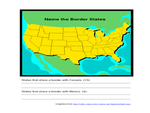
In this identifying border states of the U.S. worksheet, 3rd graders visually identify then write the names of the states that border Canada and Mexico; page 1 is a lesson, page 2 is the worksheet.
Education World
Mystery State #1
For this United States mystery learning exercise, students determine which state is described by the 5 clues listed on the sheet and then mark it on the outline map of the United States.
Curated OER
Our Fifty States
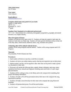
Seventh graders identify and locate all fifty states in the United States and their capitals. Individually, they research one state identifying when it became a state, its motto, song, flower and nicknames. To end the lesson, they are...
Curated OER
How To Write a Social Studies Outline
One of the keys to success in school is organization. This resource leads learners through the process of creating an outline for a chapter from a social studies text. In addition, they review facts they have learned in their class...
Curated OER
Boundaries and People
Students map watersheds to find their boundaries. In this watershed activity students map and then give their "watershed address." Students show the trail from stream, larger stream to oceans. Students describe the boundaries of the...
Curated OER
Presidential Places
Students investigate American presidential landmarks throughout the continental United States. They research and analyze American presidential landmarks to determine their value to American history and how they have been preserved over...
Curated OER
History Close to Home
Students examine primary sources as related to Nevada and the Civil War. In this United States history lesson, students gather and analyze various primary sources in small groups and interpret unknown vocabulary words by using context...
Curated OER
Rockin' Round New York State
Students discuss their favorite rock groups and bands. They create rock groups that will be touring New York State. Students research cities in New York, determine dates of concerts, create touring itineraries, and develop Inspiration...
Curated OER
Let the Music Play: Bicentennial quarter reverse
To better understand who George Washington was and why we celebrated the bicentennial, pupils read a story and complete a worksheet. They sing and talk about the song, "Yankee Doodle Dandy" as they march around the room.
Louisiana Department of Education
Comprehensive Curriculum Social Studies (Grade 7)
US history from 1776 through 1877 is the focus of a comprehensive curriculum guide designed for seventh graders. Each of the seven units in the 102-page packet includes a list of guiding questions, grade-level expectations, links to...
Curated OER
Mapping School Grounds
Learners map and analyze the natural and cultural environment of the school grounds. In small groups, they sketch the natural and cultural features of each side of the school building, create a map, participate in a class discussion,...
Curated OER
Mapping Landforms of South Carolina
Third graders analyze South Carolina maps. In this geography lesson, 3rd graders locate the five land regions in the state are and discuss how the regions are different. Students identify the major bodies of water and analyze how they...
Curated OER
Rivers, Maps, and Math
Middle schoolers use maps to locate and label the major rivers of North and South America. Using the internet, they identify forests, grasslands, mountain ranges and other landforms on the continents as well. They compare and contrast...
Curated OER
Weather Maps
Pupils interpret information on a weather map in order to construct a graph, and discuss how the weather impacts their lives.
Curated OER
What's Your Temperature?
Learners take a look at the local newspaper and focus on the weather section. They get into small groups, and each one looks at the same map, but of a different part of the country. They must prepare a presentation that shows how...
Curated OER
Arbor Day Across the United States
Students perform research about hardiness zones used to guide planting. They read a hardiness zone color-key map and create their own color-key maps to show when different states celebrate Arbor Day.
Curated OER
Mapping the Prairie
Fifth graders study maps of the Chicago area looking at defining characteristics and place names. They investigate settlement patterns by looking at the maps.


