Curated OER
Westward Expansion
Fifth graders create a brochure outlining what he or she has studied throughout the unit. The brochure contains evidence that Students have understood and mastered the answers to the essential questions.
Curated OER
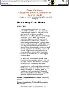
Home Away From Home
Students discover some of the threats to tigers in the wild and some of the challenges of keeping them in wildlife preserves and zoos. They then sketch and explain their designs for sensible tiger enclosures in zoos.
Curated OER
Castle/Fort Unit
Young scholars compare and contrast castles and forts. They observe buildings in their community and consider how castles and forts are similar. They design their own castle or fort and brainstorm materials to build with, discuss how the...
Curated OER
Modern Japan Unit Plan
Sixth graders research modern Japanese culture, society and traditions, examine relationship between Japanese culture and its environment,
compare and contrast Japanese Society with Canadian Society, compare lives of people in Japan with...
Curated OER
Flambe Elements
Eighth graders discuss atoms and electrons as well as atoic structure. They view atomic structure via the computer. Students watch a demonstration in which the teacher demonstrates glass tubing turning yellow in a Bunsen Burner flame....
Curated OER
Getting to the Core of Climate Change
Learners investigate climate changes by graphing and analyzing ice core data from Greenland and Antarctica. They create, explain and report the pattern of data on a graph of ice core data. In addition they find relationships between the...
Curated OER
School Redesign and Multiple Intelligences
Students examine their own intelligence to find areas of strength after studying the multiple intelligences. In this diverse learning styles instructional activity, students analyze how the school environment fosters or fails students...
Curated OER
Our Watershed
Students work with the Tribal Council and Elders to explain the historical importance of the area's watershed. They develop a model of the watershed and map the route of water flow from the watershed to the ocean.
Curated OER
The American Trail System
Learners research a trail system. They create a display board of the trail system, generate a map of the trail system, and develop a commercial advertising of the trail system. They design a display board featuring facts about the...
Curated OER
The Superheroes of Public Land Management
Students study public land management agencies and their missions. They research a management agency, design a superhero to represent the agency and describe the skills and training needed to manage public lands. They include the...
Curated OER
Southern Agriculture and the Slave Trade
Students examine the relationship between agriculture and the slave trade during the 1860s. In groups, they research how two factors led to the explosion of slavery in the Southern United States. Using maps, they answer comprehension...
Curated OER
A FOREST'S PLACE IN OREGON
Students engage in a lesson to find the purpose for the forests of Oregon. The role of the forest is researched according to different geographic perspectives. The information is portrayed in graphs and presented by group members to...
Curated OER
Barnegat Bay Watershed
Students design a model watershed. In this watershed lesson, students learn the needed parts of a watershed and how they work. Students evaluate how watersheds effect communities.
Curated OER
Aquifers and Groundwater
Young scholars understand the purpose of an aquifer. In this aquifer and groundwater lesson plan, students build a model aquifer find its relationship to water usage. Young scholars record observations as they build the layers of the...
Curated OER
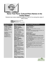
Name That Place: Cultural Place Names in the United States
Students examine the origin of the people that settled in the United States. In this United States History instructional activity, students work in small groups to complete several activities that explore early settlement, such as a...
Curated OER
Fred the Fish
Students read and retell the story of Fred the Fish. In groups, they create their own story of a similar nature and identify a situation in their community like the one in the story. They create possible solutions to the problem and...
Curated OER
Rivers And Capitals
Pupils become familiar with the use of GIS for research and become aware of the importance of rivers to cities. They also analyze the placement of cities and learn the names of rivers in the United States.
Curated OER
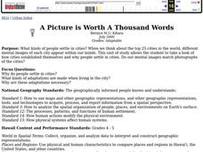
A Picture Is Worth A Thousand Words
Students complete a population pyramid for a city they are studying. They may complete a population pyramid for their city and another one for the country in which the city is located. They compare and contrast the results of the two...
Curated OER
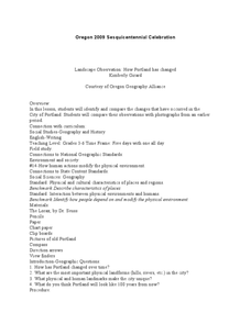
Landscape Observation: How Portland Has Changed
Students read The Lorax and discuss how populations change the environment. Using given photos, students use a Venn Diagram to compare and contrast the Portland of yesterday to present day Portland. They write a comparison paper and...
Curated OER
Planning a Healthy City
Ninth graders create a scaled model city. They create a blueprint that provides for the economic and cultural needs of a community. They identify where essential elements of the city should be located and explain the rationale for the...
Curated OER
Sense of Place Through the Eyes of an Inuit Children's Author
Students read books by Michael Arvaaluck Kusugak to explore life in the Artic Circle. After reading the books, students compare and contrast life in the Artic Circle to life in the United States. They write and illustrate a story about...
Curated OER
Water, Water Everywhere
Students are introduced to the complex issues of water resources around the globe. In groups, they take on the role of a country and map out the location of water sources. They barter, sell or take over other groups to have access to...
Curated OER
The Arctic and Taiga Ecozone of Canada
Students examine the various sub-regions of the Arctic and Taiga zones in Canada. Using the online Canadian Atlas, they locate and describe the characteristics of each zone. They organize their information into a chart and share it with...
Curated OER
Discovering the Past Using the Future: Remote Sensing and the Lost City of Ubar
Learners identify and locate specific locations on the Arabian Peninsula, the Rub al Khali Desert, and present day Oman. They identify other names for the lost city of Arabia as Ubar, the Atlantis of the Sands, Iran, and the city of towers.


