Teach Engineering
Earthquakes Living Lab: The Theory of Plate Tectonics
Find out if your class agrees with Ice Age: Continental Drift ... or if it's just a fun family movie! Class members research the theory of continental drift, examine evidence of plate tectonics, connect...
Curated OER
Plate Tectonics: Second Grade Lesson Plans and Activities
Second graders explore convection currents and how they relate to the movement of tectonic plates. Then, young geologists reconstruct Pangaea with a worksheet and pinpoint plate boundaries on a map...
Curated OER
Wegener and Plate Tectonics: A Hands-On Lesson
Students are introduced to and experiment with the basic concepts of plate tectonic theory as well as assess the history of the theory of plate tectonics. They explain and illustrate the basic concepts through diagrams and models of...
Curated OER
Pangaea Puzzle: Exploring the Tectonic Forces That Shape the Earth
Sixth graders follow in the footsteps of early scientists as they put the pieces of Pangaea back together and discovered the forces that create the variety of landforms and sea-floor features of our Earth.
Curated OER
Get the Drift?
The anticipatory set is clever: give groups five minutes to work on the puzzle and then discuss what strategies they used to match the few that connected. This introduces middle schoolers to the concept of continental drift. A portion of...
Curated OER
Forces That Shape the Earth: Plate Movement
In this tectonic plate worksheet, students learn about the movement of the plates that make up the earth's crust. They read about the Theory of Pangaea, lithosphere, divergence, convergence, and plate transformation. Students then answer...
Curated OER
The Moving Continents from Pangaea to the Future
Eighth graders examine how the movements of the Earth contribute to fossil distribution. In this fossils instructional activity students make maps of the placement of the continents.
Curated OER
Earthquakes And Fault Lines
Young scholars discuss major causes of earthquakes and identify famous fault lines, access and map information about ten largest earthquakes in world from 1989 to 1998, and theorize about location of these earthquakes as they relate to...
Curated OER
Science Jeopardy - The Earth Sciences
The earth sciences are the focus for this Jeopardy-style review game. Categories include geology, space, scientific investigation, meteorology, and oceanography. Diagrams and pictures are involved with most of the questions, making this...
Curated OER
Earth's Plate Tectonics
Students identify the different layers of the Earth. In this earth science lesson, students create a model of the crusts and continents. They explain how plates movement cause earthquakes and volcanoes.
Curated OER
The Dynamics of Plate Tectonics
Simple lab and modeling activities can help your students understand the movements of the Earth's crust.
Curated OER
Pangaea Puzzle
Students explore plate tectonics and the formations of the Earth's surface and why maps are distorted. In this Earth's surface instructional activity students complete a lab and answer questions.
Curated OER
Pangaea Puzzle
Students test evidence for the existence of Pangaea in the Earth's past. They create a current map of the Earth's continents and put them together like a puzzle. They compare this result to a a picture of the shape of Pangaea.
Curated OER
Plate Tectonics
Students simulate the three types of plate boundaries using robots. For this earth science lesson, students explain how earthquakes and volcanoes are formed. They collect real-world earthquake data and plot them on the map.
Curated OER
Prehistoric Mesosaurus
Students draw conclusions why Mesosaurus has only been found in Africa and Brazil and how its fossil remains serve as important evidence that shows where two continents were once joined together.
Curated OER
The Great Continental Drift Mystery
Students stud the concept of Pangaea by using Wegener's clues to construct a map of the continents joined together. They determine how fossil distribution can be used to enhance the study of continental drift. They locate the...
Curated OER
Explosive Ideas!
Students explore the layers of the Earth and the dynamic changes that they cause on Earth's surface. Volcanoes and earthquakes become the focus of the instructional activity as the Oregon State quarter and its Crater Lake images are...
Curated OER
A Moving Experience
Students visit Time Machine's San Francisco Earthquake Era. They understand how the Earth's layers interact to cause changes in the Earth's surface. They review information about earthquakes and Earth's layers.
Other
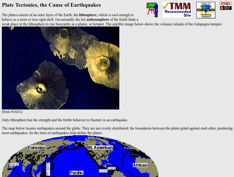
Nevada Seismological Laboratory: Plate Tectonics, the Cause of Earthquakes
This site contains an in-depth explanation of the causes of earthquakes as they relate to plate tectonics, and also has many nice and easy to read pictures, maps, and diagrams of plate tectonics and earthquakes.
Vision Learning
Visionlearning: Plate Tectonics: The Origin of Plate Tectonic Theory
Discover Alfred Wegner's ideas relating to continental drift and seafloor spreading which are both evidence to the concept of plate tectonics.
Enchanted Learning
Enchanted Learning: All About Plate Tectonics
Simple discussion of plate tectonics and Pangaea. Includes maps and interactives.
Other
Paleomap Project
Virtual reality animation map showing continental drift from 200mya to the present. The animation map is small but effective in showing the positions of the land masses.


