Curated OER
My Secret War: Lesson 8
Fifth graders explore American history by viewing videos on the Internet. In this Japanese internment lesson, 5th graders discuss the politics that took place between America and Japan during WWII and why it was necessary to incarcerate...
Curated OER
Four Immigrant Groups: Their Lives and Music
Fourth graders examine the experiences of four immigrant groups. Class members brainstorm a list of misconceptions of those groups and discuss if these perceptions are still present today. Using maps, groups locate the countries of...
Curated OER
A Brief History of Vietnam (1858-2004) and Its Evolving Communist System
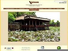
Students examine the French colonization of Vietnam, the Vietnam War, and the current evolving Communist system. They develop political maps, outline the major events of the Vietnam War, write an essay, and compare/contrast democracy...
Curated OER
Walking that Line
Students attempt to describe and use longitude and latitude. They will identify different countries, their neighbors, and borders around the world. Included in the lesson the students identify natural features that control the borders of...
Curated OER
The Mekong River
Junior geographers explore the region through which the Mekong flows, its pathway, the landscape, how people depend on the Mekong, and future uncertainties. They apply the five themes of geography to examine the region. They create a...
The New York Times
Kiev in Chaos: Teaching About the Crisis in Ukraine
Provide a historical context for the political unrest between Russia and Ukraine that began in late 2013. Learners review their prior knowledge and chronicle new understandings with a KWL chart, watch a video explaining the Ukrainian...
Theodore Roosevelt Association
Roosevelt's Legacy: Conservation
The legacy of Theodore Roosevelt carries through modern American politics, economics, foreign policy, and society. But his proudest and most profound efforts were in the world of conservation, and in preserving the natural beauty of...
Curated OER
Ann Arbor Growth & Immigration
Third graders describe some of the factors that brought early settlers to Ann Arbor. They read Narrative-A Trip from Utica, New York, to Ingham County, Michigan in 1838. As an added challenge, 3rd graders can use maps to track Silas...
Curated OER
How Do Artists Effectively Relate Historic Events?
Students explore African American migration. In this black culture and history lesson, students use a map to identify northern and southern states in which African Americans lived in the 1900s. Students observe and describe objects and...
Curated OER
Parthenon
Ninth graders explore he purposes of the Parthenon. In this World History instructional activity, 9th graders create a complete picture of the Parthenon. Students research one aspect of the structure and report their findings back to...
Chicago Botanic Garden
Faces of Climate Change
Sometimes, the best solution to a problem can be found by walking in someone else's shoes. Here, scholars use character cards to take on the roles of people around the world. They determine how their character's life affects our...
Chicago Botanic Garden
Faces of Climate Change
You know global warming is real when your squirrel feeder is full of popped corn instead of kernels! Activity two in a series of five allows learners to explore climate change through the eyes of another. After briefly analyzing their...
Curated OER
Population Diversity in Southeast Asia
Students explore diversity in ethnic, lingual, religious, and political systems of the people of Southeast Asia. The lesson's focus is designed to foster an understanding of the complexity of the region.
Curated OER
Historical Atlas
Sixth graders evaluate how revolutions have affected the world throughout history (i.e. boundaries of nations, culture, economics, etc...) through the research for and creation of a historical atlas for assigned countries.
Curated OER
Selling Warfare - Propaganda Posters
Students examine the use and purpose of propaganda posters during World War I. They work in groups to create a propaganda poster supporting a nation's war effort.
Curated OER
Lesson 2: Mapping With Words
Students demonstrate an understanding of the personal relationship that Wabanaki peoples had with the land by analyzing selected Wabanaki place names. They practice map-reading and map-making skills.
Curated OER
Mary, Queen of Scots: Heroine or Harlot?
Students explain how international politics, religion, and cultural beliefs influenced the life of Mary Queen of Scots. They watch a film about Mary, Queen of Scots and participate in a discussion and variety of extension activities.
Curated OER
Freedom of the Press Around the World
Students research press freedoms in various countries such as Iran and North Korea. They create a freedom of the press report card for the countries examined.
Curated OER
Identifying Island Countries
Students discover the definition of an island and identify island countries around the world. In this geography lesson, students determine the characteristics of an island. Finally the students will identify specific island countries,...
Curated OER
Charting Neptune's Realm: Profiles
Students identify and describe the importance of nautical profiles in early navigation. They draw a profile of a street or mall and explore the effectiveness of different types of directions.
BBC
Eu, Un, and Commonwealth: Keeping Peace
What are the UN, the EU, and Commonwealth? Have the class brainstorm all they know about these powerful international organizations. Then have them compare and contrast the ways in which different countries or political groups work. They...
Curated OER
Virginia In the World: The Geography of Commerce
Young scholars examine how Virginia connects with the world through export trade. Using a map, they use symbols to depict the value of trade and the direction of the flow of goods. They complete a scavenger hunt using electronic almanacs...
Curated OER
Camp Stark, New Hampshire, World War II Prisoner-of-War Camp
Students examine the political, personal, and geographical boundaries created by World War II to the citizens and prisoners of war at Camp Stark.
Curated OER
See the World
Seventh graders locate and write creatively about different places and their cultures. They identify the physical, economic, social, political and cultural characteristics of selected regions in the Eastern Hemisphere. Finally, 7th...
Other popular searches
- World Political Map
- World Outline Political Map
- Blank World Political Map
- World Political Map Labeled


