Curated OER
Contemporary Afghanistan
Students research the situational dynamics that have resulted in a civil war.
In small groups, they research the geography and culture of Afghanistan.
Groups analyze the political and cultural impact on people living in Afghanistan....
Curated OER
The Rise of Islam
Students read their textooks and discuss in groups the background of Muhammad answering oral questions and studying and identifying Mecca on the map. They work in groups to read handouts on "Early Revelations of Muhammad" to present...
Curated OER
The Growth of Islam
Seventh graders gain insight into the daily lives of Muslims and to develop empathy for them by studying the Islamic world and creating presentations.
Curated OER
US Policy In Somalia
Students investigate the US policy for the country of Somalia. They conduct research using a variety of resources. They locate the country and then discuss major geographical features of the areas. Students discuss the present US...
Curated OER
We Live in an International Community
Learners locate the different countries from which their clothing originates. Using a blank map, they identify and color in those areas.
Curated OER
Charting Neptune's Realm: Profiles
Students identify and describe the importance of nautical profiles in early navigation. They draw a profile of a street or mall and explore the effectiveness of different types of directions.
BBC
Eu, Un, and Commonwealth: Keeping Peace
What are the UN, the EU, and Commonwealth? Have the class brainstorm all they know about these powerful international organizations. Then have them compare and contrast the ways in which different countries or political groups...
Curated OER
Lewis and Clark and the Native Americans
Students practice using maps and identifying landmarks on the Lewis and Clark expedition. They research Lewis and Clark's relationship with the Native Americans and report their findings to the class. They identify the impact of the...
Curated OER
Location, Location, Location: Civilization's Ultimate Advantage
Students discover how geographical advantages, locational and regional, ultimately led to western Eurasian societies' disproportionate accounting of world power and innovation. They utilize a workbook which can be downloaded within this...
Curated OER
Polar Bears and Ice
Students explore the Arctic food chain. They examine the needs of the polar bear and the threat that global warming poses to them. Students write a letter to a local political representative explaining what they have studied and...
Curated OER
Hungary: The Landscape
Students work in small groups to create a topographic map of Hungary. The map will include labeled line drawing of the bordering countries. Hungary should be three dimensional, made of salt and flour clay. The mountains, plains and...
Alabama Department of Archives and History
La Mobile: A Case Study of Exploration and Settlement
The Le Moyne brothers, Jean-Baptiste and Pierre, were among the first explorers of the Gulf Coast. Class members read biographical information and journal entries about these men, study maps showing where the settlements they established...
Curated OER
Do We Still Need the Electoral College?
One of the most confusing aspects of any presidential election year is the role of the Electoral College. Learners read a bit about how the Electoral College works and then they hold a mock election in their classroom. They'll redraw a...
Curated OER
Europe – Religion and Reformation
Ninth graders examine the Reformation. In this European history lesson, 9th graders explore the 95 theses of Martin Luther and discuss the reaction of the Roman Catholic Church to his ideas. Students then take a quiz based on the lesson.
Curated OER
Discovering Dinosaurs: Planning your Summer Vacation
Students use the online Atlas of Canada to gather information about places in Canada.
Curated OER
Hemispheres & Continents
Students learn in cooperative learning groups to determine how the equator and the Prime Meridian divide the earth into hemispheres and use Venn diagrams. Students will locate and label the hemispheres, continents, and oceans.
Curated OER
Nunavut, Our Communities
Students locate the communities of Nanavut on a territorial map and identify community characteristics. They research the online Atlas of Canada
Curated OER
Setting Boundaries
Students investigate the determination of the boundaries of various countries. They work in small groups to research a country's political history and past boundary issues and territorial disputes.
Curated OER
Reaching Across Borders In Southern Africa
Students gain a greater understanding of how political borders impact human and environmental development. Then, either individually or as a class, establish a correspondence with a Peace Corps volunteer working in Africa.
Curated OER
Look! You're Wearing Geography
Sixth graders explore economic systems. In this economics lesson, 6th graders discover global markets. Students work in small groups to identify where their clothing and materials originated. Students locate countries on a map and...
Curated OER
Welcome to the Americas
Students research and map the North and South American continents. In this geography lesson on the Americas, students can locate North, Central and South American countries and states. Students choose a location to research and prepare a...
Curated OER
Mr. Powell Leaves Washington
Students examine the life and achievements of Colin Powell. After reading an article, they discuss the role of the Secretary of State. In groups, they evaluate his successes in different regions throughout the world. They reflect on the...
Curated OER
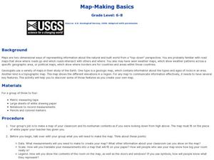
Map-Making Basics
Middle schoolers study maps. In this geography and art instructional activity, students create their own map of the classroom.
Curated OER
"Where In The World Am I?" Creating a Travel Brochure for Japan
Students create a travel brochure for the country of Japan.
Other popular searches
- World Political Map
- World Outline Political Map
- Blank World Political Map
- World Political Map Labeled


