Curated OER
Let's Have a Lesson Within a Lesson
Students role-play the role of a student who does not comprehend the language the lesson is being instructed in. Using the internet, they research the characteristics, distribution and migration of human populations over time. In groups,...
Curated OER
Ohio Census 1990 & 2000
Students use Ohio census data to solve problems, make comparisons, draw conclusions, and support predictions related to Ohio's population. They interpret and work with pictures, numbers and symbolic information.
Curated OER
Feeling the Heat
Pupils record temperatures at different locations around campus. They examine the results and draw conclusions about how materials and colors affect the amount of heat produced. They also analyze Los Angeles' temperature records over a...
Curated OER
What in Our World Affects the Way People Live
Sixth graders study various maps that show geographical features and population. They compare the maps and make inferences about how various geographical features influence the population and human activities of an area.
Curated OER
Using Different Kinds of Maps
Third graders explore the landforms and population diversity. They read maps and examine geographic terms. Students create their own map of the United States and answer questions about the location of people. After exploring the map, 3rd...
Curated OER
Culture Regions of the U.S.
Students identify the location of different cultural groups within the United States (agricultural, retirement, urban, etc.) They map these areas and analyze the correlation between the landscape of a given region and the type of...
Curated OER
World Hunger - A Cultural Crisis
Students explore the problem of world hunger and starvation. After a class discussion, students use a map to identify specific areas where populations are starving. In groups, students research reasons for the lack of food. They prepare...
Curated OER
Scarcity of Land Throughout the World and in Hawaii
Students discuss the importance of "land." They review the four types of land classification--urban, rural, agricultural and conservation--and participate in an activity involving an apple that demonstrates the use of land in Hawaii....
Curated OER
Immigration
High schoolers explore the concept of immigration. In this immigration lesson, students read literature, analyze photographs, and evaluate political cartoons that reflect feelings about immigration in America during Industrialization....
Curated OER
Alike and Different
Second graders listen to a book about how farms feed the world. They discuss elements of rural life. They listen to a story about the suburbs and discuss elements specific to a suburban community. They listen to a story about city...
Curated OER
Chapter 13 – Progressivism
In this U.S. history worksheet, students read assigned textbook pages regarding Progressivsim and respond to 48 short answer questions.
Curated OER
With Detective Fiction in the Urban Classroom
Students listen to a verbal explanation of the function of deductive reasoning and problem solving. They read one of Donald Sobol's 'Two-Minute Mysteries' and complete a worksheet requiring them to write out the information which is...
Virginia Department of Education
Succession
The final lesson in a two-part series prompts scholars to create newspaper articles and succession events. Applying their knowledge of the ecosystem and the past examples of succession, they predict what will happen in the future using...
Curated OER
Geography of the Wasatch Front
Learners examine and discuss urban geography and land-cover types along the Wasatch Front. They analyze thermal images, create collages, and predict surface and air temperatures from aerial photos in the Salt Lake City Valley.
Curated OER
Identification of Wildfire/Structure Interfaces, Risk Assessment of Structures, and Risk Management
Students participate in a class discussion about wildfire and urban interfaces as well as risk of wildfire in the area in which they live. After reviewing a wildfire/urban interface fire safety checklist, a walking field trip is...
Curated OER
Percents and Money
In this algebra learning exercise, students rewrite word problems using algebraic symbols. They solve for the amount of population or money over a period of time. There are 10 questions with an answer key.
Curated OER
Biggest Cities in India Quiz
For this online interactive geography quiz worksheet, students examine the chart that includes the population of 20 Indian cities. Students identify the names of the largest cities in India in 4 minutes.
Curated OER
Cities Named for Saints Quiz
In this online interactive geography quiz worksheet, students examine the chart that includes the populations of 16 world cities named for saints. Students identify the names of the cities in 4 minutes.
Curated OER
Aboriginal Statistics
Fourth graders analyze statistics of Native Americans by creating graphs. For this data analysis lesson, 4th graders define different statistical terms and practice finding those statistics from groups of numerical information about...
Curated OER
A Nation Counts
Students explore the functions of the U.S. Census. In this civics lesson plan, students understand the origins of the census and its role in U.S. history, recognize the political importance of apportionment based purely on population,...
Curated OER
Land Development and the Environment
Students examine the relationship between land development and the environment. For this environmental stewardship lesson, students explore how population density, land development, transportation, and impervious surfaces take their toll...
Curated OER
Diversity
Students work in groups to research and prepare an oral report about a region. In this regions lesson, students find out about the geography, population, state capitals, and landmarks. Students assign attributes to the people based on...
Curated OER
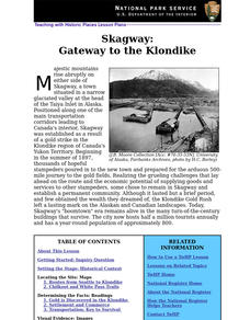
Skagway: Gateway to the Klondike
Students explore the impact of the Klondike Gold Rush on the development of Skagway, Alaska. Lesson can be used in units on western expansion, late 19th and early 20th-century commerce, and urban history.
Curated OER
Invasion of the (Cactus) Booty Snatchers
Students, in groups of four,identify and analyze relationships among birds within a population, a community and an urban ecosystem. They fill out, while they're completing their experiments, a Populations of Birds Student Data Sheet.


