Curated OER
"Families and Schools of the Past"
First graders listen to and discuss historical fiction and bigraphies from the early American time period. They role-play, draw, write stories and dress up to re-create events from these historical characters.
Curated OER
Secrets in a Grain of Sand
Students working in small groups examine beach sand to discover signs of erosion, weathering, ocean currents and waves. They present their findings to the class.
Curated OER
West Virginia Quarter Reverse: Over, Under, In, and Out
Students examine the images on the West Virginia quarter reverse. Using the quarter design as a model, the discover the meaning of directional terms. They play a game where they have to listen to and follow directions and complete a...
Curated OER
Linkages Between Surface Temperature And Tropospheric Ozone
Students organize and analyze data regarding changes in tropospheric ozone and then hypothesize about the consequences of these changes.
Curated OER
Rain and Our Environment
First graders understand the importance of rain in our environment by writing a sentence about something in existence that would cease to be without rain. They use describing words to describe the living thing's color and draw and color...
Curated OER
Nebraska: Using Pictures
Students create a scrapbook about Nebraska history focusing on Post Office murals. They choose their favorite murals and write a story to go along with the mural. In groups, students present their murals to the class and visit the...
Curated OER
Genetic Disorders
Seventh graders discuss traits, traits that are inherited and how genes and chromosomes carry the code for traits. They research genetic disorders and their link to chromosome abnormalites and write a report on their findings. which...
Curated OER
Cultural Corner- "Mexico"
Young scholars use print and electronic resources to gather information about Mexico. They present a mini-museum to share with students, parents, and other interested classes around the district. They present their information in a video...
Curated OER
Growing Concern
Pupils will define glossary words necessary for discussing global agricultural trade and explore the issues behind the Group of 21's walkout at the September 2003 World Trade Organization meeting. They then research the agricultural...
Curated OER
Effects Of Natural Disasters On Environment
Students investigate the concept of how natural disasters effect the environment. They conduct research using a variety of resources. They are given a scenario that needs a defensive speech. Students take a position and defend it by...
ClassFlow
Class Flow: Map Key
[Free Registration/Login Required] This flipchart introduces the purpose of a map, map symbols, and the map key or legend. Activote questions reinforce the concepts.
Sophia Learning
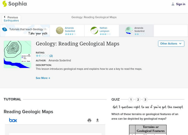
Sophia: Geology: Reading Geological Maps: Lesson 3
This lesson introduces geological maps and explains how to use a key to read the maps. It is 3 of 3 in the series titled "Geology: Reading Geological Maps."
SMART Technologies
Smart: Geography Unit: Maps
This geography unit is designed to follow the 1st Grade geography skills required in Virginia. Students are expected to use cardinal directions, read map keys and understand map symbols, as well as identify our city and capital.
Other
Reading Quest: Strategies for Reading Comp.: History Frames: Story Maps
This activity will help you teach students chronological order as well as identifying key people and events. Printable worksheets.
Read Works
Read Works: Learn About Maps
[Free Registration/Login Required] Intended to support early elementary students' reading comprehension, the basic terminology associated with map are explained in this informational text. A question sheet is available to help students...
Wisconsin Response to Intervention Center
Wisconsin Rt I Center: Event Map [Pdf]
Teachers will learn how to use event maps with students. They will learn how to implement event maps with literary and informational texts; measure progress with event maps; and find research to support event maps. A reproducible event...
Annenberg Foundation
Annenberg Learner: United States History Map: From Sea to Shining Sea
A great interactive map that reinforces your knowledge of the geographic features of the United States. Begin by reading general information on reading maps, then play the game.
Texas Instruments
Texas Instruments: Map It!
In this activity, students explore map making. Students' read a story, identify the locations of different places in the story, decide the distance between each set of places in the story, and create a map with a legend.
Soft Schools
Soft Schools: Geography/map Skills Quiz
In this ten question quiz, students can assess their understanding of key geographical features on maps.
BBC
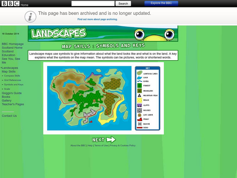
Bbc: Landscapes: Map Skills: Symbols and Keys
A guide for young learners to understand reading maps and their keys.
CommonLit
Common Lit: Maps
A learning module that begins with "Maps" Yesenia Montilla, accompanied by guided reading questions, assessment questions, and discussion questions. The text can be printed as a PDF or assigned online through free teacher and student...
ClassFlow
Class Flow: Map Sense
[Free Registration/Login Required] This flipchart reviews the basic components of maps: legend, scale, Compass rose and labels. Clips from United Streaming video are included to illustrate these concepts. Student assessment and a student...
PBS
Pbs Teachers: Virtual Egypt (Panoramic Views of Key New Kingdom Sites)
Explore in detail three key sites of Upper Egypt during the New Kingdom: the West Bank of Thebes, Abydos, and Karnak. Locate the sites on a map, read more about them, and then click through panoramic photographs that show how the areas...
Curated OER
Etc: Maps Etc: House Vote on the Tariff Bill, April 22, 1828
A map of the United States showing the results of the House vote on the Tariff Bill of 1828 during the presidency of John Quincy Adams. The map is keyed to show the areas of votes for, against, or non-votes on the bill, and the for or...


