Curated OER
Introduction To Topographic Map Activities
Students discuss different types of maps, their similarities and differences. Using a Topographical Maps CD-rom program students create their own map.
Curated OER
Learning to Read a Regional Map
Students locate the local community, surrounding communities and major geographic features of the SE Utah and the Four-Corners region on a map, after receiving direct instruction.
Curated OER
Drawing A Map
Students discuss any information they already know about maps. As a class, they draw a map of a park following written directions making sure to include a compass rose and key. They are graded based on a rubric and discuss the need for...
Curated OER
United States Map- State Capitals
Students explore the state capitals. In this geography lesson, students use a political map to identify the state capitals and place post-it notes on various capitals.
Curated OER
Map Reading
In this social studies worksheet, 3rd graders discover the various attributes of a road map. Students work with routes, map keys, and scale to find distances from one city to another.
Curated OER
River Run Through It
With vocabulary lists, worksheets, and more, this lesson sets learners on an exploration of the Hudson River area. They read an essay about the area, analyze a relief map of New York State, and complete a worksheet.
Curated OER
Rivers Run Through It
Using a relief map of New York State, learners answer questions about the distance between different cities, identify bodies of water, and more. First, they discuss vocabulary related to the Hudson River area. Then, they complete a...
Melissa Institute for Violence Prevention and Treatment
Concept Muraling
Concept muraling helps learners improve their comprehension of a text by giving them a way to organize their understanding of the key concepts in that text. Introduce readers to this process with a carefully scaffolded lesson that models...
Curated OER
Map It Out
Explore how illustrations add to a story. Young learners will look at picture books to see how the pictures tell the story. They create illustrations to go with a chosen story, and then flip the activity so they have to write a story to...
Museum of Tolerance
Where Do Our Families Come From?
After a grand conversation about immigration to the United States, scholars interview a family member to learn about their journey to America. They then take their new-found knowledge and apply their findings to tracking their family...
Reed Novel Studies
Surviving the Applewhites: Novel Study
The Bradys, the Flintstones, and the Simpsons are some of pop culture's most memorable families. So how do the Applewhites stack up? Using a novel study for Surviving the Applewhites by Stephanie S. Tolan, scholars answer text-based...
Worksheet Web
Analyzing the Text
Practice analyzing informational text with a reading passage that details the Great Depression. Scholars read about the impacts of World War I, the Roaring Twenties, and the Depression, then answer 10 true or false questions.
Curated OER
Comprehension is Key!
Students observe and demonstrate how to use a story map to identify the main idea of text. They observe the teacher read an article about birds out loud, and create a story map for the article. Students then independently read another...
Curated OER
A Map Mystery
First graders solve a mystery by following map clues. In this map clues lesson plan, 1st graders follow a computer program called Neighborhood Map Machine. In this program, it gives students directional and spatial clues in order to...
Curated OER
Rivers, Maps, and Math
Middle schoolers use maps to locate and label the major rivers of North and South America. Using the internet, they identify forests, grasslands, mountain ranges and other landforms on the continents as well. They compare and contrast...
Curated OER
Reading Maps of the East Pacific Rise
Pupils make qualitative and quantitative observations and use various maps to investigate the features of the East Pacific Rise The study actual bathymetric maps of the EPR region. They identify key features of the ridge and explore the...
Curated OER
Using Picture Mapping to Improve Student Comprehension
Students draw pictoral representations of a reading selection they read in order to recall information. For this picture mapping lesson plan, students use pictures to comprehend what they read and sequence the pictures as well.
Curated OER
Reading to Learn
Pupils complete story maps in this lesson. Students read "The Magic School Bus", and get into groups to choose their story element. Each group shares their information with the class. They then complete a story map for a book read...
Curated OER
Maps, Maps, and More Maps
First graders create a map and display an understanding of the cardinal directions. In this map skills lesson, 1st graders listen to stories where a map would come in handy, create their own map, and use the cardinal directions accurately.
Curated OER
Map It With Pixie
Fourth graders use the computer program 'Pixie' to create a topographic, detailed map for the state they live in. In this mapping skills lesson, 4th graders use Pixie to make a map of their state that includes topographic features, state...
Curated OER
The Sky and the Dichotomous Key
Students use a dichotomous key to distinguish between different types of clouds
Curated OER
Using Maps in the LCTL Classroom
Students review terms and prepositions of location and view a map to illustrate the meanings of the prepositions students are unfamiliar with. They play "Where am I?" game utilizing correct prepositions then they work with a partner to...
Curated OER
Map Grids
Students study map grids and explore how they can be used to locate positions of objects or features on a map. They read a story and then participate in a grid activity using a large map of the setting of the story.
Curated OER
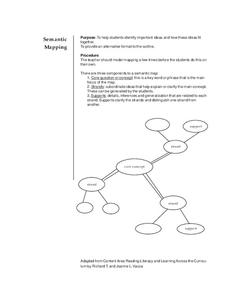
Semantic Mapping
Pupils explore semantic mapping. Through teacher modeling and independent practice they complete a variety of semantic (concept) maps to coincide with specific areas of subject matter. They identify the core concept and include...


