Curated OER
Creating A Life Map
Students investigate the concept of a life plan and how to write one with the help of a graphic organizer that encourages one to create a timeline for planning. They write journal prompts that are based upon personal knowledge of life...
Curated OER
Theatre Lesson Plan: Finding Your Way
Second graders identify story elements in familiar stories from their lives. In this story elements lesson, 2nd graders act out familiar activities by following directions. Students read a story and discuss the story elements....
Curated OER
Wales
Students read passages and look online to discover the history and important people, culture, and icons of Wales. In this Wales lesson plan, students participate in a jigsaw reading and learn a few phrases in Welsh.
Curated OER
The Water Around Us
Students discuss importance of reading maps and knowing about the geography of the United States, and locate bodies of water on different types of maps and examine how they are used in the state or local community.
Curated OER
World Map and Globe-Equator, North Pole, and South Pole
Learners identify the Equator, North Pole, and South Pole on a map. In this geography lesson, students use a world map and circle the North and South Pole. Learners locate the Equator on a globe and use a map marker to highlight it.
Curated OER
The Globe and World Map
Students explore how to use maps for travel. In this map skills lesson, students read the text, With Love from Gran and discuss the places the character traveled. Students list the names of each city and country on chart paper.
Curated OER
From Here To There
Students plan a trip while using maps and times tables. In this trip planning lesson plan, students work in pairs, and complete problems about gas, travel time, and more.
Curated OER
Discovering New Mexico
Seventh graders discuss the elements of maps and using basic linear measurement. They calculate the distance between the cities and create a simulated journey around New Mexico using a road map. They write out the directions for their...
Curated OER
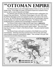
The Ottoman Empire
In this Ottoman Empire worksheet, students read a 1-page selection about the empire and examine a map. Students then respond to 5 short answer questions about the reading selection and the map.
Curated OER
Leapin' Landmarks: Locating 10 Man-made Landmarks Around the World
Third graders label continents, oceans, and major mountain ranges on maps and use the maps to write an informational report about landmarks. In this landmarks lesson plan, 3rd graders write about 1 major landmark.
Curated OER
The Bread of the Sandwich
Students create relief maps of Canada and Mexico out of everyday objects like dried macaroni, dry rice, sand, etc. They create a clue card for a location game and try to stump their classmates. They host a travel fair to display their...
Curated OER
Where Am I?
High schoolers apply map reading skills by locating places through the use of latitude and longitude.
Curated OER
Finding Your Way
Students work in small groups to practice basic map skills. They take turns giving directions and tracing a path from one location to different destinations on the map.
Curated OER
Tortoise and Hare Races
Students listen to the fable, The Tortoise and the Hare, and participate in various map skill activities. They manipulate magnetic tortoises and hares on metal cookie sheets to practice direction, and construct racing tortoises out of...
Curated OER
Are We There Yet?
Students discover how to use maps and why they are important when using a map. They calculate distance using a map scale and time using travel speed and a map scale.
Curated OER
Location, Location, Location!
Twelfth graders locate cities, states and countries on maps. They use the cardinal directions to locate places on maps. They describe where they were born by giving clues without naming the exact state. They trade papers and try to guess...
Curated OER
Map Making
First graders explore maps to realize the concept that maps are simply small representations of a much bigger picture. They discuss the importance of maps in everyday life, examine a map of the school, and then make a map of their...
Curated OER
Land Elevation
Students investigate land elevation. In this map skills lesson plan, students use a physical map to identify various elevations of the land. Students find landform features such hills and coastlines.
Curated OER
World Projections
Students identify map projections and examine polar maps. In this map skills lesson, students use a flat world map to identify various projections and calculate the distances between locations by using a map scale.
Curated OER
Review Letters and Words: 10
In this reviewing letters and words worksheet, students name letters, read sentences, read words, name pictures, and more. Students complete 7 exercises total.
Curated OER
Maize to Maquiladoras: Movement from Mexico to Arizona
Fourth graders label maps of Arizona and Mexico to show the people, goods, and ideas that have moved between the two places. In this Arizona and Mexico lesson plan, 4th graders summarize the effects of the movement on Arizona life.
Curated OER
Thinking Critically about Geography
For this map reading worksheet, students answer 2 critical thinking questions about a map shown. Page has links to additional resources.
Curated OER
Follow the Light
Students investigate the role of lighthouses in navigation and practice the use of cardinal directions through reading activities, discussion, locating geographical features, and mapping lighthouses along the east coast of the United...
Curated OER
Planning A Railroad Online Lesson
Pupils plan a route across Donner Summit using topographical maps in order to understand the challenges involved in constructing the railroad in the Sierra Nevada Mountains. In this history lesson, students first discover how to read a...
Other popular searches
- Map Reading
- Map Reading Skills
- Earth Science Map Reading
- Esl Map Reading
- Map Reading Activities
- Basic Map Reading
- Map Reading Powerpoint
- Topographic Map Reading
- Map Reading Grade 6
- Reading Maps and Globes
- Lessons on Map Reading
- Elements of Map Reading


