EngageNY
Reading Closely to Expand Understanding of Adaptations
Third graders work to determine the main idea, recall key details, and answer questions using an informational text on the topic of animal adaptations. Using the non-fiction text "Staying Alive: Animal Adaptations" (provided) the teacher...
EngageNY
Close Reading of Bullfrog at Magnolia Circle: Text-Dependent Questions, Main Ideas, and Key Vocabulary about the Bullfrog
As your 3rd grade class finishes reading Bullfrog at Magnolia Circle, the eighth lesson plan of this unit helps readers from an understanding of the very specific information on the final page of the book. As with the entire unit,...
EngageNY
Mid-Unit Assessment: Close Reading of Bullfrog at Magnolia Circle: Bullfrog Life Cycle
The sixth lesson plan in this Bullfrog at Magnolia Circle unit assesses your third graders' ability to read and understand informational text. The included assessment asks learners to take notes about the main idea and supporting...
K-State Research and Extensions
Water
How are maps like fish? They both have scales. The chapter includes six different activities at three different levels. Scholars complete activities using natural resources, learn how to read a map, see how to make a compass rosette,...
Tennessee State Museum
An Emancipation Proclamation Map Lesson
Did the Emancipation Proclamation free all slaves during the Civil War? Why was it written, and what were its immediate and long-term effects? After reading primary source materials, constructing political maps representing information...
Texas State Energy Conservation Office
Investigation: Concept Mapping Fuels
After reading an article, "Fuels for Everything," collaborative groups create a concept map poster of the transportation and non-transportation fuels. This makes a strong introduction to the different types of fuels used for transportion...
Curated OER
What Do Maps Show?: Lesson 4 How to Read a Topographic Map
Students examine the use of topographic maps as two dimensional representations that show elevations and slopes with contour lines. They read maps of the Salt Lake City, Utah area and complete the associated worksheets that show map...
KOG Ranger Program
Fire Behavior in Forests
Understanding the ways a fire will act is a key factor in fire safety and fire prevention. Young campers focus on how the weather and terrain can affect the behavior of a fire with topographic maps and different...
National WWII Museum
What It Takes to Win: Mapping Primary Source Evidence
World War II was not just waged in Europe and Asia; the home front was key to Allied victory. Using newspaper clippings from World War II and a map, scholars plot out wartime production in the United States. After that, class members...
Curated OER
Mapping Perceptions of China
Students discuss what types of things are included on a map. They compare and contrast maps of China with a map they create and practice using different types of maps. They write analysis of their classmates maps.
Curated OER
United States Map- State Capitals
Students explore map skills. In this state capital lesson, students view a United States Political Map and identify and use post-it notes to label the state capitals.
C-SPAN
2016 Electoral College Map
The electoral college can be confusing for citizens of any age. Clear up misconceptions with a handy printable map that details how many electoral votes are allotted to each state, as well as a history of modern elections, complete with...
Howard Hughes Medical Institute
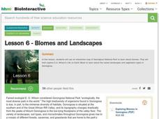
Lesson 6: Biomes and Landscapes
Aside from the amazing animals in Gorongosa National Park, what else is there to discover? The sixth installment in an eight-part themed series contains an interactive map where scholars can learn more about the geographic features of...
K12 Reader
Where On Earth Are You?
What do we use to determine the exact locations on the earth? Your kids can learn all about compass roses and latitude and longitude. Test understanding with the five reading comprehension questions included on the page.
K5 Learning
Treasure Hunt
After reading about a book that leads two friends on a treasure hunt, class members respond to four short answer reading comprehension questions. Skills include describing the characters, retelling the story in their own words, writing...
K12 Reader
Meteorologists
Meteorologists and the tools they use are the subject of a reading comprehension worksheet that asks kids to read the attached article and respond to a series of comprehension questions.
McGraw Hill
Study Guide for Island of the Blue Dolphins
Dive your class into a reading of Island of the Blue Dolphins with this in-depth study guide. Breaking the novel into three parts, the resource begins each section with a focus activity that identifies a specific theme or question...
K12 Reader
Colonization: for Gold, God, and Glory
Colonization, cartography, and circumnavigation. After reading a short article about early explorations, kids use the information provided to answer a series of comprehension questions.
Curated OER
Map Skills
Students explore geography by creating a poster presentation in class. For this mapping lesson, students identify the different components featured on a modern day map and how to utilize them in order to navigate. Students read a book...
Curated OER
Archaeology- State Map
Students study state maps. In this map skills lesson, students identify the states' location and how to use a legend. Students complete photocopies of the state map.
Curated OER
Learning to Read a Map
First graders identify the map and globe symbols: Cardinal Directions; Compass Rose; Mountains; Rivers; Lakes; Towns; Roads.
Curated OER
Learning About Maps
Students take a "field trip" with the teacher through the school then draw a diagram of what they saw. They bring the maps to the computer lab where they create electronic maps using the software program Neighborhood Map Machine.
Institute for Geophysics
Understanding Maps of Earth
Here is your go-to student resource on primary geography concepts, including facts about the surface of the earth and its hemispheres, latitude and longitude, globes, types of maps, and identifying continents and oceans.
Curated OER
Community Map
In this community map worksheet, students practice their map reading skills as they use the map key to determine the locations of community places on the map.


