Curated OER
Star Patterns
Third graders create constellation maps and record their own legends of how constellations came into existence. After observing the sky at night, 3rd graders discuss star maps, read previously recorded legends on the origin of stars. ...
Curated OER
War and the Animal
Students analyze the spatial organization of people, places, and environments in a spatial context. They gain personal insight into the horrors of war and the importance of ethnicity. Students define all key terms, analyze a world map...
Curated OER
Snow Cover By Latitude
Students examine computerized data maps in order to create graphs of the amount of snowfall found at certain latitudes by date. Then they compare the graphs and the data they represent. Students present an analysis of the graphs.
Curated OER
Mass Matters
Fourth graders, in pairs, explore the relationship between a star's life and its mass. They use a concept map to illustration the three categories of stars.
Curated OER
Adventuring in the Archipelago
Students study Charles Darwin's voyage on the HMS Beagle and his visit to the Gal??pagos Islands. They click through an interactive map of the Gal??pagos Islands to read actual and fictional journal entries from a fellow eco-tourist.
Curated OER
Boilermaker Geography
Fifth graders investigate the geography of central Indiana with an emphasis upon finding the location of Purdue. They make a connection to literature with the reading of a newspaper article to create the context for the lesson plan while...
Curated OER
Navigation, Working With Coordinates
Young scholars view a polar view map and discuss ways of telling locations on the map. They view a copy of the map superimposed on a coordinate grid, then discuss ways of telling the locations. Students practice as a class and then...
Curated OER
Summing It All Up
Students summarize a selected piece of text nonfiction text. After reviewing the correct way to read silently, students read a nonfiction article. They write a summary paragraph using a concept map and the process outlined by the...
Curated OER
Giving Generously
Students are read a book about giving. They discover that giving to others is rewarding. They also locate China on a map and make their own rice cakes.
Curated OER
The American Dream
Students expand their knowledge by researching on the Internet the African American civil rights movement and compiling a timeline of events and heroes. In addition to the civil rights timeline, students identify the key historical sites...
Curated OER
Census Statistics
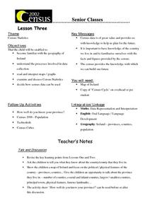
Twelfth graders become familiar with the geography of Ireland. They explore the processes involved in data collection. Students examine and discuss Census Statistics and read and interpret maps/graphs. They decide how the census data can...
Curated OER
Exploring For Copper Deposits
Students examine ore deposits and identify factors in their origin. They analyze geologic maps, and locate porphyry copper deposits on a sediment geochemistry map.
Curated OER
Togo's New President
Students read an article about Togo's new President. They locate Togo on a map. They practice using new vocabulary they find in the story. They also complete worksheets.
Curated OER
Fair Trade: Chocolate Can Be Good For You
Students discover the process of chocolate production. They read stories from boys in Ghana and Brazil who work on cocoa plantations. They illustrate the principles of fair trade.
Curated OER
Geography: Snow Cover on the Continents
Young scholars create maps of snow cover for each continent by conducting Internet research. After estimating the percentage of continental snow cover, they present their findings in letters, brochures or Powerpoint presentations.
Curated OER
Mobile of Information
Students create a mobile of various geometric designs to be usend to display information from a variety of texts. They add graphics as well as graphs and charts, color, design and artwork to express the ideas learned through the...
Curated OER
Why Here? Why Not There?
Middle schoolers analyze a map and graph information on eleven countries. Using the characteristics of the countries, they determine if they should host the summer or winter Olympic games. After viewing a video, they locate the...
Curated OER
Horse and Toad
First graders identify key elements of folktales and the countries in which they are told. They compare and contrast folktales they have previously heard with the Haitian folktale Horse and Toad. Reading materials and maps are included.
Curated OER
Fort Pickens and Fort Barrancas Historic District
Students use maps, readings, photos and diagrams to identify and describe events in Pensacola, Florida that preceded the Civil War. They examine the role of Fort Pickens during the Civil War and consider the community impact of military...
Curated OER
Japanese Manners and Life Style
Students continue their examination of modern Japan and its culture. Using a map, they locate various cities and landforms in the country and watch a video on related topics in which the make a timeline of key events. In groups, they...
Curated OER
Land Bridge Theory
Fifth graders observe a map that includes where the land bridge was located and that its name was Beringia and look in the Social Studies books to read about the Land Bridge Theory. The class then brainstorms reasons why they think...
Curated OER
The Regions In Which I Live
Learners investigate different regions. Beginning with the idea that a neighborhood is a region, students explore maps to discover that towns, states, and countries can also be considered regions. Learners create a book, with...
Curated OER
Comparing Time Periods in U.S. History: The Ashford Project
Fifth graders use a "fact book" comparing periods in American history then students create a picture to illustrate their assigned periods. # # students use their pictures and concept maps to write expository paragraphs about their...
Curated OER
Dividing the Philanthropic Shares
Students define who volunteers are the and the types of jobs that they do. They identify various groups who volunteer in their community, and locate them on a city map.


