Curated OER
Where In the World Are We?
Fifth graders read postcards and find their locations on maps. They use the pictures and text on the postcards to write about imaginary vacations. They compute the mileage and compare it to TripMaker data.
Curated OER
Fly on the Ceiling
Fourth graders complete activities to increase their understanding of coordinates. They listen to Julie Glass' book, The Fly on the Ceiling, before playing fly tic-tac-toe and Swat the Flies, in which they use ordered pairs to state the...
Curated OER
Earth and Space Science: Exploring Earthquakes
Students explore earthquakes. In this earthquake lesson, students research earthquakes and identify where they take place. Students use map skills to track down earthquake locations. There are internet sites suggested in this lesson.
Curated OER
Fictional Narrative Writing in Mathematics
Fifth graders discuss variety of fictional writing genres and connect each to familiar story that has been read, use creative and analytical skills to develop original piece of fictional writing that incorporates math skill, and share...
Curated OER
Poetic Justice: A Study of Poe's Famous Works
Students explore Edgar Allan Poe's most famous short stories. In this Edgar Allan Poe lesson, students complete a 25 page packet of activities where they recognize the features of genres and literary devices Poe uses. Students read "The...
Curated OER
Catch Me If You Can: Over and Under
Students read a story. In this vocabulary skills lesson, students read The Gingerbread Man, use flannel cut outs to re-enact the gingerbread man running over and under.
Curated OER
Persuasive Letters and The Tell Tale Heart
Students write persuasive letters based on "The Tell Tale Heart." They brainstorm topic sentences, main ideas, and details. They analyze the character and determine if he is innocent or guilty. They create a map listing their reasons to...
Curated OER
X Marks the Spot
Fourth graders use games and puzzles to explore co-ordinate systems and their uses. Students are given the opportunity to invent their own systems by locating counters on a sheet of paper and by finding the dead center of a set of objects.
Curated OER
States of Fitness
Young scholars participate in physical activities coordinating to divisions on a map.
Curated OER
Life on an Island: Early Settlers Off the Rock-Bound Coast of Maine
Students study the characteristics of life on the Cranberry Isles off the coast of Maine as they were settled. They examine images and maps to determine the location and lifestyle.
Curated OER
Rivers Bridge State Historic Site
Students use maps, readings, illustrations and photos to analyze the Civil War Rivers Bridge battlefield and describe how geography affected the outcome of the battle. They explore and explain the causes for the battle's heavy human...
Curated OER
The Tale of Scale
Eighth graders, using a range of data, produce three bar graphs for various scales along the y-axis.
Curated OER
Radiation Comparison Before and After 9-11
Using the NASA website, class members try to determine if changes could be detected in cloud cover, temperature, and/or radiation measurements due to the lack of contrails that resulted from the halt in air traffic after the attacks...
Space Awareness
How To Travel On Earth Without Getting Lost
Have you ever wanted to travel the world? Take a virtual trip with a geography lesson that uses longitude and latitude, the position of the sun, an astronomy app, and a classroom globe.
Curated OER
Differences Between Ground and Air Temperatures
Middle schoolers examine the differences between air temperature and ground temperature. In this investigative activity students find NASA data on the Internet and use it to create a graph.
Mathed Up!
Transformation of Graphs
In what ways can you transform a graph? An engaging video answers this question as it covers reflections, translations, and stretches of graphs. To test their knowledge, individuals complete a set of problems to apply this knowledge.
Curated OER
Measurement and Data Collecting using Image Processing
Students trace the route of the historical event and measure the distance over which the people involved journeyed. A data sheet be constructed outlining the location of events, and the speed with which the journey occurred.
Curated OER
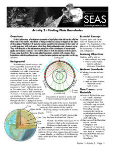
Recent Volcanoes And Earthquakes:
Students investigate the current model for the structure of the Earth. On a world map, they mark areas where they think earthquakes and volcanoes occur and compare those areas with earthquake and volcano location patterns.
Curated OER
Understanding Hurricanes and the ER-2
Students study hurricanes; in particular, what they look like, how they are formed, how they are categorized, how they are named, and how they are tracked. They examine the science of hurricanes as well as the mathematics of hurricanes.
Curated OER
Religions of the World
Second graders explore the part that religion plays in a culture. They explore how many different religions there are in the world and where they're located.
Curated OER
The Sugar Cane Curtain/ Defining Political and Social Struggles Between Haiti and the Dominican Republic
Twelfth graders explore historical events that created conflict between Dominican Republic and Haiti, examine how need for cheap source of labor has led to exploitation of Haitian workers, and discuss how topography of island of...
Curated OER
Common Theme in Folktale: 900 Versions of Cinderella
Seventh graders examine various stories that have a Cinderella theme. In this Language Arts lesson, 7th graders compare and contrast stories. Students write various journal assignments in regards to the stories.
Curated OER
High and Low Tides
Students collect real world data from the Web regarding high and low tides at various locations in the United States. They find a function which models this data and make predictions on tide levels based on the information found.
Curated OER
Documenting a Historic Climb of Mount Everest
Learners create front pages of newspapers that document the historic attempt of a group of Sherpa women to summit Mount Everest.


