Curated OER
Knights of the Round Table
As an exploration of the Knights of the Round Table, this activity helps students organize their information and check for understanding by using the comprehension questions. This packet would be a terrific supplement to a unit on this...
National Geographic
The Monsoon
Few things are as fascinating as the challenge of climbing Mount Everest. This lesson plan investigates how monsoon weather impacts climbers. To begin, you are instructed to show various video clips. The only one directly provided,...
Curated OER
Mapping a Garden
Second graders recognize the components of a map, particularly the legend, the key, the symbols and the area. They develop their own map of a garden they be planting in their upcoming science lesson plan.
Curated OER
Is there a map in that story?
Eighth graders examine different pieces of literature from specific isolated Pacific islands. For this Geography lesson, 8th graders read and interpret a written selection. Students construct a map of the stories setting.
Curated OER
United States Map- Land Elevation
Students explore a physical map. In this map skills lesson, students discuss examples of elevation and investigate the symbols used to identify elevation on a map. Students use the map to identify various land elevations.
Curated OER
Mapping Roxaboxen
Fourth graders read Roxaboxen and draw a map of the Roxaboxen community. In this language arts and geography lesson, 4th graders use specifications given, adding features to the map as described in the book and creating a legend.
Curated OER
Learning about Maps and Colors
First graders discuss "Harold and the Purple Crayon" and his drawings. In this neighborhood geography lesson, 1st graders learn to detect and classify places on a map including their home. Students recognize their address as a specific...
Curated OER
Sybil Ludington's Ride - a poem
Fourth graders examine the role a teen from the Hudson Valley played in the American Revolution. They view the map of Sybil's ride and calculate the distance using the map's legend.
Curated OER
Making Personal Maps
Students study maps and become familiar with how to use one. In this investigative lesson students create a map of an area and provide a legend.
Curated OER
Cultural Maps
Fifth graders examine map elements. In small groups they create a map of an imaginary country that includes a title, legend, directional indicator, scale, boundaries, capital cities, country name, and icons of five natural resources. ...
Curated OER
The O Zone-Code Read Alert
What are the effects of an air quality alert? Expert groups receive one component of air quality information resources to study. Pupils then jigsaw into new groups and share their knowledge. Finally, they draft a statement of what they...
Curated OER
Route Map Lesson Plan
Students read and make a route map by following step by step directions. They identify and make legends.
Curated OER
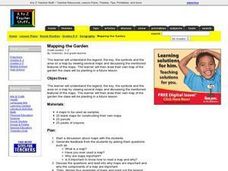
Mapping the Garden
Students discuss maps, the features on a map, and why maps are important. They make a map of a garden they will be planting, complete with symbols that represent the various plants they choose to plant.
Curated OER
Map It!
Fourth graders collect and explore different maps and their uses before using the program Pixie to create maps of geographic features, political features, and economic information for the state in which they live.
Curated OER
Latin American Relief Map
Students, in groups, research, design and construct a relief map of a section of Latin America using papier-mache. They show major landforms, elevations and notable bodies of water. They present their maps to the class.
Curated OER
Mapping the Local Community
Young scholars review the symbols and legends of a map. In groups, they follow a set of directions to create a map showing the route to a specific place. They present their map to the class and review the basic components of a community.
Curated OER
Globe Skills Lesson 5
For this map skills worksheet, students read a text selection about locations during the American Revolution and then respond to 8 fill in the blank questions.
Curated OER
Globe Skills Lesson 1 Some Early American Cultures
Middle schoolers apply their knowledge of geography. In this geography skills instructional activity, students read brief selections regarding early Americans. Middle schoolers respond to the questions included in the self-guided map...
Curated OER
Build Listening Skills With Asian Folktales
Young scholars read five folktales. After each folktale is read students use a map to find the location of the country of the tale's origin. Next, young scholars answer comprehension questions related to each folktale.
Curated OER
WORLD GEOGRAPHY
Students identify and analyze map symbols and map grids by completing various worksheets and creating their own map using these skills. Students identify and analyze what latitude and longitude are on a map to play a game of Bingo....
Curated OER
Country Capitals
Students locate country capitals on a world map. In this map skills lesson, students review the definition of the word country and discuss what a capital is. Students locate and label capital cities on a world map using a map marker.
Curated OER
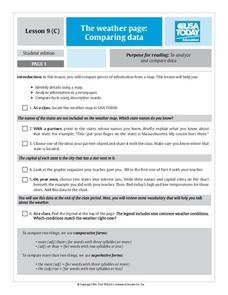
The Weather Page: Comparing Data
Students analyze data from maps. In this comparing data lesson, students use comparative and superlative statements to draw comparisons among the weather in different American cities based on USA Today weather maps.
Curated OER
Lesson Design Archaeology- World Map
Students practice locating positions on the world map. In this map skills lesson, students explore the world map and items such as the compass rose, Equator, mountains, cities, etc. The students practice locating positions on the world...
Curated OER
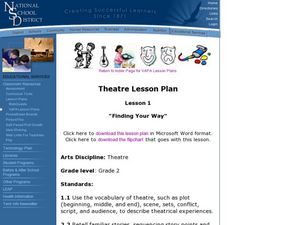
Theatre Lesson Plan: Finding Your Way
Second graders identify story elements in familiar stories from their lives. In this story elements lesson, 2nd graders act out familiar activities by following directions. Students read a story and discuss the story elements....


