Curated OER
Food Traditions: Making Cherokee Bean Bread
Imagine being forced out of your home and walking over 1,000 miles with only the things you could carry. How would you survive? What would you eat? After reading about the Trail of Tears and Cherokee resilience, middle schoolers are...
Curated OER
"Trails, Rails, and Roads" Lesson 2: Road Tripping
Young scholars practice map skills and take a virtual road trip through Maine examining the history of transportation. They create questions from the information they learned and play a game against other groups.
Curated OER
Introduction to the United States Map
Students identify the United States of America and it's states on a map. In this mapping lesson, students examine a globe and find the United States as well as a few land marks (Florida and the Great Lakes). Students then look at a...
Curated OER
Lesson Plan for a 5th Grade Science Class
Sixth graders use the SQ3R reading strategy to learn about the behavior of light. In this behavior of light lesson, 6th graders read a selection about the behavior of light and use the strategy to complete the reading. Students make a...
Curated OER
The Amazing PE Race
Students utilize map reading skills, perform locomotor movements, and practice skills as they make their way through the Amazing PE Race. They use a map of school grounds to collect clues around the building.
Curated OER
Do You Know Your Story Grammar?
Pupils are introduced to the concept of story structure as a way to aid in reading comprehension. They identify the main parts of the story as they read. Students create a story map of the main plot points of their reading.
Curated OER
Locomotor Treasure Hunt
Students practice in refining their locomotor skills and developing their understanding of pathways and basic map reading skills.
Curated OER
The Bread of the Sandwich
Students create relief maps of Canada and Mexico out of everyday objects like dried macaroni, dry rice, sand, etc. They create a clue card for a location game and try to stump their classmates. They host a travel fair to display their...
Curated OER
Discovering New Mexico
Seventh graders discuss the elements of maps and using basic linear measurement. They calculate the distance between the cities and create a simulated journey around New Mexico using a road map. They write out the directions for their...
Curated OER
Fun with Summarizing
Students practice summarization by creating a story map. After reading Freckle Juice, students working in groups, create a story map of the main events of the story. Groups use their story maps to summarize a chapter of the story and...
Curated OER
Arthur's Tooth
Students practice their reading comprehension by reading a story in their class. In this story map lesson, students read the Marc Brown book Arthur's Tooth and discuss the story, characters and setting. Students create a story map based...
Curated OER
Multimedia Book Reports
Students read a chapter book of 100-200 pages in length. They create a story map and multimedia book report. Pupils review the elements of a story map such as: characters, setting, problem, important events, solution, etc.) Students...
Curated OER
Finding My Way
Learners determine a route from their home to the Stones River National Battlefield. For this map work lesson, students use a detailed city map of Murfreesboro to locate a route to the Stones River National Battlefield. They follow...
Curated OER
Claiming Land
Students examine several European maps with conflicting representations of the same geographic region. They uncover why different European nations produced different maps. In addition, they determine the role maps played in helping...
Curated OER
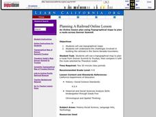
Planning A Railroad Online Lesson
Students plan a route across Donner Summit using topographical maps in order to understand the challenges involved in constructing the railroad in the Sierra Nevada Mountains. In this history lesson, students first discover how to read...
Curated OER
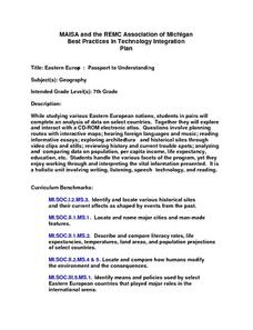
Eastern Europe: Passport to Understanding
Seventh graders explore Eastern Europe. They analyze data on select countries. Students prepare a short oral presentation on the country they researched. They locate their country using an interactive map.
Curated OER
Nursery Rhymes
Young scholars recall details of nursery rhyme read by teacher, identify main characters, and demonstrate knowledge of poem by creating concept map about story that includes title, clip art, and changes in font and color.
Curated OER
African Dance: Drumbeat In Our Feet
Second graders read "African Dance: Drumbeat in Our Feet". In groups, they identify the message of the story and discuss a personal experience that relates to a part of the book. They practice reading fluently as a class and making...
Curated OER
Leapin' Landmarks: Locating 10 Man-made Landmarks Around the World
Third graders label continents, oceans, and major mountain ranges on maps and use the maps to write an informational report about landmarks. In this landmarks lesson plan, 3rd graders write about 1 major landmark.
Curated OER
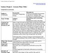
Longitude & Latitude
Seventh graders role play as ship's captains to study longitude and latitude.
Curated OER
Changing Images of Childhood in America: Colonial, Federal and Modern England
Young scholars compare and contrast maps of New Haven, Connecticut from today and the past. After taking a field trip, they draw sketches of the types of architecture and discuss how the buildings have changed over time. They read...
Curated OER
Map Making
First graders explore maps to realize the concept that maps are simply small representations of a much bigger picture. They discuss the importance of maps in everyday life, examine a map of the school, and then make a map of their...
Curated OER
Indianapolis Government
Students read about a girl who takes a trip during the time of the State Capital moving to Indianapolis and then write their own essay about a trip that they took. In this Indianapolis Government lesson plan, students use maps and...
Curated OER
Maize to Maquiladoras: Movement from Mexico to Arizona
Fourth graders label maps of Arizona and Mexico to show the people, goods, and ideas that have moved between the two places. In this Arizona and Mexico lesson plan, 4th graders summarize the effects of the movement on Arizona life.


