Curated OER
Maps
First graders look at their classroom or school setting. They use positional word to describe where things are located in the school. Students discuss a map and why they are important. They read the story "Taylor's New School" and...
Curated OER
Using Cinderella Stories to Study Venn Diagrams
Seventh graders read Cinderella stories and complete graphic organizers for the various versions. In this story analysis lesson, 7th graders read versions of the story Cinderella. Students organize the story's information using a variety...
Curated OER
Life Map
Students compose plans for their futures. In this writing lesson plan, students create life maps of past events and predict future events. They brainstorm events of their lives and decide which ones are most pertinent to the...
Curated OER
Maps that Teach
Students study maps to locate the states and capital on the US map. Students locate continents, major world physical features and historical monuments. Students locate the provinces and territories of Canada.
Curated OER
Make Your Own "Weather" Map
Students create their own "weather" map using data from x-ray sources. They analyze and discuss why it is important to organize data in a fashion in which is easy to read. They compare and contrast different x-ray sources using a stellar...
Curated OER
A Special Relationship: Connecticut and Its Settlers
Students study both geological and geographical features of Connecticut and the New Haven area. They focus on map works and rock formation.
Curated OER
Latitude & Longitude Bingo
Students practice map reading skills through a reinforcement game of bingo. They select any 24 of 30 listed cities to write on blank bingo cards. Then using atlases, locate a city based on the latitude and longitudinal coordinates...
Curated OER
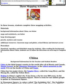
China: Dim Sum: 3 Mapping Lessons
Fourth graders, after studying maps, draw a very large outline map of Asia and then a large map of China on it in the appropriate place. They label the appropriate information.
Curated OER
The Science of Weather: How Doppler Radar reads weather
Students read about how radar detects changes in the weather. In this lesson on weather reporting, students read a diagram that shows how radar reads weather. This lesson includes discussion questions and an individual activity that can...
Curated OER
MAPPING THE SCHOOL FOREST
Young scholars measure distances and directions using paces and a compass. They determine their own pace, explore how to read a compass bearing, and how to take bearings on given sites.
Curated OER
You Can Do It, Mr. And Mrs. Mallard!
Learners watch the video "Make Way for Ducklings" by Robert Mc Closkey. They write letters to Mr. and Mrs. Mallard and make a map for the mallards. They talk about the importance of animal habitats.
Curated OER
Silly Sally: Love Two Teach
In these reading and writing skills worksheets, students complete a packet about a story titled 'Silly Sally.' Students create popsicle stick characters to retell the story, create their own alliteration name and draw themselves silly,...
Curated OER
Mapas Bailados: Creating Visual Representations of Dances Using Maps
Third graders listen to "Frank the Monster..." and discuss the dance map on the inside cover of the book. They create their own dance map using sentence strips to record the types of movement.
Curated OER
Mapping A Stream
Students participate in mapping an actual waterway. They include reach lengths, transects, compass reading, and scale determinations. They include windfalls, plant cover, types of streambed composition, and landmarks such as trees and...
Curated OER
Studying the Caribbean Immigration
Students use the site maps and other resources to research one of the influential Caribbean immigrants or descendents of immigrants mentioned in a narrative they have read. They write an essay about an influential immigrant.
Curated OER
United States Geography and Topography
Fifth graders recognize the major regions of the US while reading a map. Students study the physical features of the US. Student research and report on states and their capitols.
Curated OER
Beginning Reading Lesson: Aaa-aaa-aaa-choo!!
Pupils study the letter sound recognition for the /a/ by recognizing the sound one makes when they sneeze. They use a chart with a tongue twister on it and work with letterboxes and manipulative letters that focus on words with the /a/....
Curated OER
What's the Main Idea?
Fourth graders comprehend what they are reading. An effective strategy for comprehension is summarization. They single out and explaining the main ideas of a passage. Students find a sentence or rewrite their own that covers...
Curated OER
Vacation Matrix-Integrated Core
Students read aloud, "The Best Vacation Ever," by Stuart Murphy locate vacation spots on a map and describe their own vacations. Students illustrate their summer vacation spot and describe the vacation, placing it on a "vacation matrix"...
Curated OER
In a Nutshell....
Students examine how to summarize the most important details in a reading passage in order to increase their comprehension. They design a story web using the summarization skills. Before class, they complete a reading assignment prior to...
Curated OER
Just the Facts, Ma'am
Students use tables of content, chapter titles, and key words as a strategy for organizing non-fiction information. They write a paragraph with a partner using information from a graphic organizer.
Curated OER
The Eighty Yard Run
Students read and explore the themes of the book The Eighty Yard Run. In this literature lesson, students discuss their observations and predictions. Students develop their own story which is similar to that of The Eighty Yard Run.
Curated OER
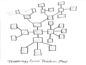
Wayne County Public Schools: Motto - Opening Minds...
Students use research, planning, and organizational skills to devise a technology crisis solution for the given school's problem. In this mapping and planning activity, students read through the letter about the technology crisis for a...
Curated OER
Choosing Plymouth - Pilgrim Study Unit
Students identify the principal physical features the Pilgrims considered when choosing the location of Plymouth. They create a postcard to send to a friend in Europe as if they were a Pilgrim; illustrating one aspect of the settling in...


