Curated OER
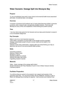
Sewage Spill into Biscayne Bay
Learners use a hypothetical case study to learn about environmental health issues associated with water, recreational water, and sewage. They use an inquiry-based learning module to generate questions, draft a research plan, and generate...
Curated OER
The Weather
Students explore earth science by reading articles in class. In this weather identification lesson, students analyze weather science articles on the Internet and view their own local weather patterns as well. Students define a list of...
Curated OER
Seeing in 3D: Interpreting Two-Dimensional Diagrams of Three-Dimensional Objects
Students hone in on their skills at reading diagrams. In this dimensional lesson plan students collect information on the functions of organs then figure out how all the parts work together.
Curated OER
Rescue!
Students explore movement and position concepts. They follow directions using left , right, up, down, North, South, East and West. Students draw and follow a path on a grid to show a route followed. They label and follow legends on a map.
Curated OER
Our Monster Travels...
Students write emails to their parents and locate specific places on a map. For this email lesson, students email their parents from the teacher's account and map locations of their parents.
Curated OER
The Grand Excursion GPS Map
Eighth graders investigate the uses of a global positioning system. They create waypoints and have to find them using the system. Students must review the geographical concepts of latitude and longitude. The media requirements of the...
Curated OER
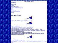
That's NorthEastWestSouth to Me!
Pupils demonstrate north, south, east and west. In groups, students participate in games to decide what directions a specific bear must travel. They play a "Simon Says" game to develop single step directions. Pupils listen to and follow...
Curated OER
Snow Cover By Latitude
Middle schoolers create graphs comparing the amount of snow cover along selected latitudes using data sets from a NASA website. They create a spreadsheet and a bar graph on the computer, and analyze the data.
Curated OER
Oregon Trail Maps
Fourth graders explore the Oregon Trail. In this Oregon Trail lesson, 4th graders collaborate to conduct Internet research regarding states along the Oregon trail route. Students present their findings to their peers.
Curated OER
Balanced Literacy: Presidents
Students participate in a unit (all lessons on the same page) to explore the Presidents of the United States. They choose one President to write a mini-book about, create a puppet and an original puppet show to perform about their chosen...
Curated OER
Earth Matters
Students identify Earth's equator, prime meridian, lines of latitude, lines of longitude, parallels, and meridians.
Curated OER
Read a Transportation Story
Third graders research the building of a transcontinental road. In this railroad history lesson plan, 3rd graders discuss past and present transportation. Students look at historical photos and compare and contrast photos from today.
Curated OER
Primary Sources and Archaeology in the Study of Ancient Mediterranean Trade
Tenth graders begin the lesson by plotting trade routes, major empires and items traded. Using primary sources, they examine their own values regarding trading items for royality. They participate in a role-play exercise in which they...
Curated OER
Mapping the Circulatory System
Learners investigate the circulatory system in human beings. In this human body instructional activity, students create an outline of a human body using colored markers and butcher paper. Learners use red and blue colors to...
Curated OER
Cultural Mapping
Students are introduced to the cultural diversity in Australia. Using new vocabulary, they define multiculturalism and explore their own cultural backgrounds. In groups, they complete a series of worksheets to develop a better sense of...
Curated OER
Celebrating the Solstice and Equinox
Fourth graders graph the number of daylight hors throughout the year and examine why day length varies. They discover that seasonal changes and latitude on Earth affect the number of hours of daylight in each day. Students listen to...
Curated OER
Folktales around the World (Middle, Reading/Writing)
Students analyze, synthesize, and use the elements of various US cultural folk tales to describe the elements of fiction in general and in folk tales specifically.
Curated OER
Organizing Your Ideas Into an Effective Outline
Students explain the components of a speech outline and write an interesting speech.
Curated OER
Science: Reading a Compass
Students demonstrate how to take bearings using a compass. In pairs, they select objects in the classroom then write down its first initial and bearing. They exchange papers and try to disciver their partner's object.
Curated OER
Using Charts and Graphs to Study East Asia's Modern Economy
Learners examine East Asia's modern economy. In groups, classmates use the internet to compare the resources, products, and economy of specified countries. After collecting the data, pupils create charts, tables and graphs. They...
Curated OER
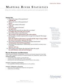
Mapping River Statistics
Students research different statistics to do with the Mississippi River. They answer questions about finding data and collect it by conducting research. The research is used to construct a data table. Then students use the table to...
Curated OER
Individual Horizontal Sundial 2: Cloud/Rain Activity
Learners create a sundial to measure local apparent time as it relates to the position of the sun in the sky. In this sundial lesson, students cut and glue gnomon to a sheet of thin cardboard. Learners then set the sundial in an...
NET Foundation for Television
1850-1874 Beef Moves to Nebraska
Just how long was the Long Drive? Learners investigate the movement of cattle in the Great Plains during the mid-1800s. They incorporate photographic, newspaper, video, and primary source evidence into their posters, artwork, and written...


