Alabama Learning Exchange
Coordinate Geometry
Where do the coordinates lead? As children brainstorm ways to find the location of different buildings, they learn about coordinate points and how to use them to locate areas on a grid or map. They practice using ordered pairs by playing...
Penguin Books
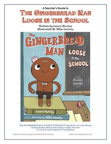
A Teacher's Guide to The Gingerbread Man Loose in the School
What if the Gingerbread Man was trying to catch you, rather than the other way around? Pupils can find out what happens by reading the story The Gingerbread Man Loose in the School by Laura Murray and enrich their experience with the...
Orlando Shakes
The Great Gatsby: Study Guide
Uncover the exciting world of the Roaring Twenties with The Great Gatsby study guide. Individuals become critics as they write a review of the production. Scholars also read historical information and analyze the differences between the...
August House
Go to Sleep, Gecko
Use this multidisciplinary lesson to delve into these subjects: English language arts, math, science, drama, and character education. After reading, discussing, and making interpretations about Go To Sleep, Gecko!: A Balinese Folktale by...
Curated OER
Some Things You Need to Know to Read a Map
Students study things the you need to know to read a map and explain location.
Curated OER
Tooling Around Arizona: Reading Arizona Maps
Students research Arizona maps. In this map lesson, students discuss map titles, scales, directions, elevation, and symbols. The class will examine topography, landforms, and rivers found on an Arizona map.
Curated OER
Lesson Design Archaeology- USGS Maps
Students research USGS maps and identify the major features. In this map skills lesson, students identify low and high elevations on a USGS map and practice finding latitude and longitude.
Curated OER
Mapping Electricity
Students complete Internet research and use their map reading skills to learn about how the United States creates and uses electricity in different states. For this energy sources lesson, students study the mini map of energy usage in...
Curated OER
A School Map
In this school map worksheet, students practice their map reading skills as they use the word box and the compass rose the help them answer 6 fill in the blank questions.
Curated OER
Map Keys
Third graders examine maps and map keys. In this locating map features lesson, 3rd graders use crayons, markers and colored pencils to label maps. Students work in partners to read map keys and locate given places and things.
Curated OER
Compass Rose for the New Millennium
Sixth graders are introduced to the concepts of a compass rose and how it used in relationship to reading maps in geography. The lesson plan is meant to build upon prior knowledge and skills.
EngageNY
Close Reading of Bullfrog at Magnolia Circle: Predators and Prey
Reading is fantastic, especially when it's reading about bullfrogs. Kids get cozy with predator/prey relationships as they hone their information-reading skills. They start out as they read a portion of the text aloud, then they...
Curated OER
Mesopotamia
Here is resource that offers a great, organized approach to your unit on Mesopotamia and early civilizations! As learners study the topics in the unit, such as the Fertile Crescent, ancient Sumeria, the Assyrian and Persian Empires, and...
Curriculum Corner
Fairy Tale Unit of Study
What makes a fairy tale a fairy tale? Use a 27-page packet to supplement your next fairy tale unit. With sequencing activities, story map worksheets, character analyses and story elements graphic organizers, and fairy tale highlight...
Penguin Books
Teacher's Guide: Where the Crawdads Sing by Delia Owens
An 11-page teacher's guide that focuses on Delia Owens' bestseller Where the Crawdads Sing is packed with discussion questions and activities. Text-dependent questions, activities, and writing prompts are also included. It's a valuable...
Curated OER
Where in the Latitude Are You? A Longitude Here.
Students distinguish between latitude and longitude on the map. In this mapping lesson, students participate in mapping skills to recognize spatial relationships, and where to find natural resources on the map. Students create their own...
Curated OER
Map Skills
Young scholars construct a road map using map pieces precut by the teacher. They apply geometric terms such as rotation and turns. Students apply the use of ordinal directions. They apply a variety of map keys.
Curated OER
Mapping Counties
Students practice reading a map. For this mapping lesson, students illustrate a map and compare and contrast the counties based on their population. Students also explore what a census is and read census data on a map. A student...
Curated OER
Map Skills
In this history instructional activity, students utilize a map and legend to answer eleven comprehension questions. Students check their answers when done.
Curated OER
Bird's Eye View Map
Students explore seeing things from a bird's eye view. They listen to the book, "As the Crow Flies," view various objects from eye level views and standing on a chair, create a drawing of an object from both views, and read "Ben's...
Curated OER
Topographic Maps Worksheet
For this geography skills worksheet, students respond to 37 multi-part questions that require them to read and interpret topographic maps.
Curated OER
Geography Skills
Students practice their geography skills. For this geography skills lesson, students locate, plot, and label places on maps and globes.
Curated OER
United States Map- State Capitals
Students explore the state capitals. In this geography activity, students use a political map to identify the state capitals and place post-it notes on various capitals.
Curated OER
Reading Maps of the East Pacific Rise
Students make qualitative and quantitative observations and use various maps to investigate the features of the East Pacific Rise The study actual bathymetric maps of the EPR region. They identify key features of the ridge and explore...


