Curated OER
Map Coordinate Bingo
Students play a bingo-type game to locate cities by coordinates. They explain the use of orientation on a map and identify cities in the western hemisphere. They compare road maps, shutttle images, and a CIR image and obtain an...
Curated OER
The Landscape of a Novel
Students, after reading a novel, utilize geographic skills to map out the places described in the novel. They collect data, envision spatial features and then design a map to work off of to complete their assignment. Each student also...
Curated OER
National Road to Indiana
Students explore the National Road to Indiana. In this U.S. highway history and primary source research lesson, students read an original journal written by Jane Voorhees Lewis in 1806 describing her trip west on the first federally...
Curated OER
Project Whistlestop:Missouri Vacation Learning Unit
Fourth graders reserach the state of Missouri. In this Missouri History lesson, 4th graders plan a vacation to a region of Missouri. Students work in collaborative groups to determine all aspects of the trip. Students use math...
Curated OER
From Claws to Jaws: Atlantic Regions of the United States
Students explore New England, Mid-Atlantic, and southeastern regions of the United States. In this social studies thematic unit, students research a state and make a regional quilt. Students wrte a book report and read two novels...
Curated OER
Navigation
Learners explain that globes are the best way to show positions of places, but flat maps are portable and can show great detail. They make a mercator projection of the route Lewis and Clark took on their journey.
Curated OER
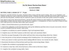
On My Honor-Marion Dane Bauer
Learners read and examine the novel On My Honor by Marion Dane Bauer. They choose to complete a variety of intriguing assignments on this novel. Critical thinking skills are intertwined throughout this lesson.
Curated OER
George Washington's Revolutionary Journeys
Middle schoolers take a closer look at historical maps. In this American Revolution lesson, students examine the provided historical maps and documents to determine the assignments that George Washington assigned to subordinates during...
Curated OER
Why We Count
Students visualize census data on a map and use a map key to read a population map. In this census lesson, students use a map of the Virgin Islands and corresponding worksheets to gain an understanding of population density.
Curated OER
Charlotte's Web
Fourth graders focus on fluency by reading the book Charlotte's Web. In this reading strategies lesson, 4th graders partner read, do guided reading, and independent reading to increase fluency. Students use Venn Diagrams, discuss...
Curated OER
Transportation in Indiana
Fourth graders investigate Indiana transportation. In this transportation lesson students discover early forms of transportation such as railroads, rivers, boats, and roads. Students compare and contrast the different...
Curated OER
State or Region Project
Invite your youngsters to learn about a state or region through their choice of a creative project. The resource lists 15 project options that range from a 3-D map of the area, to a puppet show about the region. Pupils can also propose...
Curated OER
Lesson 2: Mapping Our Home
Students recognize the importance of community participation in the census. For this U. S. Census lesson plan, students use map-reading skills to find answers and learn the difference between senators and members of Congress.
Curated OER
"Trails, Rails, and Roads" Lesson 2: Road Tripping
Students practice map skills and take a virtual road trip through Maine examining the history of transportation. They create questions from the information they learned and play a game against other groups.
Curated OER
Mapping My Trip to the 2002 Winter Olympics!
Eighth graders map their route from their local community to Salt Lake City, Utah for the Winter Olympics. Using atlases, they gather topographical information and use the internet to research any landmarks they might pass on the way....
Curated OER
Reading Maps Critically
Students discover that maps represent different values of the cultures who make them. Using the internet, they research the role of a cartographer and how their culture affects them. In groups, they are given examples of maps in which...
Curated OER
Mapping My World
Students are introduced to simple maps and view a map of a classroom and compare distances of items shown.
Curated OER
Mapping Your Neighborhood
Pupils use atlases, maps, and Web resources to generate and examine maps of their own neighborhoods.
Curated OER
Gotham Equinox
By looking at the direction of the parallel streets of New York and figuring which days the setting sun is directly visible along those lines, your class can calculate the degree and angle of the sun. A really nice lesson, giving a...
Mrs. Robbins' Social Studies Site
The Berlin Blockade
The Berlin Blockade may not take up as much space in the history books as other events of the Cold War, but for the citizens of west Berlin in 1948—and the events to follow between the Soviet Union and the United Stattes—those 318 days...
Curated OER
Contour Map Worksheet #3
Earth scientists answer five multiple choice questions about the topographical map atop the worksheet. Use this as a quick assessment of understanding after having taught how to read contour lines and topographic maps.
Curated OER
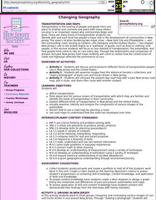
Changing Geography
Young scholars visually examine, identify and analyze the components of various images of the automobile. They discern how to use a road map by planning a route, then use road maps to explain how the state has developed over time.
Curated OER
Mapping The Ocean Floor
Young scholars explore and analyze the bottom structure of underwater habitats. They describe and explain what can't see through the collection and correlation of accurate data. Learners assess that technology is utilized as a tool for...
Curated OER
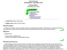
CHARTING THE COURSE
Students uses atlases, maps, and Web resources to determine the distance, driving time, and amount of money they need to make the trip (estimates should include hotel/motel stays, meals, and souvenirs).


