Curated OER
Riemann Sums
Students calculate the area under a curve. In this calculus lesson plan, students use Riemann Sums to find the area under a curve. They apply the boundaries of intervals as they solve for each area.
Curated OER
Lewis and Clark and Native Americans, Part II
Students research the Native Americans living in the regions explored by Lewis and Clark. They identify the modern-day names of sites claimed by the Lakota Indians, and create a poster of the original Native American names.
Curated OER
Siting Wind Power
Students analyze a variety of curves that describe the power extracted from the wind by a variety of commercially produced wind turbines. They utilize site specific topographic maps and political boundary data to evaluate and make...
Curated OER
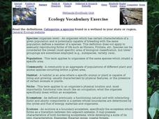
Ecology Vocabulary Exercise: Wetlands
In this ecology vocabulary exercise: wetlands worksheet, students read the definitions of 8 words, then categorize a species found in a wetland in their region. This page has numerous links to helpful web resources.
Curated OER
No Magic Borders: Haleakala Style
Young scholars discuss borders and boundaries. They discuss pollution and the fact that boundaries cannot stop pollution and that pollution affects even protected wildlife and plants. They participate in an activity in which they must...
Teach Engineering
Earthquakes Living Lab: Geology and Earthquakes in Japan
Sometimes it seems as if earthquakes hit the same places over and over again. Class members study Japan in order to determine why earthquakes keep happening there. Pairs work together to research and try to determine whether there...
Mathematics Vision Project
Module 5: Systems of Equations and Inequalities
Systems of equations and inequalities model contextual situations. A set of 12 lessons build a solid understanding of writing and solving systems of equations and inequalities using a variety of methods. The module is the fifth in a...
Curated OER
Geography And The Gulf War
Students develop maps, tables, graphs, charts, and diagrams to depict the geographic implications of current world events, and analyze major human conflicts to determine the role of physical and cultural geographic features in the...
Curated OER
Ideas and Commodities Cross Cultural Regions
Students compare and contrast how commodities native to certain countries have impacted the economies of other nations. After gathering information regarding how commodities are grown and traded, students use their information to...
Curated OER
Worksheet 34 - Fall 1995
In this math learning exercise, students sketch the finite area whose boundary is composed of pieces of the curves x =1− y 4 and x = y2 − 1.
Curated OER
Complex Analysis: Transformations
In this transformation instructional activity, students find the linear transformation of equations and use the Mobius transformation to identify image boundaries. Students describe the images in each quadrant. This two page...
Curated OER
Ecology Vocabulary
In this ecology worksheet, students read the vocabulary words and then categorize a species found in a field, meadow, or fencerow in their state or region. Students complete 6 problems.
Curated OER
Risk Assessment and Geometry
Tenth graders study the concept of risk analysis as it relates to geometry. In this spatial relationship activity, 10th graders are provided a set of coordinates to analyze a piece of land described. Students write a description that...
Curated OER
Mystery Mollusc
Students investigate the different regions of our oceans by researching the Internet. In this oceanography lesson, students discover the different jobs related to ocean research and examine their roles by reading related...
Curated OER
Canada's Geographic Position
Ninth graders investigate the characteristics of the geographic position of Quebec and Canada in the World. They study Canada's land and water boundaries, surface area and time zones.
Curated OER
Building the Best Brochure
Students research characteristics of a good brochure. Using the Internet, students explore the areas of the Mission Trails Regional Park. Students incorporate ClarisWorks and other software, to design a brochure of the area they...
Curated OER
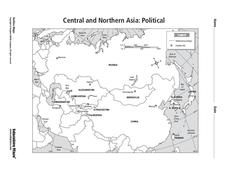
Central and Northern Asia: Political
In this Central and Northern Asia map worksheet, students examine national political boundaries and national capitals in this region of the world. The map is labeled.
Curated OER
Central and Northern Asia: Political
In this Central and Northern Asia outline map, learners examine the political boundaries of the nations in this region and note the location of their capital cities. This unlabeled map may be used in a variety of classroom activities.
Curated OER
Rectangular Gardens
Students create a rectangular garden using paper and tiles. In this geometry lesson plan, students investigate the largest possible rectangle that can be created given specific boundaries. They use grid paper to draw the rectangles...
Curated OER
Four Color Theorem
Young scholars identify and interpret how the Free Response questions are graded on an AP Exam. They also discuss coloring the included map, placing several examples on the board to determine the number of colors necessary to color each....
Curated OER
Microsoft Publisher Country Brochure
Young scholars explore geographic information. In this geography and technology lesson, students choose a county and answer related questions on a Webquest. Young scholars create a word web and design a country brochure.
Curated OER
Eastern Hemisphere Map
In this Eastern Hemisphere polar map learning exercise, students examine the Eastern Hemisphere including the political boundaries formed by the countries in this region of the world.
Curated OER
South east Asia and the South Pacific: Political: Labeled Map
In this Asia and the South Pacific map worksheet, students examine the boundaries of the nations in this region of the world. Students also note the location of capital cities as they are denoted by stars. This map is labeled.
Curated OER
Central & Southwest Asia: Labeled Map
In this Central and Southwest Asia outline map worksheet, students examine boundaries of each of the countries in the region. This map is labeled.


