Curated OER
Sailin' Through Time...Rhode Island, The Ocean State
Fourth graders explore the history of Rhode Island. They research famous people who brought change to the state. They explore the state song, natural resources, and colonies of the state. In groups, 4th graders create a travel brochure...
Curated OER
Canada's Forests and Resource Management
Students are introduced to the Canadian forest industry so that they may assess the economic and environmental sustainability of the industry.
Curated OER
Discovering the Northwest Territories Through the Five Themes of Geography
Students use the Atlas of Canada to find basic geographical information about the Northwest Territories.
Curated OER
Introduction to the Virtual Atlas
Students use an atlas online to gather information about the state of Washington. Individually, they practice using the database and researching specific items in the Pacific Northwest. They complete a quiz to end the activity.
Curated OER
Globe Skills Lesson 5
In this map skills worksheet, students read a text selection about locations during the American Revolution and then respond to 8 fill in the blank questions.
Curated OER
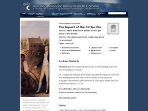
The Impact of the Cotton Gin
Fourth graders study Eli Whitney and the cotton gin. In this lesson on the cotton gin, 4th graders use primary and secondary sources to gather information about Eli Whitney, the cotton gin that he invented and how it changed the south.
Curated OER
United States & Canada: How Are We The Same? How Are We Different?
Young scholars compare and contrast similarities and differences between Canada and the US. In this geography lesson, students read various articles and identify similarities and differences in economies, cultures, geography,...
Curated OER
Kinds of Maps
In this map worksheet, students match a set of descriptions with the names of different types of maps and answer true/false questions and short answer questions about using maps.
Curated OER
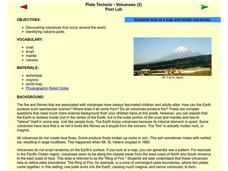
Plate Tectonic - Volcanoes Post Lab
Second graders discover volcanoes that occur around the world. They identifying volcano parts.
Curated OER
Dryline Characteristics
Students view animations of several atmospheric variables (e.g., temperature, rainfall) during a cold front passage and locate the dryline, determine its direction of movement, and list at least two weather conditions associated with the...
Curated OER
Bluebirds Ecology Vocabulary Exercise
For this bluebirds worksheet, students categorize bluebird species found in their state and define vocabulary related to it. Students complete 6 vocabulary words.
Curated OER
Rainforest Rock
Students discuss the impact of environmental change on people and culture; create musical instruments that reflect cultural influences. apply musical concepts, evaluate Internet resources, and make a meaningful presentation.
Curated OER
Uncharted Territory
Students examine what were preconceived perceptions of the areas Lewis and Clark explored. They compare and contrast past and modern maps of North America. They accurately place route and site information on the map.
Curated OER
The Challenges Ahead
Students examine the physical obstacles that the Lewis and Clark expedition encountered on its journey. They report what challenges these physical obstacles might have posed. They review a modern-day map and explain if the obstacles...
Curated OER
Constructing a Timeline of African History
Students create a timeline of African History. In groups, they research and describe eight different important periods in the country's history. They apply this information to compare and contrast them and how it has allowed Africa to...
Curated OER
Solve a System of Inequalities
In this system of linear inequalities learning exercise, students solve 5 problems with the graphing method and are given 2 examples with multiple steps to follow.
Curated OER
Systems of Linear Inequalities
In this Algebra I/Algebra II learning exercise, students solve systems of linear inequalities by graphing the inequalities on a coordinate plane and determining the location of all ordered pairs that solve the system. The three...
Curated OER
Desert Views - First Impressions: Travelers on the Gila Trail
Students draw animals and plants that are described to them as they read passages of people who traveled across the Gila Trail in the Southwest. In this Gila Trail lesson plan, students also write a letter describing a plant or animal in...
Curated OER
Historical Indian Treaties and Aboriginal Population
Sixth graders navigate an online atlas of Canada and compare the land area of of historical Aboriginal peoples in Manitoba to present-day figures.
Curated OER
Colonization: Africa
Students analyze maps of Africa. They label physical features, tribal kingdoms, and European settlements, among other topics on the maps. They write reflective paragraphs on their work.
Curated OER
Documenting a Historic Climb of Mount Everest
Young scholars create front pages of newspapers that document the historic attempt of a group of Sherpa women to summit Mount Everest.
Curated OER
Environment: Assess Your Habitat's Health
Students research their ecozone in Canada and label on maps various parks and wildlife areas. They role-play as doctors with their ecozones as patients and search for symptoms from pollution, urbanization, loss of habitat, and decline of...
Curated OER
Letters from Rifka
Students read Karen Hesse's book "Letters from Rifka" and explore how it presents the experiences of a Russian immigrant to America. They research and write reports on the experiences of various immigrants from different cultures, keep...
Curated OER
The Sands of Arabia
Sixth graders apply geographic information to the study of World History. In this Geography lesson, 6th graders create a political/physical map of the Middle East, develop questions and answers about the culture of the Middle East,...


