Global Oneness Project
Bearing Witness
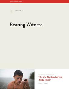
A controversial construction project in South America, the Belo Monte dam, is endangering local cultures, ecosystems, and communities. High schoolers create a concept map based on an online article they read before engaging in discussion...
Southwest Florida Water Management District
WaterWeb - Conservation and Water Supply
If 71% of our planet is covered with water, why do we need to bother conserving water? Find out with these activities designed for middle and high school environmental scientists. From reading articles to solving crossword puzzles, to...
Curated OER
Dig In
Students identify where vegetables originate from. In this agriculture lesson plan, students use a search engine to find out where certain vegetables originate from. Students plot the information onto a world map.
Curated OER
Identifying Ozone Variations over Different Locations
Students analyze ozone data. In this atmosphere lesson, students will use a NASA resource to gather data for different regions of the Earth. Students will then create a graph for their data and answer related questions.
CK-12 Foundation
Sums and Differences of Independent Random Variables: Traveling Seasickness
Use a Punnett square to calculate probabilities. The resource presents a situation in which two patients are randomly selected from a group of patients with a particular illness. Pupils use the interactive to determine the likelihood...
iCivics
County Basics
To understand the concept of a county government system, scholars read a short passage, view a helpful visual aid, use the web to conduct some research about their local areas, and then answer related questions online.
College Board
2002 AP® Calculus AB Free-Response Questions
Peek behind the curtain. Using a helpful resource, teachers and pupils see the way concepts appear on the AP® Calculus exam. Scholars use the questions to prepare for their own exams, gaining quality practice before test day. Questions...
Federal Reserve Bank
Ten Mile Day
Get your class working on the railroad with this detailed and interactive lesson. After reading and discussing Ten Mile Day, learners explore division of labor, human capital, and productivity with a hands-on group activity in which they...
Curated OER
Weather Patterns
Students research to determine weather patterns and natural hazards most likely to affect their region.
Curated OER
Active and Passive Voice: Finding Examples Online
Incorporate technological fluency with a search for examples of active and passive voice in online resources. Discuss how use of active or passive voice influences mood or tone and contributes to author's purpose. List of...
Curated OER
Northwest Hawaiian Islands
Students compare and contrast places around the world. Students analyze the effects of human activity on the physical environment and devise plans to address the consequences. Students also focus on geographical topics such as formation...
Curated OER
Looking to Our Environment
Eighth graders studied an environmental region in Illinois. The wetlands, swamps, woodlands and prairies were chosen. They research this region and create a picture that looks as if they are looking out the window. They had to have at...
Curated OER
Where it Grows
First graders identify the commodities of Oregon and produce a map of the different commodities in different regions.
Curated OER
Central America and the Caribbean
Use the library or Internet to find resources on a chosen topic. The class will comprehend the collected information, structure the information with texts and graphics for a presentation. Each presentation focuses on Hispanic culture and...
Curated OER
Africa - Clothing
Third graders discuss the differences between the clothing choices within the three regions in Africa and in Hawaii.
Curated OER
Location, Location, Location: Civilization's Ultimate Advantage
Students discover how geographical advantages, locational and regional, ultimately led to western Eurasian societies' disproportionate accounting of world power and innovation. They utilize a workbook which can be downloaded within this...
Curated OER
Population Pyramids
Students explain the significance of population trends on world regions. They define relevant population vocabulary and examine age-gender patterns at various scales.
Curated OER
Africa: Introduction, Geography and Mapping
Students study the geography of Africa through the use of maps. They locate, distinguish, and describe the relationships among varying regional and global patterns of geographic phenomena such as landforms, climate, and natural resources.
Curated OER
Technology Integration
Third graders describe and locate the five geographical regions of the state of Virginia. Using that information, they organize the descriptions in a database they created. They are graded based on accuracy and spelling all noted on a...
Curated OER
The Amazing Race -- Africa
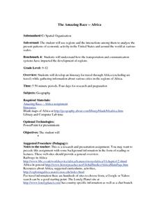
High schoolers conduct research and gather information regarding various cities in Africa. They discover what it would take to travel to and through Africa and plan a trip through various regions of the continent. They present their...
Southern Nevada Regional Professional Development Program
Common Core Reading Standards: Understanding Argument
What does your class know about logical fallacies? They can find out quite a bit and practice identifying logical fallacies if you follow the steps and use the resources provided here! After reviewing ethos, pathos, and logos, ask small...
Curated OER
LAND USE DEBATE / TOWN MEETING
Ninth graders research, analyze, and orally defend an issue related to the use of geologic resources. They defend their position in written form by composing a letter to an appropriate source.
Curated OER
Habitats: must live with them....cannot live without them.
Students conduct an internet study regarding habitat, ecosystem, biome and the region they live in. They observe the habitat by visiting a State Park and observing the organisms in their habitat. In addition, they create their own...
Curated OER
Tree Riddle Book
Fourth graders study the tree identification cards, identifying conifers sheet, and western forest cards. From the information gathered from these resources, each team help create a tree riddle book of 12 trees of Washington State.


