Curated OER
Welcome To Wales
Fourth graders explore the the culture and geographical region of Wales. After reading a picture book on Wales, 4th graders compare and contrast life in Wales to that in the United States. Given a camera, students develop their own...
Curated OER
African Americans and the Move West
Middle schoolers examine the phases of westward migration in the United States during the 19th century focusing on the incentives that led many African Americans to make the move.
Curated OER
Patchwork of the Planet
Students are taught how satellite images can be joined to make a picture mosaic. They use actual satellite images to make satellite mosaics regions of the United States. Students use a camera to photograph portions of a globe in the...
Curated OER
Rivers And Capitals
Pupils become familiar with the use of GIS for research and become aware of the importance of rivers to cities. They also analyze the placement of cities and learn the names of rivers in the United States.
Curated OER
Civil War in Vietnam
Students view and discuss Powerpoint presentation on Vietnamese Conflict, read essay, Resuscitation of the Dead Earth, review vocabulary, and answer critical thinking questions as a class.
American Chemical Society
Exploring Moisture on the Outside of a Cold Cup
As a stand-alone or as part of the intended unit, this is a valid investigation of what causes condensation to occur. By limiting the amount of air around a cold cup of water and comparing it to one out in the open, they find that the...
Curated OER
A Whale of Importance to the Arctic People
The bowhead whale of the Arctic region is of great importance to the people that live there. Your class will brainstorm all they know about this wonderful whale and create an informational video, which they will share with the children...
Curated OER
Social and Cultural Issues in the Civil Rights Movement
Learners watch videos, listen to speeches and analyze the information that is presented about the civil rights movement. They examine visual art of the period.
Curated OER
Finding the West
Students question the idea of a geographic space called 'the West.' They first examine a map of the United States and hypothesize what region constitutes the West, then read two passages that critically discuss the notion of a geographic...
Curated OER
Climate
Students make and record observations about local weather. They write about their favorite kind of weather and what it would be like to live in a climate of their choice. They take a quiz on regional U.S. climates.
Curated OER
Kansas Land
Fourth graders discover the geographic regions of Kansas. In this geography instructional activity, 4th graders explore the different regions of Kansas and determine how the different geography affects daily life in Kansas.
Curated OER
Linear Programming
In this algebra instructional activity, students calculate the maximum and minimum of a shaded region. They identify the boundaries and their vertices's. There are 2 problems.
Curated OER
Matching Worksheet
In this historical literacy worksheet, students match the vocabulary terms with the definitions and the answers are accessed by clicking the button at the bottom of the page.
Curated OER
Places and Production
Learners calculate United States GDP and GDP per capita, use a choropleth map to acquire information, and create choropleth maps of GDP per capita in South America. They identify regions with high and low GDP per capita
Curated OER
America the Beautiful
Students analyze the physical geography of the United States and how we have adapted to or altered the land to create the country we know today. Students complete maps with physical features, states and cities of interest.
Curated OER
World History Fair and Exposition
Students role-play as invitees to the World's Fair to develop a virtual electronic pavilion or poster presentation about the United States, its history and challenges. They act as tour guides giving their presentations and answering...
Curated OER
Who Dropped What into the Melting Pot?
Students show the movement of people to the United States from other countries on maps. They study the geographic cultural roots of foods that contribute to the melting pot of food in America. They research where an ingredient comes from...
Curated OER
The Immigrant Experience
Students utilize oral histories to discover, analyze, and interpret immigration and migration in the history of the United States. A goal of the unit is fostering a discussion and encouraging students to make meaning of the bigger...
Curated OER
The Water Around Us
Students discuss importance of reading maps and knowing about the geography of the United States, and locate bodies of water on different types of maps and examine how they are used in the state or local community.
Curated OER
Japan: Images of a People
Students learn the geography of Japan and its location in reference to the United States.
Curated OER
Our Country's Landforms
Learners investigate the many different landforms that are found throughout the United States. They use the internet and other resources to gather information. The information is used to prepare a multimedia slideshow and to create a...
Curated OER
Korean Lesson Plan
Seventh graders are introduced to the history of Korea. Using maps, they identify the reasons why Korea is important geographically. They also research the reasons for the Korean War and how actions of the United States and Korea led...
Curated OER
The Power of Maps & Native American Cultures
Sixth graders discover where and how five Native American cultures lived in North America in what is currently the United States. They examine their way of life and the regions they inhabited. Additionally, 6th graders will understand...
National Endowment for the Humanities
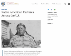
Native American Cultures Across the U.S.
Students examine how American Indians are represented in today's society. They read stories, analyze maps, and complete a chart and create an illustration about a specific tribe.


