Curated OER
Michigan Food: From Farm to You
Students recognize Michigan on a map and understand how its climate is affected by the Great Lakes. In this Michigan food lesson, students play a trivia game to identify the produce of Michigan. Students relate the climate in each part...
Curated OER
UN Conference on the Impact of Civil War on the Common Person
Students simulate understanding of conflict or civil war they researched, and role play character they developed at model UN conference on the impact of civil war on the common person.
Curated OER
Lake Tahoe Then and Now
Students investigate the differences in Lake Tahoe from the past to the present. In this geography instructional activity, students read the book Washoe Seasons of Life and identify the descriptions of the land and lake. Students create...
Curated OER
Entering the Twilight Zone
Students describe major features of cold-seep communities and the process of chemosynthesis as it relates to organisms in each habitat. In this deep-sea habitats lesson plan, students study the categorization of ocean habitats according...
Curated OER
Wow! You're Eating Geography
Middle schoolers examine patterns of food producing areas, and identify foods that are grown locally, in the U.S., and around the world. They map and graph the major food crops of their local area, the U.S., and other countries, and...
Curated OER
MAISA and the REMC Association of Michigan
Students complete online research to study geography's impact on weather. In this geography and weather lesson, students research weather in their city for ten days using an online website. Students bookmark the site, enter data into a...
Curated OER
Chart Making for Navigators
Students discuss the importance and function of nautical maps for sailors. They, in groups, take soundings of a simulated bay in a shoebox and develop a nautical chart that enable them to navigate the shoebox safely.
Curated OER
Charting Neptune's Realm: Profiles
Students identify and describe the importance of nautical profiles in early navigation. They draw a profile of a street or mall and explore the effectiveness of different types of directions.
Curated OER
River Run Through It
With vocabulary lists, worksheets, and more, this lesson sets learners on an exploration of the Hudson River area. They read an essay about the area, analyze a relief map of New York State, and complete a worksheet.
Curated OER
Rivers Run Through It
Using a relief map of New York State, learners answer questions about the distance between different cities, identify bodies of water, and more. First, they discuss vocabulary related to the Hudson River area. Then, they complete a...
Curated OER
Westward Expansion
Students locate California and New York on a map and explore available means of travel in the 19th century. Students explore the role of trade in pioneer America and simulate various barter transactions.
Curated OER
Carnavals and Colonialization
Ninth graders compare and contrast different Carnavals throughout Latin America. For this Latin American lesson, 9th graders study the geography and colonial history of Latin America.
Curated OER
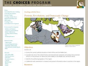
Protests, Revolutions, and Democratic Change
Learners examine uprisings in the Middle East and North Africa. For this global issues lesson, students view video clips, conduct group research, and present their findings in group presentations about the unrest in Algeria, Bahrain,...
Curated OER
Panama Canal
Learners investigate a way to sail a boat around the world without touching land while learning about the Panama Canal. In this Panama Canal lesson plan, students learn about the relationship of socio-political continents and how the...
Curated OER
The Fabric of Our World
Middle schoolers discuss cultural diversity, and examine how the community reflects the cultural background of the inhabitants. They read the book, People, take a community walk, create a rainbow chart, and research other states for...
Curated OER
What's Your Temperature?
Learners take a look at the local newspaper and focus on the weather section. They get into small groups, and each one looks at the same map, but of a different part of the country. They must prepare a presentation that shows how...
Curated OER
Video Boxes
Students create a video box about a Central American country. In this world history lesson, student research Central America and pick a country they want to investigate. They work in groups to create a video box that shows images about...
Curated OER
Honduras Finding the Top Bananas
Eighth graders complete an online scavenger hunt about banana cultivation before they visit a grocery store to examine banana products. They investigate "certified" means in relation to banana production and read the "Rainforest Alliance...
Curated OER
Summer Challenge
In this summer challenge activity, student choose the correct answer from the four choices they are given in 9 examples. They choose from ideas and items related to summer in each one.
Curated OER
Summer Vocabulary
In this summer vocabulary learning exercise, students read 10 definitions that pertain to summer. Students match these definitions with the words they describe.
Curated OER
Summer Crossword
In this summer crossword puzzle worksheet, students use the 10 clues and the terms in the word bank to help them correctly complete the word puzzle.
Curated OER
How Cultures Differ - Two Different Perspectives on the Same Even
Students explore the effects of culture through the story Running by Peter Hessler. In this geography and cultural lesson, students act as newspaper reporters covering the story of the race. Students write newspaper articles as reporters...
Curated OER
Boundaries
Students are introduced to the term of mental mapping. Individually, they develop their own mental map of Washington state and discuss as a class what makes a boundary. They draw their mental map on paper and compare it with their...
Curated OER
Charting the Discovery of the Americas
Students create chart using Microsoft Word depicting how trade led to the exploration of different regions of the world.


