Curated OER
America the Beautiful
Students analyze the physical geography of the United States and how we have adapted to or altered the land to create the country we know today. Students complete maps with physical features, states and cities of interest.
Curated OER
World History Fair and Exposition
Students role-play as invitees to the World's Fair to develop a virtual electronic pavilion or poster presentation about the United States, its history and challenges. They act as tour guides giving their presentations and answering...
Curated OER
Who Dropped What into the Melting Pot?
Students show the movement of people to the United States from other countries on maps. They study the geographic cultural roots of foods that contribute to the melting pot of food in America. They research where an ingredient comes from...
Curated OER
The Immigrant Experience
Students utilize oral histories to discover, analyze, and interpret immigration and migration in the history of the United States. A goal of the unit is fostering a discussion and encouraging students to make meaning of the bigger...
Curated OER
Exploring our National Parks
Students utilize maps/Atlases to find key spatial information, locate U.S. National Parks, characterize the geography of a specific region, and create a National Park brochure.
Curated OER
The Water Around Us
Students discuss importance of reading maps and knowing about the geography of the United States, and locate bodies of water on different types of maps and examine how they are used in the state or local community.
Curated OER
Time for Monet - Timeline Game
This is a game using the artwork of Claude Monet to chronologically arrange events occurring in France and the United States on time lines. Students discuss the probable differences, cause and effect relationships, and similarities,...
Curated OER
Planting Time
Students research crops grown in the United States. In this agriculture lesson, students identify various crops cultivated across the United States as they create charts and maps that note the information.
Curated OER
Japan: Images of a People
Students learn the geography of Japan and its location in reference to the United States.
Curated OER
Geography and Artifacts of Mexico
Students review the structure of government in Mexico and discuss how it is different than the United States. Using artifacts, they must label and identify the city or state in which the artifact originated. They use the artifact clues...
Curated OER
Our Country's Landforms
Learners investigate the many different landforms that are found throughout the United States. They use the internet and other resources to gather information. The information is used to prepare a multimedia slideshow and to create a...
Curated OER
Korean Lesson Plan
Seventh graders are introduced to the history of Korea. Using maps, they identify the reasons why Korea is important geographically. They also research the reasons for the Korean War and how actions of the United States and Korea led...
Curated OER
refugees From Vietnam and Cambodia
Tenth graders explore the massive immigration from Vietnam and Cambodia. In this World History lesson, 10th graders examine the crisis that led to this immigration. Students participate in a debate on whether the United States owes a...
Curated OER
Comparing Canadian and U.S. Political Systems and Political Campaigns
Students interpret historical evidence presented in primary and secondary resources. In this political systems instructional activity, students conduct research to compare and contrast the forms of government in the ...
Curated OER
Ecology Vocabulary
In this ecology worksheet, learners read the vocabulary words and then categorize a species found in a field, meadow, or fencerow in their state or region. Students complete 6 problems.
Curated OER
U.S. Archaeological Sites: Geography Practice
In this archaeological sites worksheet, students read about sites in the Unites States and use a map to complete a set of 7 short answer questions.
Curated OER
Sociology: What is life like for Gulf Coast rice farmers
Students read 1 page about Gulf Coast rice farmers and then describe what rice farming in the U.S. is like in the United States. In this rice farming lesson plan, students tell why they would or would not want to be a rice farmer.
National Endowment for the Humanities
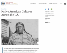
Native American Cultures Across the U.S.
Students examine how American Indians are represented in today's society. They read stories, analyze maps, and complete a chart and create an illustration about a specific tribe.
Curated OER
California Poppy Postcards
What a great lesson! Learners discuss California history, including the state flower, the poppy, and then engage in an art activity. For the activity, they learn about value, shading, layering, blending etc. to produce a realistic...
Curated OER
Major American Water Routes
Sixth graders locate and identify the major bodies of water and waterways in the United States. Through a simulation activity, they describe how early explorers would have described their surroundings. Working in groups, they create...
Curated OER
Statue of Liberty: Liberty Enlightening the World
Students explore reasons that people immigrate to the United States. In this Statue of Liberty activity, students read a handout regarding immigration, analyze the poem, "The New Colossus," and complete the provided worksheet activities.
Curated OER
Did Voters Turn Out -- or Are They Turned Off?
What was the voter turnout at your last state election? Examine voter turnout statistics from the most recent election to learn which ten states have the best turnout record. This lesson plan offers election data, handouts, and worksheets.
Curated OER
Understanding "The Stans"
Students explore and locate "The Stans" in Central Asia to create, write and illustrate maps, graphs and charts to organize geographic information. They analyze the historical and physical characteristics of Central Asia via graphic...
Curated OER
Hands On Biodiversity: Networking Students and Their Biomes
Students telecommunicate and use the US Mail to network students from five biomes in the United States in order to monitor water quality in each area. They have e-mail pals and exchange materials representative of themselves and their...


