Curated OER
Graphing Temperatures
Students identify current temperatures for different regions of the United States. Using current information, they develop hypothesis for the temperature in the same region tomorrow. They use the Weather Channel website to find actual...
Curated OER
A Measuring Adventure
Young scholars practice measuring items. In this measurement lesson, students read the book Measuring Penny and create their own system of measurement. Young scholars measure various items in the classroom, using their creative...
Curated OER
Exploring Virtual Europe
Students research the geography, government, climate, history, economy, and culture of a European country. They select a country in Europe, explore various websites, and complete a worksheet.
Curated OER
Border History
High schoolers research primary sources to construct an outline of a border city's history.
Curated OER
Our Unique Legacy of Giving
Students view The Gift of All, a Community of Givers. In this philanthropic lesson plan, students discuss the gifts of philanthropists they've seen. Students research and write a two page paper with four bullet points. Students include a...
Curated OER
UN Conference on the Impact of Civil War on the Common Person
Students simulate understanding of conflict or civil war they researched, and role play character they developed at model UN conference on the impact of civil war on the common person.
Curated OER
Where Do I Live?
Young scholars gain a better understanding of the population of the region they live in by comparing U.S. census data on the internet.
Curated OER
Wow! You're Eating Geography
Middle schoolers examine patterns of food producing areas, and identify foods that are grown locally, in the U.S., and around the world. They map and graph the major food crops of their local area, the U.S., and other countries, and...
Curated OER
MAISA and the REMC Association of Michigan
Students complete online research to study geography's impact on weather. In this geography and weather lesson, students research weather in their city for ten days using an online website. Students bookmark the site, enter data into a...
Curated OER
The Amazing Race -- Africa
Students conduct research and gather information regarding various cities in Africa. They discover what it would take to travel to and through Africa and plan a trip through various regions of the continent. They present their itinerary,...
Curated OER
Chart Making for Navigators
Students discuss the importance and function of nautical maps for sailors. They, in groups, take soundings of a simulated bay in a shoebox and develop a nautical chart that enable them to navigate the shoebox safely.
Curated OER
Charting Neptune's Realm: Profiles
Students identify and describe the importance of nautical profiles in early navigation. They draw a profile of a street or mall and explore the effectiveness of different types of directions.
Curated OER
Determination of Water Hardness
Students investigate water hardness. In this water hardness lesson plan, students determine the water hardness in 4 samples of water after buffering each. By using titration and an indicator, students can determine the amount of calcium...
Curated OER
Flag Etiquette
Students study flag etiquette. In this US flag lesson, students explore the flag and its history. Students also demonstrate the proper procedures for folding a U.S. flag.
Curated OER
River Run Through It
With vocabulary lists, worksheets, and more, this lesson sets learners on an exploration of the Hudson River area. They read an essay about the area, analyze a relief map of New York State, and complete a worksheet.
Curated OER
Rivers Run Through It
Using a relief map of New York State, learners answer questions about the distance between different cities, identify bodies of water, and more. First, they discuss vocabulary related to the Hudson River area. Then, they complete a...
Curated OER
Westward Expansion
Students locate California and New York on a map and explore available means of travel in the 19th century. Students explore the role of trade in pioneer America and simulate various barter transactions.
Curated OER
Carnavals and Colonialization
Ninth graders compare and contrast different Carnavals throughout Latin America. For this Latin American lesson, 9th graders study the geography and colonial history of Latin America.
Curated OER
FBI Counts Mosques
Students research the term "racial profiling to help decide if this directive fits in that category. Students explore the reaction of each side and the pros and cons each offers. Students Prepare a debate with one side supporting the FBI...
Curated OER
Minority Graduation Rates: A 50-50 Chance
High schoolers read the Civil Rights Project report. Students collect data from graduation rates in their school/district or city. High schoolers compare state and local data. Students discuss and analyze minority graduation rates. High...
Curated OER
To Your Health
Students read articles on health and read about how storks and other animals are cultural icons in bringing good health. In this health lesson plan, students also list ways to live a healthy lifestyle.
Curated OER
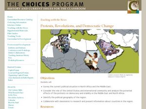
Protests, Revolutions, and Democratic Change
Learners examine uprisings in the Middle East and North Africa. For this global issues lesson, students view video clips, conduct group research, and present their findings in group presentations about the unrest in Algeria, Bahrain,...
Curated OER
Panama Canal
Learners investigate a way to sail a boat around the world without touching land while learning about the Panama Canal. In this Panama Canal lesson plan, students learn about the relationship of socio-political continents and how the...
Curated OER
The Fabric of Our World
Middle schoolers discuss cultural diversity, and examine how the community reflects the cultural background of the inhabitants. They read the book, People, take a community walk, create a rainbow chart, and research other states for...


