Curated OER
Worksheet #61 Questions - James Madison
In this James Madison historical term quiz, students define the meaning of several terms relating to the aforementioned topic in order to advance their historical knowledge.
Curated OER
Constitutional Acts (Chapter 3)
Help your students review constitutional acts in this review worksheet, which could also be used as a class quiz. Five matching questions and five multiple choice questions address checks and balances, the powers of the Senate and House,...
Curated OER
The American Landscape (1800 - 1850)
Learners are introduced to the romantic cultural movement in America. Reading examples of pictures of Washington Irving's home, they identify the characteristics of the movement. They view other paintings of artists from the same time...
Edgate
Discovering New Resources
What is a natural resource, and what resources did the Lewis and Clark expedition seek? After reading an article on the mapping of the west, learners get into small groups to discuss the important natural resources of the period. They...
Curated OER
Women in United States History
High schoolers identify and explain the significance of key terms, such as: 19th Amendment, Femisnism, Flappers, Immigration and Jobs in Wisconsin. They identify and analyze viewpoints, events, social classes, and people of various years.
Curated OER
Patchwork of the Planet
Learners are taught how satellite images can be joined to make a picture mosaic. They use actual satellite images to make satellite mosaics regions of the United States. Students use a camera to photograph portions of a globe in the...
Curated OER
We've got the whole world in our hands
Students explore spatial sense in regards to maps about the globe. In this maps lesson plan, students label oceans, locate the continents and poles, follow directions, and explain the symbols on a map.
Curated OER
Vermont History True / False
In this Vermont history activity, students read two and a half pages of information about Vermont history. After reading, students complete 10 true or false questions about what they read.
American Chemical Society
Exploring Moisture on the Outside of a Cold Cup
As a stand-alone or as part of the intended unit, this is a valid investigation of what causes condensation to occur. By limiting the amount of air around a cold cup of water and comparing it to one out in the open, they find that...
Curated OER
A Whale of Importance to the Arctic People
The bowhead whale of the Arctic region is of great importance to the people that live there. Your class will brainstorm all they know about this wonderful whale and create an informational video, which they will share with the children...
Curated OER
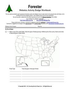
Forester
In this forester worksheet, students illustrate a map that shows the types of forests growing in various parts of the country. They also identify six forest trees common to the area where they live and explain how both wildlife and...
Curated OER
Civil War and Beyond
Sixth graders play a game. For this Civil War lesson, 6th graders discuss the beginnings of the Civil War and define vocabulary words associated with the war such as abolitionist and Emancipation Proclamation. Students play a...
Curated OER
Linear Programming
In this algebra worksheet, students calculate the maximum and minimum of a shaded region. They identify the boundaries and their vertices's. There are 2 problems.
Curated OER
Introducing Industries
If you are looking for a way to explore Michigan's resources, physical features, and more, this lesson is for you. After discussing Michigan and the Great Lakes, learners fill out a graphic organizer identifying the state's natural...
Curated OER
Exploring our National Parks
Students utilize maps/Atlases to find key spatial information, locate U.S. National Parks, characterize the geography of a specific region, and create a National Park brochure.
Curated OER
A House Dividing: The Growing Crisis of Sectionalism in Antebellum America
Students explore the debates over American slavery and the power of the American federal government for the first half of the 19th century and how the regional economies and political events produced a widening split between the states.
Curated OER
Finding the West
Students question the idea of a geographic space called 'the West.' They first examine a map of the United States and hypothesize what region constitutes the West, then read two passages that critically discuss the notion of a geographic...
Curated OER
The Global Village and Trade
Students analyze maps of trade patterns between the United States and other nations and identify factors that may influence the production of goods.
Curated OER
Did Voters Turn Out -- or Are They Turned Off?
What was the voter turnout at your last state election? Examine voter turnout statistics from the most recent election to learn which ten states have the best turnout record. This lesson plan offers election data, handouts, and worksheets.
Curated OER
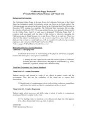
California Poppy Postcards
What a great lesson! Learners discuss California history, including the state flower, the poppy, and then engage in an art activity. For the activity, they learn about value, shading, layering, blending etc. to produce a realistic...
Curated OER
Maryland’s Chesapeake Bay Landscape Long Ago and Today
Combine a fantastic review of primary source analysis with a study of Captain John Smith's influence on the Chesapeake Bay region in the seventeenth century. Your young historians will use images, a primary source excerpt, and maps...
It's About Time
Petroleum and Your Community
I was going to write a joke about oil, but it seemed crude. This lesson starts with a comparison of where the US gets oil from and how that has changed over time. After analyzing the data, scholars create a graph and use the Internet to...
It's About Time
Electricity and Your Community
Young scientists read and interpret a data table about energy generation around the world. Next, they use the Internet to investigate energy generation in their own state, and, finally, pupils read a passage and answer questions about...
Curated OER
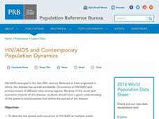
HIV/AIDS and Contemporary Population Dynamics
Students describe the spread and occurrence of HIV/AIDS at multiple scales.
They explain global and regional variations in the occurrence of HIV/AIDS
and the spread of HIV/AIDS in the United States
Other popular searches
- United States Regions
- United States Maps Regions
- 5 United States Regions
- United States Regions South
- Seven United States Regions
- Unites States Regions
- 5 Regions of the United States
- United States Economic Regions
- United States Climate Zones


