Curated OER
What are Dinosaurs?
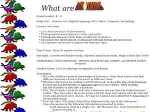
Students explore the attributes of dinosaurs. In this dinosaur lesson, students read books and watch videos featuring dinosaurs. Students also research dinosaur traits using Internet sources.
Curated OER
The Extinction of Dinosaurs
Students study the life and death of the dinosaur by building dioramas. For this dinosaur lesson, students research the extinct creatures, then build dinosaur dioramas. Afterward, the students engage in a discussion about the extinction...
Curated OER
When Dinosaurs Ruled the World
Students graph the varying sizes of dinosaurs. In this math and dinosaur lesson, students view dinosaur models and compare the different shapes and sizes of the dinosaurs. Students complete a dinosaur math activity, read The Dinosaur...
Curated OER
Digging Up Facts About Dinosaurs
Second graders conduct research on a given dinosaur using various resources, complete an information sheet that be used to create their graphic organizer from, and produce a graphic organizer, using the Kidspiration software.
Curated OER
Discovering Dinosaurs
Students research facts about dinosaurs and practice effective speaking strategies by creating a Keynote or PowerPoint presentation in this Science and Language Arts lesson for the upper-elementary classroom. It includes one lesson...
Curated OER
Paleontologist: Can You Dig It?
Students investigate what a paleontologist does. They participate in a dinosaur dig, write a story, and explore the Dinosaur Dig website to view and discuss photos of a real dinosaur dig.
Curated OER
Dinosaurs
Students will develop goals for inquiry. They will also improve content area reading and research skills. The context of studying dinosaurs will help learners to distinguish from organisms that live presently and those from the past...
Curated OER
Dino Hunt
Students use the Internet to gather information about dinosaurs. They practice navagating through the different websites. They also practice listening to directions and also explore how to fill out a KWL chart.
Curated OER
We Really Dig Archeology and Palentology
Sixth graders examine the differences between archeology and paleontology. Using the internet, they explore the tools and techniques used in each field. They must use the correct tools to uncover and record the objects they find. They...
Curated OER
Water, Water, Everywhere!
Students complete a WebQuest. In this water cycle lesson, students investigate the cycle through a WebQuest activity. Students research the water cycle through Internet resources and create a documentary video of their process.
Polar Trec
Where is the World's Water?
Scholars discover the amount of the Earth's water in various locations such as the ocean, ice, the atmosphere, etc. They then make a model of the how much water those percentages represent. Finally, analysis questions bring the concepts...
Curated OER
Solving Science Mysteries
Students choose a science-related mystery to investigate such as the Loch Ness Monster or Bigfoot. They, in groups, research theories and give a persuasive talk presenting the theory they feel to be most likely.
Curated OER
Exploring the Internet for Information
Students identify and use the internet as a resource for information. They integrate the writing process and create a multimedia project using the information from an internet research. Projects can be created from Microsoft Word,...
Curated OER
Building A Topographic Model
Students visualize, in three dimensions, features represented by contour lines on a topographic map. They see that the different elevations shown on a two dimensional topographic map can be used to build a 3-D model.


