National Wildlife Federation
Go with the Flow
The quality of a watershed has a direct impact on the community it services. Learners study their own watershed using a topographical map. They recreate the watershed components using colored pencils to track the upstream and downstream...
CK-12 Foundation
Topographic and Geologic Maps: Topographic Maps
Maps are great for helping you get where you're going, but what does that place actually look like? Geology scholars compare and contrast the features of topographical and geologic maps using an interactive lesson. The resource describes...
DiscoverE
Build a Cable-Stayed Bridge
Large or small, bridges are architectural wonders! Construct a large-scale cable-stayed bridge during a whole class project. Scholars work in groups to erect the towers, build the roadway, and secure the cables of their very own bridges....
CK-12 Foundation
CK-12 Earth Science Concepts for Middle School
Explore a variety of science concepts in an interactive textbook created for middle school scholars. A lengthy table of contents takes readers to pages comprised of a subject overview, outline, and summary. Follow links further to find...
American Museum of Natural History
Field Trip Mars
Fly around the Martian surface. Pupils view a presentation on the planet Mars featuring a flyover that shows different views of the surface where rovers have landed and explored on different missions. As individuals watch the images, the...
Curated OER
Water Cumulative Student Project
Students collect real world data, interpret data, and present conclusions based on their findings. They collect data from monthly Texas Watch monitoring or download data from the Texas Watch Data viewer of a section of a river and track...
Curated OER
Goop to Geoforms
Students illustrate geographical terms in three-dimensional form. They use magic modeling goop and paint to create features of the geographic landscape. Students explain the meaning of geographical terms.
Curated OER
Fish Communities in the Hudson
Young scholars use tables of fish collection data to draw conclusions about where fish live in the Hudson Estuary. Given available data they interpret organized observations and measurements and recognize simple patterns, sequences, and...
Curated OER
Floodplains in the field (with GIS)
Students measure a topographic and geologic cross-section across a floodplain by simple surveying and auguring techniques. They consider the spatial context of the field observations, use GPS measurements, and desktop GIS analyses.
Curated OER
Landform Bingo
Students review landform terms and review fact and opinion. They make fact and opinion statements and play landform BINGO.
Curated OER
Exploring Our Watershed System
Pupils examine how watershed systems are made up, and visit the Susquehanna watershed system and map out the system. They evaluate the order of watercourses in their area.
Curated OER
The Caspian Sea
In this comprehension and geography instructional activity, students read an article about the Caspian Sea, identifying where it is located and what countries surround it. Then they describe three parts of the sea, what are tributaries,...
Curated OER
A. B. "Banjo" Paterson
In this A. B. "Banjo" Paterson online instructional activity, students read three poems written by one of Australia's best know writers. Students click on several sites to answer fourteen questions about the author and his poems.
Curated OER
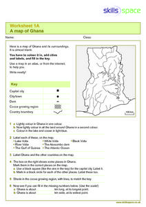
A Map of Ghana
In this Map of Ghana learning exercise, students are given a blank map and key. They are told to label major features and color according to directions.
Curated OER
"Tri-County" Project--Water Cycle
Students analyze the parts of the water cycle through research and experimentation. Particular attention is paid to the processes of evaporation and condensation.
Curated OER
Fred the Fish
Students read and retell the story of Fred the Fish. In groups, they create their own story of a similar nature and identify a situation in their community like the one in the story. They create possible solutions to the problem and...
Curated OER
War of 1812
Eighth graders locate the major land forms and bodies of water on a map of Louisiana. In groups, they discuss the role of the Mississippi River in the Battle of New Orleans and how land and water affect the outcome of battles. To end...
Curated OER
Coho Salmon and Habitat Loss
Learners investigate the issues threatening coho habitat in the BS Interior's Fraser River watershed. They determine how personal choices and actions have environmental consequences. Evaluate human impacts on local ecosystems.
Curated OER
Pet Rocks
Students complete a variety of activities related to the physical characteristics of minerals. They classify and group candy, classify rocks and complete a Pet River Rock worksheet. Students try to guess which rock goes with each...
Curated OER
Using Abiotic and Biotic Parameters to Monitor Air Quality
Students identify the abiotic factors that influence a river or stream and the organisms that live in it. They measure several abiotic and biotic parameters to gauge water quality. Students examine the biotic environment by identifying...
Curated OER
Chart Your Course
Young scholars explore change represented in graphs comparing distance and time. They exchange and share their graphs. Students interpret and create distance versus time line-graphs, and write stories based on these graphs. They...
Curated OER
Design Your Own Imaginary Continent
For this continent worksheet, students design their own continent and include latitudes, mountain ranged, river, wind patterns, and temperature highs and lows. They also include a variety of cities in specified locations.
Curated OER
Evidence of Climate Change
Sixth graders examine climate change in the state of Colorado. In this climate lesson, 6th graders watch 2 video clips regarding the topic and research the subtopics- snow pack, precipitation, temperature, forest fires, river flow,...
Curated OER
Stream Study
Students study the characteristics of a stream habitat. In this life science lesson plan, students use sieves, nets, and jars to collect aquatic organisms. Students also measure the temperature of the stream and calculate the speed of...
Other popular searches
- Rivers and Streams
- Major Rivers
- Rivers and Lakes
- Geography Rivers
- Mapping Rivers
- Ireland Geography Rivers
- United States Rivers
- Colorado Rivers
- Rivers and Deltas
- Source Rivers
- Understanding Rivers
- Rivers of the World


