Curated OER
Learning the Blues
Students take a virtual field trip to Memphis, Tennessee in their study of the blues, its characterisitics, founding fathers, and histororical influence on modern music. They compose blues lyrics that reflect present-day attitudes and...
Parkwood Hill Intermediate
Map Skills Project
Young pupils develop their mapping skills and knowledge by designing their own islands, using geographic terms and physical features they have learned as features of their work.
NOAA
Coastal Dynamics
Life's a beach! The 16th installment of a 23-part NOAA Enrichment in Marine sciences and Oceanography (NEMO) program first examines different types of coasts and how they form. An activity then has learners investigate the shoreline...
Curated OER
Coasts
Students explain the different types of marine coasts and where they are located in the United States and its territories. They explain and identify some of the life forms that inhabit different marine coastal regions.
Curated OER
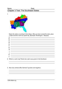
Chapter 3 Test: The Southeast States
For this geography worksheet, students complete a test about the southeastern United States. They name the states, tell about the climate and crops, complete a matching activity about the landforms. and another about the industry.
Curated OER
Sixth Grade Reading Test
In this reading worksheet, 6th graders answer multiple choice questions about passages they read, word parts, and more. Students complete 25 problems.
Curated OER
Rice Consumption
Fourth graders discover facts about rice and how it is farmed. In this rice research lesson, 4th graders investigate how much rice is eaten in the United States compared to other countries. Students research countries and graph the...
Curated OER
Landforms: Geomorphology of Arkansas
Second graders create large, salt dough maps of Arkansas and the natural regions in the state created by geographical and morphological features.
Curated OER
Annotating Change in Satellite Images
High schoolers construct a movie using Landsat images to observe changes over time on Earth. In this satellite images lesson, students observe changes in land use over time and document one type of change they observe. They produce an...
Curated OER
Timeline of Extreme Weather Events
Students research and chart extreme weather events on a timeline. In this extreme weather lesson, students interview older people who have experienced extreme weather events. Students complete a worksheet based on the information of the...
Curated OER
"Professional" Settlement of Arkansas
Eighth graders examine the physical geography of Arkansas played and instrumental role in the settlement of the state.
Curated OER
Ancient Egypt
In this ancient Egypt worksheet, 6th graders use maps in chapter 5 of a Houghton Mifflin text to label items on an outline map and answer a set of 10 related questions.
Curated OER
Locke and Walnut Grove: Havens for Early Asian Immigrants in California
Students use readings, maps and photos to examine the life of Japanese-American immigrants in Locke and Walnut Grove in the early 1900s. They discuss their research findings, role-play the lives of immigrants and write responses.
Curated OER
Walking on Frozen Ground
Students listen to an Elder speak about permafrost structures in their area. For this permafrost lesson plan, students listen to the guest speaker, take a tour outside to view permafrost structures, and draw them.
Curated OER
Landforms of Illinois
Students discover the primary landforms of Illinois. They examine how those landforms were formed as well. In groups, they research one of the landforms from their vocabulary list. They create their landform in a shoebox and present it...
Curated OER
What's a Swamp Good For?
Learners identify the function and value of wetlands. In this lesson on appreciating wetlands, students explain how different household items can represent different aspects of the wetlands.
Curated OER
Unit 5 - Food
Learners study the biodiversity existing in the Amazon rainforest. In this Amazon biodiversity lesson, students study diagrams, maps, and information about the biodiversity in the Amazon.
Curated OER
Arkansas Geography/History Relief Map
Sixth graders research a number of sources including the Internet to find information about the regions of Arkansas while locating sites of national historic interest. They located sites on maps while working at assigned websites. They...
Curated OER
Geography: why is Arkansas a great place to grow rice?
Second graders become familiar with the geography of Arkansas and analyze why it is a good place for certain crops to grow. In this rice lesson, 2nd graders list reasons Arkansas is a good place to grow rice. Students become...
Curated OER
Demonstrating Erosion in Action
Students easure and record volume of water, then measure and record mass of soil. They explain the effects of the following in controlling erosion: Contouring, cover crop, strip cropping, reforestation, inter-seeding.
Curated OER
Should New Orleans be Rebuilt?
Students, after researching two websites dealing with New Orleans, complete a chart as they read the arguments for and against rebuilding New Orleans. They locate the evidence offered for support, analyze the geography domains and...
Curated OER
Making Use of Fieldwork
Learners transcribe, analyze, and archive fieldwork and create a team project drawn from fieldwork. They brainstorm a list of reasons why preservation of collected materials is important and explore the online archives of the American...
Curated OER
Geography Terms
In this social studies worksheet, students match the correct terms with its meaning in the column on the right. The answers are found by clicking the button at the bottom of the page.
Curated OER
Seasons
Students name the 4 seasons, discussing the weather, plant life, animal life and and activities of each. Students read the book titled, "Hello Arctic," and and discuss changes in seasons that accompany the story. Students complete...


