Curated OER
Know Your Watershed
Pupils investigate the importance and the location of their own watershed by visiting and EPA website and also work in groups to create an action plan on how to protect their local watershed.
Curated OER
The Great Water Hunt
Students create a model of the land to water ratio in a large group and search for all the places water is used at their school while on a Great Water Hunt. They identify where water can be found and compare how much of world is covered...
Curated OER
All About Lakes, Rivers, and Flyfishing Too
In this insect and fish story writing worksheet, students draft a story that includes a setting, characters, problems, and events from the perspective of an insect or fish. In addition, students locate 51 science terms in a word search...
Curated OER
From Lake to Tap
Students use the Internet to study how water is treated to make it safe to drink. They use a tutorial on the U.S. Environmental Protection Agency's website to gain this information. They complete a worksheet for the assessment portion...
K12 Reader
Water Carves the Land
What affect do bodies of water have on the world around us? Kids can find out by reading this passage. After reading, they answer five questions related to the text.
ESL Kid Stuff
Our World
There's a beautiful world all around us! Learn about the features of our planet with a series of activities designed for English learners. Kids sing, dance, and read about nature with fun lessons and interactive play.
Mr. E. Science
Erosion and Deposition
Get an in-depth look into erosion and deposition with a 23-slide presentation that details how gravity, water, waves, wind, and glaciers cause changes to the Earth's surface. Each slide consists of detailed images equipped with labels,...
Curated OER
Marquette and Joliet Explore the Mississippi in 1673
Students locate and name the St. Lawrence River, the five Great Lakes, and the Mississippi River on a modern map. They find Quebec, Michilimackinac, Wisconsin, and Chicago on that map. They find the same places on a 1681 map.
Curated OER
Getting a Sense of Time
Students gain an appreciation for geologic and historic time. They gain a general amount of information of the development of hte Chicago area, with particular attention given to the role of the Chicago River. Students contruct a time...
Curated OER
VARVES: Dating Sedimentary Strata: Geology, Paleontological Patterns
Students count the number of varves (annual layers of sediment) in shale billets, taken from the Green River Formation in Wyoming. The count is then extended to reflect the entire 260 meters of sediments where the billets originated.
Curated OER
Michigan Food: From Farm to You
Students recognize Michigan on a map and understand how its climate is affected by the Great Lakes. In this Michigan food lesson, students play a trivia game to identify the produce of Michigan. Students relate the climate in each part...
Curated OER
A Good Boat is Hard To Find
Eighth graders design and construct a safe and efficient human powered watercraft that can be used on a trip on the Great Lakes. Students utilize math and measurement skills to design and cut the pieces for their boat. Working in...
Curated OER
Eutrophication Lab
Middle schoolers examine the effects of detergents and fertilizers on aquatic life and describe algae. Students define the term eutrophication as the process by which a body of water, such as a pond, lake, stream, or river, has a sudden...
Curated OER
Introduction to Algae
Students explore different types of algae found in both local regions of Salt Lake and different parts of the world. They discover different types of algae found in an ecosystem and the significance and function it serves.
Curated OER
Living Organisms as Indicators of Pollutants in Fresh Water Ecosystems
Students observe the effects of pollution on living organisms. In this pollution lesson plan, students observe fresh water Hydra and look at their structures and movement. They place samples of pond and lake water on the Hydra and...
Curated OER
Culmination of Mighty Waters
Third graders investigate the concept of bodies of water. The information is obtained from the internet while conducting research. Then students draw upon prior knowledge from a film to combine information for the purpose of creating a...
Rivanna Regional Stormwater Education Partnership
Invisible Passengers
How does water pollution affect the organisms living in the water? Use three science experiments to examine how erosion and other pollutants can affect water quality. Each experiment focuses on a different aspect of pollution and...
Curated OER
Where is the Water?
Students explore freshwater ecosystems. In this geography lesson, students brainstorm all the lakes and rivers they know then mark them on a map. Students will then mark all the major freshwater resources on each of the seven continents,...
Curated OER
The Relationships and Cultural Exchanges Between Native Americans and the Hudson's Bay Company at Fort Vancouver
Students are introduced to the geography of the Columbia River basin and its history. Using the internet, they research the relationships between the Native Americans and the Hudson Bay Company. They also discuss the effects on the...
Curated OER
The Caspian Sea
In this comprehension and geography learning exercise, learners read an article about the Caspian Sea, identifying where it is located and what countries surround it. Then they describe three parts of the sea, what are tributaries, and...
Curated OER
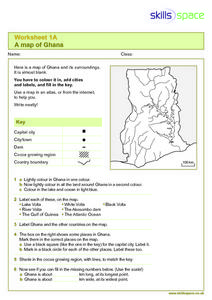
A Map of Ghana
In this Map of Ghana worksheet, students are given a blank map and key. They are told to label major features and color according to directions.
Curated OER
"Tri-County" Project--Water Cycle
Students analyze the parts of the water cycle through research and experimentation. Particular attention is paid to the processes of evaporation and condensation.
Curated OER
Landform Bingo
Students review landform terms and review fact and opinion. They make fact and opinion statements and play landform BINGO.
Curated OER
River Study
Students study physical features of a local stream. They study how to identify water features on topographic maps.
Other popular searches
- About Rivers and Lakes
- Rivers and Lakes Geography
- Lakes and Rivers
- Rivers Lakes Streams
- Rivers, Lakes, Streams
- Usa Lakes and Rivers


