Curated OER
World Geography Quiz
In this world geography worksheet, students answer several questions based on world geography and landmarks. Students answer 10 multiple choice questions.
Curated OER
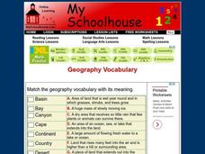
Geography Vocabulary
In this identifying geographic terms and their definitions online interactive worksheet, students match the vocabulary words with their definitions. Students match 24 answers.
Curated OER
Geography of the United States
Students examine the population growth of the United States. In this Geography lesson, students construct a map of the fifty states. Students create a graph of the population of the USA.
Curated OER
Archaeology- State Map
Students study state maps. In this map skills lesson, students identify the states' location and how to use a legend. Students complete photocopies of the state map.
Scholastic
Perfect Postcards: Illinois
Connect the geography and history of Illinois using an art-centered lesson on the railroads. The railroad connected once-distant places, particularly in the Midwest. Using research, class members create postcards of fictional cross-state...
Curated OER
Geographic Landforms
Each slide is a simple notebook page with one landform in blue and its definition in red. There are 26 vocabulary terms in all, some you may want to use, and others easily hidden. It is recommended that you add photos or other graphic...
NASA
Outline Maps
Don't miss this gold mine of blank maps for your next geography lesson! Regions include traditional continents such as Asia, Europe, and Africa, as well as other major world areas such as the Pacific Rim and the Middle East.
Curated OER
Natural Features
Students identify natural features on a map. In this geography instructional activity, students identify six physical features and create pictorial definitions for each term. The terms which are listed in this instructional activity are...
Curated OER
Africa: Introduction and Study Guide
In this Africa worksheet, 7th graders answer 26 questions about the geography, economy and climate of the nations of Africa.
Curated OER
What You Can Learn From a Map
Students discover how to interpret maps. In this geography skills activity, students explore geographic themes as they complete worksheet activities regarding road maps, shaded relief maps, and topographic maps.
Curated OER
Canada Geography PowerPoint
Students create a PowerPoint about Canadian geography or history. In this Canada lesson plan, students spend two days researching their Canadian topic in the library and online. They create a PowerPoint presentation and add pictures...
Curated OER
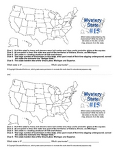
Mystery State #15
Do you know the name of the Badger State? Using five fantastic clues, your super sleuths will determine the name of mystery state number 15. A wonderful way to warm up the class!
Curated OER
Geography
In this geography learning exercise, students write the vocabulary word for the geography definition given. Students complete 22 problems with words from a word bank.
Curated OER
Science: Draining the Land - the Mississippi River
Students use topographic maps to identify parts of rivers. In addition, they discover gradient and predict changes in the channels caused by variations in water flow. Other activities include sketching a river model with a new channel...
Curated OER
Geography A to Z - The Letter O
For this geography worksheet, students answer clues about geographical place names that all begin with the letter O.
Curated OER
Geography Action! Rivers 2001- Stream Table
Students use a stream table to simulate river and watershed systems. The affect of gradient on stream flow as well as erosion and deposition are two items that students examine.
Curated OER
Geography Journey
In this geography instructional activity, students use a map of Amtrak train routes (not included) to answer 10 short answer questions. Students describe physical features and landmark cities they would see if traveling by train across...
Curated OER
Geography Terms
Students identify different landforms and fill out a worksheet where they explain what each landform is. In this geography lesson plan, students fill in a landform map and then use landform words as they describe the landforms.
Curated OER
The Caspian Sea
In this comprehension and geography learning exercise, learners read an article about the Caspian Sea, identifying where it is located and what countries surround it. Then they describe three parts of the sea, what are tributaries, and...
Curated OER
Geography Terms
In this social studies worksheet, students match the correct terms with its meaning in the column on the right. The answers are found by clicking the button at the bottom of the page.
Curated OER
Basic Geography of Canada
Young scholars identify different geographical locations in Canada by using an Atlas. In this geography of Canada lesson plan, students locate features such as rivers, lakes, cities, provinces, and more.
Curated OER
Geography With Dr. Seuss
Students read the book, The King's Stilts by Dr. Seuss and discuss the geographical information given in the book. Then they discuss and locate on a map the physical features that make up the continent of Africa. They create an original...
Curated OER
Ireland Quiz 2
In this Ireland instructional activity, students answer short answer questions about the history and geography of Ireland. Students complete 20 questions.
Curated OER
The Eerie Canal
Students discover bodies of water in the United States by investigating the Eerie Canal. In this U.S. Geography activity, students discuss Lake Eerie and the canal that was built in order to transport goods. Students research...


