Curated OER
Mapmaker, Make Me a Map!
Here is a well-designed, very thorough lesson plan on mapping for very young children. Within the six-page plan, you will find everything you need to implement the lesson. They will identify various landforms found in Colorado on a map,...
Curated OER
The Landscape of a Novel
Students, after reading a novel, utilize geographic skills to map out the places described in the novel. They collect data, envision spatial features and then design a map to work off of to complete their assignment. Each student also...
Curated OER
National Marine Sanctuaries Shipwrecks
Junior oceanographers access the Channel Islands National Marine Sanctuary Shipwreck Database and plot the locations of several shipwrecks. Shipwrecks are always an enthralling subject and this activity allows your learners to act as...
Curated OER
Natural Features
Learners identify natural features on a map. In this map skill instructional activity, students use a landscape picture map to identify mountains, hills, islands, lakes, and rivers. Learners use post-it notes to demonstrate their location.
Curated OER
Nina Bonita: Culture and Beauty
Young scholars read Nina Bonita by Ana Maria Machado. In this reading comprehension/ geography lesson, students recall various parts of the story and create a map of where the rabbit traveled throughout the story. They participate in...
Curated OER
Marine Life, Oceans, Lakes and Rivers
Students examine the types of organisms found in oceans. In groups, they read articles about the research done at certain sites. They work together to research their own water ecosystems and report the findings to the class. To end...
Curated OER
Lake Billy Chinook
Students explore aerial photographs and maps of Round Butte Dam. They examine the land modifications necessary to create a dam. After reading a book about building a dam, students compare the environmental impact of Lake Billy Chinook to...
Curated OER
Geography
Young scholars engage in a study of geography while studying a foreign language. They write complete sentences to identify and describe geographical features. Students also use a map in order to use the key to find geographic features...
Curated OER
Landforms and Resources of the United States and Canada
For this North American geography worksheet, students read about the physical features and resources of the United States and Canada. Students take notes and answer 3 short answer comprehension questions as they read the selection.
Curated OER
Summertime Travel
Third graders write about a summer event they participated in. In this paragraph writing lesson, the teacher models how to write about a place they have visited. Students then write their own paragraphs. Students will point out on...
Curated OER
What in the World Is a Watershed?
Learners discover the role of a watershed. In this geography lesson, students are shown a diagram of a watershed and discuss the definition of a watershed. Learners demonstrate the role of a watershed by using an umbrella and spraying it...
Curated OER
Contributions
Learners explore the history of Canada by analyzing the First Nations' citizens. In this Native Canadian contributions instructional activity, students research the geography of Canada and create a book about the First Nations'...
Curated OER
Mapping Landforms of South Carolina
Third graders analyze South Carolina maps. In this geography lesson, 3rd graders locate the five land regions in the state are and discuss how the regions are different. Students identify the major bodies of water and analyze how...
Curated OER
Countries of South America
Young scholars focus on the geography of the countries of South America. Using a map, they identify the European countries who claimed the South American countries and research the influences they had on South America. To end the...
Curated OER
Mapping West Virginia
Fourth graders explore West Virginia. In this Unites States geography instructional activity, 4th graders discuss the type of land and the cities in West Virginia. Students create two overlays, with transparencies, that show the natural...
Curated OER
Michigan Food: From Farm to You
Students recognize Michigan on a map and understand how its climate is affected by the Great Lakes. In this Michigan food lesson, students play a trivia game to identify the produce of Michigan. Students relate the climate in each part...
Curated OER
Chapter 3 Test: The Southeast States
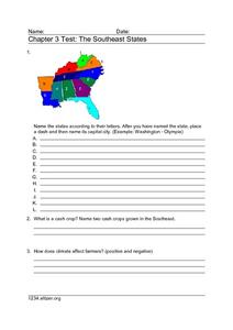
For this geography worksheet, students complete a test about the southeastern United States. They name the states, tell about the climate and crops, complete a matching activity about the landforms. and another about the industry.
Curated OER
A Place of My Own: A Study of Maps
Students investigate maps. They demonstrate their knowledge about maps and place landforms in the proper place as they create salt dough maps. They create a geography folder as well.
Curated OER
Topographic Mapping Skills
For this geography worksheet, students read an excerpt about topographic maps and why they are useful for various jobs. They also respond to eleven questions that follow related to the excerpt and locating specific map points on the map...
Curated OER
Story Stretching: Tall Tales in North America
Students are introduced to tall tales. In this introductory tall tales unit, students explore the tall tales of Casey Jones and Johnny Appleseed. This unit includes many interdisciplinary lessons including graphing skills and geography.
Curated OER
Interpreting Aerial Photographs
Young scholars interpret aerial photographs. They view aerial photographs or satellite-produced images to locate and identify physical and human features. They study satellite images and label their images for bodies of water, clouds,...
Curated OER
Where is the Water?
Students explore freshwater ecosystems. In this geography lesson, students brainstorm all the lakes and rivers they know then mark them on a map. Students will then mark all the major freshwater resources on each of the seven continents,...
Curated OER
There's a Watershed in my Backyard!
Students explain what the term watershed is by creating a model. In this science, geography lesson, students demonstrate how the water moves in a watershed. Additionally, students learn about point source and nonpoint source pollution....
Curated OER
The Relationships and Cultural Exchanges Between Native Americans and the Hudson's Bay Company at Fort Vancouver
Students are introduced to the geography of the Columbia River basin and its history. Using the internet, they research the relationships between the Native Americans and the Hudson Bay Company. They also discuss the effects on the...


