Curated OER
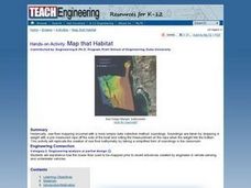
Map that Habitat
Students participate in an activity that replicates the creation of sea floor bathymetry by taking a simplified form of soundings in the classroom. They discuss sea floor mapping technologies, sonar, soundings, and remote sensing,...
Curated OER
Mapping the Aegean Seafloor
Earth science learners create a two-dimensional topographic map of the floor of the Aegean Sea. They use it to then create a three-dimensional model of the ocean floor features. This comprehensive resource delivers strong background...
NOAA
Mapping the Deep-Ocean Floor
How do you create a map of the ocean floor without getting wet? Middle school oceanographers discover the process of bathymetric mapping in the third installment in a five-part series of lessons designed for seventh and eighth graders....
Curated OER
The Unseen Ocean Floor
Students build ocean floor structures, then map and model an unfamiliar ocean floor. They are introduced to bathymetry and sea floor features, and discover one of the most widely usd methods for studying the ocean.
NOAA
Mapping the Ocean Floor: Bathymetry
Bathymetry is not a measure of the depths of bathtubs! Through the three lessons, scholars explore two different types of maps and how they are made. The resource focuses on topographic and bathymetric maps and teaching the techniques...
NOAA
Wet Maps
How do oceanographers make maps under water? Junior explorers discover the technologies and processes involved in creating bathymetric maps in part three of a five-part series designed for fifth- and sixth-grade pupils. The lesson...
Curated OER
Ping!
Using "mystery bathymetry" shoeboxes, young explorers simulate sonar action to map out the topography of an un-viewable landscape. This classic activity helps physical oceanography learners understand how sonar works. It would be...
Curated OER
Ocean Floor Model
Students construct a simulated model of the ocean floor in a shoe box. They determine that the floor of the ocean is composed of hills, plains, ridges, trenches, and sea mounts. They draw out a plan for their ocean floor which includes...
Scholastic
Study Jams! The Ocean Floor
Under the sea, the geography is as varied as it is on land! Young oceanographers find out about continental shelves, abyssal plains, seamounts, trenches, and mid-ocean ridges by viewing and reading the eight high-quality slides. Then...
Curated OER
Mapping the Sea Floor
Students review their prior knowledge on topographical maps. Using a map, they examine the sea floor off the coast of San Diego, California. With a partner, they chart the sea floor of an area and use cutouts to create a visual...
Curated OER
Mapping the Canyon
Students compare and contrast topographic maps and bathymetric maps. They investigate how bathymetric maps are made and how to interpret one.
NOAA
Into the Deep
Take young scientists into the depths of the world's ocean with the second activity of this three-part earth science series. After first drawing pictures representing how they imagine the bottom of the ocean to appear, students...
Curated OER
Mt. Whitney to Death Valley
This is an intriguing problem that brings together real-world data, technology, and mathematical problem solving. If visibility wasn't an issue, could you see from the highest point in the lower 48 states, Mt. Whitney, to the lowest...
Curated OER
Mapping Ancient Coastlines
Most of this lesson plan is spent working on the "Bathymetry Worksheet." It includes a graph of the changes in sea level over the past 150,000 years and a bathymetric map of changes in an imaginary coastline over time. Participants...
Curated OER
The Ocean Floor
Fifth graders discuss the process of sedimentation and the continental drift theory. They locate major structures on the ocean floor and they identify life forms at each level of the ocean.
Curated OER
Map Puzzles
Students make puzzles from world maps, dramatizing how much of the globe is covered by ocean.
Aurora Trust
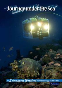
Journey Under the Sea
Discover the interesting world of maritime archaeology and explorations under the sea with this nice set of worksheets, which cover such topics as search tools and techniques of underwater archaeology, carbon dating, vessel types, and...
Curated OER
Bathymetric Mapping
Students draw contour lines based on NOAA soundings on a nautical chart. They color the contours and glue label tags for topographic features. They determine that the floor of the ocean is composed of hills, plains, ridges, trenches,...
Curated OER
Mapping the Ocean Floor
Students construct and interpret a line graph of ocean floor depth and a bar graph comparing the height/depth of several well-known natural and man-made objects and places. In addition, they calculate the depth of two points using sonar...
Curated OER
Seeing What You Cannot See--RADAR
Student imitate mapping the ocean floor using the basic concepts of radar. Then they explain what radar is and how it workds. All of their measurements are recorded on a data sheet. Then the data is entered into a spreadsheet program. A...
Curated OER
Understanding Topographic Maps
Students are introduced to the characteristics and uses of topographical maps. Using a worksheet, they examine the use of specific terminology and use cutouts to create their own topographical map of an area. They answer discussion...
Curated OER
Reading Maps of the East Pacific Rise
Students make qualitative and quantitative observations and use various maps to investigate the features of the East Pacific Rise The study actual bathymetric maps of the EPR region. They identify key features of the ridge and explore...
Curated OER
Creature From The Deep
Students become familiar with oceanography terms by writing an oceanography horror story.
Curated OER
Graphing: Ocean Floor
Students graph the ocean floor using given data. In this earth science instructional activity, students label different oceanic features on the map. They answer questions at the end of the lab.


