Curated OER
The Land and People Before Columbus
The major pre-Columbian settlements are studied in this excellente social studies lesson. Fifth graders explain how geography and climate influenced the way various nations lived and adjusted to the environment, and focus on eight...
Curated OER
Rockin' Round New York State
Students discuss their favorite rock groups and bands. They create rock groups that will be touring New York State. Students research cities in New York, determine dates of concerts, create touring itineraries, and develop Inspiration...
Curated OER
Radio Program Disc 1, Track 6
Students place the Ohio river in its historical and geographical context. They listen to the radio stories, and are asked what postive and negative influences does the Ohio River have on nearby communities>
Curated OER
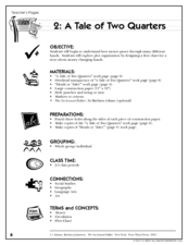
A Tale of Two Quarters
Have your class use the life of a quarter to understand and design plot and flow charts. They read the book, The Go-Around Dollar, think about how their teacher got her quarters that day, then create a flow chart. They have to show how...
Curated OER
From Sheep to Rug
Ever wonder where wool comes from? How it is used to make a woven rug? Introduce the Native American craft of rug making to your preschool or kindergarten class with a discussion. Learners examine and discuss images of a Native American...
NET Foundation for Television
1850-1874 Homestead Act Signed: The Challenges of The Plains
Start a whole new life in a land known as the Wild Wild West! Learners analyze maps, personal accounts, the Kansas-Nebraska Act, songs, and video clips to uncover life under the Homestead Act. Using their new skills, class members role...
Teacher.org
Christmas Around the World Part 1
A creative lesson shines a spotlight on Christmas celebrations throughout six different countries. Scholars read an informative text and share their new-found knowledge with their peers. After hearing about each country, pupils choose...
C-SPAN
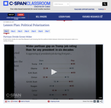
Political Polarization
Dive into the political breach with pupils and explore the reasons for political polarization. Using clips from C-SPAN that include discussions from reporters and scholars, class members consider what is causing the political fault lines...
Smithsonian Institution
Borders with the World: Mexican-American War and U.S. Southern Borderlands
The Mexican-American War created social borders—not just physical ones. Scholars learn about the effects of the Mexican-American War on the people living in the borderlands using text excerpts, maps, and partnered activities. Academics...
Curated OER
Tears of Joy Theatre Presents Anansi the Spider
Accompany the African folktale, Anansi the Spider, with a collection of five lessons, each equipped with supplemental activities. Lessons offer multidisciplinary reinforcement in English language arts, social studies, science, and arts...
Curated OER
Arc GIS Project: Visualizing the Holocaust
A cross-curricular lesson for middle schoolers that covers language arts, social studies, geography, and math, this is a great extension activity if your class is reading The Diary of Anne Frank or learning about the Holocaust. Using...
Curated OER
The Fabric of Our World
Middle schoolers discuss cultural diversity, and examine how the community reflects the cultural background of the inhabitants. They read the book, People, take a community walk, create a rainbow chart, and research other states for...
Curated OER
Human Impacts on Major Rivers of the World
Middle schoolers explore motivations behind human intervention in the stream flow of selected rivers, infer kinds of interventions and their results, and evaluate level of success of such interventions of stream flow as well as...
Curated OER
Time For Change
Students examine and discuss the inventions and changes created by the Industrial Revolution. They create posters or clay models about inventions, write paragraphs about the advantages and disadvantages of the changes, and develop a...
Curated OER
The Tennessee River: The Tie That Binds
Seventh graders examine the Tennessee River to see why it is still a major transportation artery in lieu of the age of modern transportation such as interstate highways, air cargo, and elaborate railway systems.
Curated OER
Focused Learning Lesson: World Geography
Students compare human activities and the physical characteristics of the land and how they have given some regions labels. They also analyze the cultural changes occuring in these regions.
Curated OER
Focused Learning Lesson: World Geography
Students examine the distribution of economic systems of the world. They learn the difference between developing and developed countries.
Curated OER
Geography Lesson 2
Students interpret photographs and search for common and opposite cultural and physical aspects of countries, and create a collage for an "ideal" country.
Curated OER
Studies of the Ancient World
Sixth graders, after taking a pretest, write a paragraph describing the difference between Athens and Sparta and write an article about the ancient Phoenicians, describing their contributions to world history. They compare democracy in...
Curated OER
Using Charts and Graphs to Study East Asia's Modern Economy
Students examine East Asia's modern economy. In groups, classmates use the internet to compare the resources, products, and economy of specified countries. After collecting the data, pupils create charts, tables and graphs. They...
Curated OER
Geography of the Roman Empire
Students explore the Roman Empire. For this ancient Rome lesson, students research regions of the Roman Empire and present their finding to their classmates. Students also use an interactive map to practice placement of the regions...
Curated OER
What You Can Learn From a Map
Students discover how to interpret maps. In this geography skills lesson plan, students explore geographic themes as they complete worksheet activities regarding road maps, shaded relief maps, and topographic maps.
Curated OER
Latitude on World Maps
Sixth graders examine the purposes of maps. In this Geography lesson, 6th graders practice using latitude and longitude on a map.
Curated OER
Trekking to Timbuktu: The Geography of Mali - Student Version
Eleventh graders locate Mali on a world map, describe the landscape and climate of Mali, and locate the city of Timbuktu and describe the local weather. They compare life along the Niger in ancient times to that of today


