Curated OER
Land Plan Challenge
Students use maps to plan towns, being conscious of water resources. In this geography and land planning lesson plan, students create collaboratively in small groups towns using maps. At the conclusion of the activity, students build...
Curated OER
My Sierra County
Students investigate the special landmarks of their county. In this geography lesson, students view a Powerpoint presentation about counties. Students create a Powerpoint presentation of their own county and use a digital camera to take...
Curated OER
Pack Your Bags: Explore South Carolina
Third graders investigate different counties in South Carolina. In this geography lesson, 3rd graders are assigned a county in South Carolina to research and identify important facts about the county. Students create a PowerPoint...
Curated OER
Ivory Wars
Students examine the controversy surrounding African trade. In this geography lesson plan, students research the killing of elephants for ivory. Students collaborate to report on the history of the ivory trade and its modern-day...
Curated OER
Africa: Economics And Change
Students examine the gold-mining industry in Africa. In this geography skills lesson, students watch "Africa: Economics and Change," investigate the challenges of working in mines, research attributes and production of gold and discuss...
Curated OER
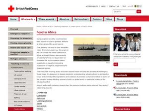
Food in Africa
Students examine the shortage of food in Africa. In this geography skills lesson, students consider how conflict and extreme situations may result in food shortages for some nations. Students analyze the provided photographs and videos...
Curated OER
Combining Map and Compass
Students practice using the map and compass to find a location. In this geography lesson series, students identify basic requirements needed when traveling in the wilderness. They plan a healthy menu for a backpacking trip.
Curated OER
State Database Lesson
Fifth graders create a database about the geography of the United States. The access to a computer is essential for this lesson. The outcome is that technology is used as a tool to measure student understanding of geographical locations....
Curated OER
Living By Water
Students research a coastal community, locate it on a map and profile its physical, geography, climate, architecture and cultural characteristics. They envision this coastal community and make a detailed drawing of it by blending...
Curated OER
Jeopardy: Germany
Introducing your students to general knowledge about a region or topic can spark their interest or get the inquiry ball rolling. This Jeopardy game tests students on what they know about German related topics such as, religion, food,...
Curated OER
Geography and Archeology of the River People
Seventh graders work together in groups to read a handout and answer questions about the geography and archeology of a group of native peoples. As a class, they discuss their opinions and answers and the importance of using artifacts to...
Curated OER
The Geography of Aboriginal Languages in Canada
Students study the relationship between geography and the Aboriginal language communities.
Curated OER
Geography: How do Louisiana Rice Farmers Help the Environment after they Harvest Rice?
Third graders study maps of the United States locating Louisiana, the East Coastal Plain, the Mississippi Alluvial Plain, the West Gulf Coastal Plain, and five of the main rivers. In this geography instructional activity, 3rd graders...
Curated OER
Getting Comfortable with the Internet & Geography
Students are introduced to the basic characteristics of Geography. Using maps, they practice identifying locations and other landmarks. They use the internet to explore websites with are geographically oriented.
Curated OER
Studies of the Eastern Worlds: Japan
Seventh graders, in their study of Japan, examine and discuss the effect the atomic bomb had on Japan. They watch videos and then read the story of Sadako and her magic cranes. They make their own origami cranes and write a paragraph on...
Curated OER
Mongolia Geography
Students examine the geography and culture of Mongolia. Individually, they cut out cut-outs of animals to place on their maps and label the grasslands and desert areas. They locate major cities and rivers along with vegetation.
Curated OER
The Birthplace
Students use a world map, to identify the country of origin of the target language and other countries and areas where the largest language is on e of the principal languages. They complete this assessment orally using a world map.
Curated OER
Case Studies: Cross-Cultural Comparison
Students examine maps of Lebanon, Vietnam and Nigeria, discuss relationship between ethnicity, land and conflict, review material from case studies, complete comparison chart, and write essays comparing two of the case studies.
Curated OER
Geography
Students, after hearing a radio broadcast on 'A Day in School Abroad,' explore and study the lives and experiences of children in a variety of places. They assess the advantages and disadvantages of living on a small island, find out...
Curated OER
The Geography of the Philippines
Students examine the geographic features and population distribution of the Philippines. They analyze maps, take a quiz, define monsoon, and discuss how the people in the Philippines have adapted to their environment.
Curated OER
Geography - Climate
Tenth graders explore how to analyze a climograph and identify the differences between two different climates. They explain how important climate is to their everyday lives
Curated OER
Peru Geography and the Environment
Fourth graders draw maps of Peru and examine how Peru is a geographically diverse country.
Curated OER
New Hampshire and the Five Themes of Geography
Young scholars explore the location, place, human-environmental interactions, movement, and regions of the New Hampshire landscape through the use of visual representations.
Curated OER
Geography Game
Second graders, in groups, selects a letter as a starting point and announces the direction in which he intends to move on a map. The team that closes a square takes possession of the square and marks it with their symbol.


