Curated OER
Native Americans and Natural Resources
North American Indian civilizations had already been in place for over 10,000 years before the arrival of European settlers. Introduce your young historians to Indian tribes that lived in the Chesapeake region in the early seventeenth...
Global Oneness Project
Far From Home
A timely and provocative lesson inspires high schoolers to tackle the Syrian refugee crisis. They analyze a compelling photo essay before discussing and writing about it.
Global Oneness Project
A Collapsing City Skyline
Have your high schoolers learn about the modern history of Myanmar by close-reading an article about the city and people of the city Yangon. As they'll learn, the country is going through some dramatic transitions. After reading the...
Curated OER
Learn the States and Postal Abbreviations
If you are preparing to cover the 50 states with your class, you don't want to miss this resource. It includes an excellent set of worksheets through which learners practice identifying states from their abbreviations and placing those...
Curated OER
Social Studies: Regions of the United States
Third graders create Powerpoint presentations of various geographic regions of the United States. They focus on the Northeast, Southeast, and Midwest regions. Students combine their individual slides into a class presentation.
Curated OER
Map Study
In this geography worksheet, students study the United States. Students respond to 6 multiple choice questions about the map.
Curated OER
United States Geography: Crossword Puzzle
For this geography worksheet, students use the 14 clues in order to fill in the crossword puzzle with the appropriate United States geography answers.
Curated OER
Geography Terms
In this social studies learning exercise, students match the correct terms with its meaning in the column on the right. The answers are found by clicking the button at the bottom of the page.
Curated OER
Number The Stars Geography
In this social studies worksheet, middle schoolers look for the location of Denmark and then color the continents of Europe and North America.
Curated OER
Massachusetts Word Search
In this social studies instructional activity, students complete a word search. They find words related to Massachusetts (such as names of cities) as well as words about surrounding areas (Atlantic Ocean).
Curated OER
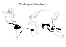
World Map With Rain Forests
In this geography worksheet, students study a map of the world which shows shaded areas indicating where the rain forests are located. There are no labels for countries or continents.
Curated OER
Geography With Dr. Seuss
Students read the book, The King's Stilts by Dr. Seuss and discuss the geographical information given in the book. Then they discuss and locate on a map the physical features that make up the continent of Africa. They create an original...
Curated OER
Exploring South Carolina
If you are having your students conduct a State study this presentation could be a nice example to show them. This resource provides general information about the geography, animals, and city life one may find in South Carolina. Web...
Curated OER
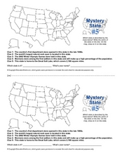
Mystery State # 5
Mystery state number five is none other than Utah! Quiz your kids on state knowledge while building deductive reasoning skills. They use each of the five clues to determine the name of the mystery state. A great warm up when studying...
Curated OER
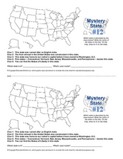
Mystery State #12
What's better than learning about US geography? Having fun while your doing it! After reviewing each of the five given clues, learners attempt to name the mystery state. A great way to reinforce geography skills and deductive reasoning...
Curated OER
Connecticut Map
In this state maps worksheet, students identify the state of Connecticut, and fill in the state capital, major cities, and other major attractions.
Curated OER
Colorado Map
In this state maps worksheet, students identify the state of Colorado, and fill in the state capital, major cities, and other attractions for the state.
Curated OER
North Carolina Map
In this state maps worksheet, students identify the state map of North Carolina. Students fill in the state capital, the major cities, and other state attractions.
Curated OER
Michigan Map
In this state maps worksheet, students identify the map of Michigan. Students then fill in the capital city, major cities, and other state attractions.
Curated OER
Maine Map
In this state maps learning exercise, students identify the map of Maine. Students fill in the capital city, major cities, and other state attractions.
Curated OER
Montana Map
In this state maps instructional activity, students identify the state map of Montana. Students fill in the capital city, the major cities, and other state attractions.
Curated OER
New Mexico Map
For this state maps worksheet, learners identify the state of New Mexico. Students fill in the state capital, major cities, and other state attractions.
Curated OER
Vermont Map
In this state maps activity, students identify the map of Vermont. Students fill in the state capital, the major cities, and other state attractions.
Curated OER
The Earth's BIG Features
Your students will enjoy the vivid pictures and interesting facts about world geography, in this presentation. Depicted are several major geographical features found around the world and a description of each.


