Curated OER
Regions Change
Middle schoolers examine how geography can have an impact on change in a region. They discuss what their local area might be like in 50 years, and in pairs, select a situation and write a short story to describe how it changed from one...
Curated OER
Sacred Sites
Students read about the one-year anniversary of the bombing of the Mosque of the Golden Dome, or Askariya Shrine, in Iraq. They explore a number of other sites of religious significance to create designs for a geography Web site on holy...
Curated OER
Everybody Celebrates
Examine the holidays of La Posada in Mexico, Hanukkah in Israel, and Kwanzaa in the United States. Learners identify the countries on a world map, listen to stories, create art projects for each holiday, and make recipes celebrating the...
Curated OER
The Superheroes of Public Land Management
Learners study public land management agencies and their missions. They research a management agency, design a superhero to represent the agency and describe the skills and training needed to manage public lands. They include the...
Curated OER
Day-to-Day Life in a Small African Village
Young scholars experience just a bit of what it's like living in a village in Tanzania-from language to geography to health and hygiene issues. They compare aspects of school and home life in the United States with those in Tanzania and...
Curated OER
American Indians and Their Environment
Students create a storyboard of the three American Indian language groups showing the geography of where they lived and how they adapted to the environment. They compare European and American Indian views of nature and explain how these...
Curated OER
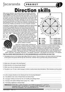
Direction Skills
For this geography worksheet, students read an excerpt on what directions tell someone. They respond to 6 short answer questions related to the neighborhood illustration found on the second page of the worksheet.
Curated OER
Feral Cats
In this geography activity, students identify the feral cats of Australia. They read an excerpt and respond to the three questions that follow. Students also imagine that they are a part of scientific team that has been set up to deal...
Curated OER
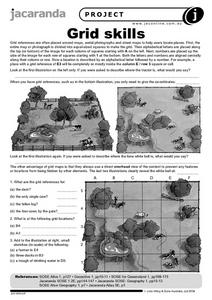
Grid Skills
In this geography learning exercise, students use grid references on a map to locate places in the pictures given. They also identify another advantage of using a grid map, which they have an overhead view of the content to prevent any...
Curated OER
Jobs and Places
Students explore where jobs can be done. In this geography and careers lesson, the teacher presents the idea that some jobs are location specific while other are not, then students consider a list of jobs and determine where each would...
Curated OER
Learning about Maps and Colors
First graders discuss "Harold and the Purple Crayon" and his drawings. In this neighborhood geography activity, 1st graders learn to detect and classify places on a map including their home. Students recognize their address as a specific...
Curated OER
Waldseemuller's Map: World 1507
Students investigate the 1507 word map. In this world geography lesson plan, students examine the details of each section of the map and then draw conclusions about how the people of 1507 understood the world. Students are evalated on...
Curated OER
Chinese Lion Dance
Students celebrate the Chinese New Year and listen to the story behind the Chinese Lion Dance. In this Chinese New Year lesson, students research the geography and culture of China. Students create puppets, dance the Lion Dance and...
Curated OER
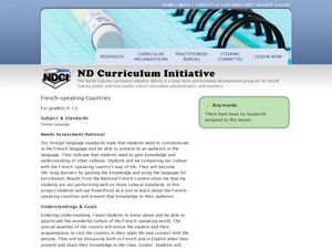
French-Speaking Countries
High schoolers investigate the customs and culture of French-speaking countries. In this geography skills lesson, students research selected nations to learn about the culture, industries, lifestyles, and foods that are eaten there. High...
Curated OER
Mesopotamia
Students map Mesopotamia. For this Geography lesson, students are introduced to Ancient Mesopotamia. Students use an atlas to label the defining features and areas of Mesopotamia on a map.
Curated OER
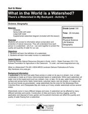
What in the World Is a Watershed?
Students discover the role of a watershed. In this geography lesson, students are shown a diagram of a watershed and discuss the definition of a watershed. Students demonstrate the role of a watershed by using an umbrella and spraying it...
Curated OER
In Search of Truce
Students explore the relationship between a country's political and social history and its position today. They study 8 African countries immersed in the present conflict in Congo. They present their findings.
Curated OER
Old Kids From The Bloc
Students study about wide scale construction and development in Moscow and its impact on cultural and historic preservation. They research the political, social, economic, and cultural changes in the former Eastern Bloc and create a...
Curated OER
Westward Expansion
Fifth graders create a brochure outlining what he or she has studied throughout the unit. The brochure contains evidence that Students have understood and mastered the answers to the essential questions.
Curated OER
Early Explorers
Fifth graders study early explorers. In this World history lesson, 5th graders draw an outline of a map labeling each part, build geographical features out of dough, and paint each of the land and water features.
Curated OER
On the Road with Marco Polo
Young scholars follow Marco Polo's route to and from China. They explore the geography, local products, culture, and fascinating sites of those regions. They record their findings.
Curated OER
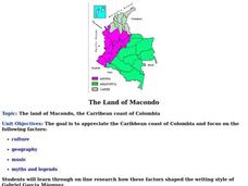
The Land of Macondo
Students research the culture, geography, music, myths and legends of the Caribbean coast of Colombia using online tools. They determine how these factors influenced the writing style of Gabriel Garcia Marquez. They design and write a...
Curated OER
Countries of South America
Middle schoolers focus on the geography of the countries of South America. Using a map, they identify the European countries who claimed the South American countries and research the influences they had on South America. To end the...
Curated OER
Foreign Language: Travel Brochure
Learners research either French or Spanish speaking countries. After compiling information covering the geography, people,government, economy, and culture, they produce travel brochures on their respective countries.


