Arizona Cooperative Extension
Geocaching
Using GPS units, small groups participate in a scavenger hunt to find an object that you have hidden. They use coordinates for stopping points along a pre-planned path to get to the final cache. This is a terrific activity to include in...
Curated OER
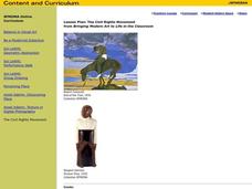
The Civil Rights Movement
Students compare and contrast African-American, Asian-American, Chicano and Native-American movements with the civil rights movement and are exposed to the sociopolitical and economic factors involved in the rise of social movements.
Curated OER
Ragtime: 1880-1920
Build an understanding of the social, economic, and cultural changes that were incited by the American Industrial Revolution. Learners will research the historical context of the Ragtime Era, and compose an oral presentation in the...
Pulitzer Center
Revolution in Tunisia
How much do your pupils really know about the revolution in Tunisia? In order to inform your class and spark discussion, first create a country profile, comparing and contrasting Tunisia with the United States. Learners then analyze the...
The New York Times
Kiev in Chaos: Teaching About the Crisis in Ukraine
Provide a historical context for the political unrest between Russia and Ukraine that began in late 2013. Learners review their prior knowledge and chronicle new understandings with a KWL chart, watch a video explaining the Ukrainian...
Curated OER
Introduction to China
Compare and contrast the distinctive characteristics of art forms from various cultural, historical, and social contexts, and describe how the same subject matter is represented differently in works of art across cultures and time...
Curated OER
What Can a Map Tell You?
Learners investigate how maps can provide useful information about health issues. They study a map to draw conclusions about cholera death in London.
Curated OER
On the Road with Marco Polo: From Hormuz to Venice
Students study the route from Hormuz to Constantinople that was traveled by the Polos. They explain the importance of Constantinople in medieval time and discuss its location, and outer wall structure.
Curated OER
Dos mapas de Florida, el Caribe y parte de Sur America
What can maps tell us about the past? Find out with a Spanish lesson that incorporates geography. After examining maps individually, comparing two old maps of Spanish Florida and writing notes in the provided Venn diagram, pupils pair up...
Smithsonian Institution
Dia de los Muertos: Celebrating and Remembering
Help scholars understand the history, geography, traditions, and art of Dia de los Muertos, the Day of the Dead. Find background information for your reference as well as a detailed cross-curricular lesson plan. Learners compare...
Curated OER
Social Studies: Great Circle Route
Students compare routes between Minnesota and China using a map and globe. Using the "great circle route" method, students find the shortest route between two points.
Curated OER
Lesson Design Archaeology- World Map
Students practice locating positions on the world map. In this map skills instructional activity, students explore the world map and items such as the compass rose, Equator, mountains, cities, etc. The students practice locating...
Curated OER
World Map and Globe - Lesson 15 Mountains of the World
Students locate major world mountain ranges. In this geography lesson, students identify major mountain ranges on 6 on of the 7 continents on a large world physical map.
Curated OER
Three Gorges Dam: Will China Sink or Swim?
Seventh graders study the Three Gorges Dam, which is the largest dam built in the world. They examine how the dam impacts China as it prepares for the 21st century.
Curated OER
The Influence of Physical Geography
Students explore the limits and demands of their physical world and how it relates to the survival and well-being of people.
Curated OER
A Study of Alaska
Learners explore Alaska. This lesson is gearing mostly for students who live in Alaska.
Curated OER
Geography and our Family Favorites
Students talk with older family members about favorite family foods and where they have originated. They learn the process that went into the preparation and cooking of these foods and contrast how technology has affected food...
Curated OER
Your Neighborhood Geography
Tenth graders observe geographical characteristics of their own neighborhoods. They take digital pictures and write a summary of the geographical features they find which they present to the class.
Curated OER
Finding Your Spot in The World; Geography, Maps, Multi-Culturalism
Students use a variety of maps to locate their home, their school and the origin of their ancestors.
Curated OER
Tissue Paper Geography
Students explore geographic features of the desert and apply their understanding of the topography of the desert by creating a tissue paper painting.
Curated OER
John Smith’s Map of the Chesapeake Bay
Young geographers travel back through time with primary source and map analysis and envision Captain John Smith's arrival at the Chesapeake Bay.
Curated OER
Postcards from California: A Unit on Geography, Social Studies, History and California's Resources
Fourth graders examine patterns that influence population density in the various regions of California. The unit's three lessons utilize graphic organizers for the interpretation and presentation of data.
Curated OER
Geography of Africa
Students examine the geography of Africa and understand its diverse ethnicity. In this African geography lesson, students create a mental map of Africa. Students label the maps and list the languages of Africa. Students compare the...
Curated OER
Where I Live…
Second graders explore their community. In this social studies lesson plan, 2nd graders use Internet tools to locate their community on a map and then locate where they live.


