Curated OER
Mapping Community Values
Students discuss the origin of various maps focusing on the values behind them. Students also explore how human needs and geography influence community settlement patterns. Students extend learning by creating and mapping their own ideal...
Curated OER
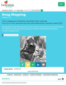
Our Land Lesson 2: Song Mapping
Students study the meaning of philanthropy as giving of time. talent, and treasures. They sing This Land Is Your Land while locating five of the places on a map of the United States showing that relief office are everywhere. They decide...
Curated OER
Lesson Design Archaeology- U.S. Map
Students examine the U.S. map and identify cultural areas. In this archaeology lesson, students locate cultural areas on the U.S. map and fill in the proper locations.
Curated OER
Mount Everest History Lesson
Students explore Mount Everest. In this exploration activity, students read "The Top of the World: Climbing Mount Everest," by Steve Jenkins. Students then respond to discussion questions and participate in a map skills activity.
Curated OER
European Union Map Quest
Sixth graders identify countries of the European Union. They locate countries of Europe on a map and pair with a student to complete a blank map of Europe. They label each country and complete worksheets for the European Union. They...
Curated OER
Globe Lesson 17 - Alaska and Hawaii - Grade 4-5
Students develop their globe skills. In this geography skills lesson, students explore the area added to the United States when the Alaskan territory was purchased from Russia.
Curated OER
U.S. Political Map
Learners explore the symbols found in a map legend. In this map skills lesson, students locate the legend on a political map and explain what each of the symbols mean. Learners locate and identify several symbols on the map.
Curated OER
Mapping Districts
Students use maps to learn about the U.S. Census. For this 2010 Census lesson plan, students visualize census data on maps, use map keys to read population maps, and explore the concept of population density.
Curated OER
Mapping the Family
Students research the locations where their fathers have lived. In this map skills lesson, students identify the locations their fathers have lived in the world as they create charts and maps that note the information.
Curated OER
Globe Skills Lesson 8 Dust Bowl Travelers
Students develop their globe and map skills, In this geography instructional activity, students examine the Dust Bowl as they complete an activity that requires them to plot latitude and longitude.
Curated OER
Globe Skills Lesson 7 The Transcontinental Railroad
Students explore the Transcontinental Railroad. In this geography skills lesson, students use map skills in order to locate legs of the Transcontinental Railroad on globes.
Curated OER
Globe Skills Lesson 11The Vietnam War
Students develop their globe and map skills, In this geography lesson, students examine the Vietnam War as they complete an activity that requires them to plot latitude and longitude.
Curated OER
Interdisciplinary Unit Planning II
Students create playground maps and identify means of using these maps to enhance social studies learning of elementary students. They develop elementary-level interdisciplinary unit plans using social studies content for the primary...
Curated OER
Working on the Railroad
Students plan a trip on the railroad. For this railroad creation and implementation lesson, students listen to the song "Working on the Railroad", make a map of where the track was laid and discuss the geographical...
Curated OER
Play Doh Map of Your State
Students create a state map using Playdoh. For this hands-on state geography lesson, students work in groups to form a three-dimensional map of their state using Playdoh made at home following a (given) recipe. Students use four...
Curated OER
Me on the Map Lesson 2
Learners analyze and interpret maps, globes and geographic information systems to define and identify cities, counties, states, countries and continents to create a booklet called me on the map. They also determine and calculate the...
Curated OER
Learning about Maps and Colors
First graders discuss "Harold and the Purple Crayon" and his drawings. In this neighborhood geography instructional activity, 1st graders learn to detect and classify places on a map including their home. Students recognize their address...
Curated OER
Edible State Map
Fourth graders, using a map of a state for reference, make an edible map that shows the major cities in that state. Once the map is shaped, have students place the M&M's where each major city would be. Now this is a lesson I could...
Curated OER
200 Years and Counting: How the U.S. Census Tracks Social Trends
Students examine the process of census taking in the United States. In this "200 Years and Counting" lesson, students examine the data collection process, look at an example of a census form, analyze data, and learn what the information...
Curated OER
Combining Map and Compass
Learners practice using the map and compass to find a location. In this geography lesson series, students identify basic requirements needed when traveling in the wilderness. They plan a healthy menu for a backpacking trip.
Curated OER
HISTORICAL AND SOCIAL SCIENCES ANALYSIS
Students examine a variety of maps and documents to identify physical and cultural features of neighborhoods, cities, states, and countries, to explain the historical migration of people, expansion and disintegration of empires, and the...
Curated OER
Mapping the Library
Learners compare their school library with another library such as: town library, for example, or a virtual library and identify the most important features. Students use their observations to create a map of the school library that can...
Curated OER
Students Slide to School on Air-Powered Sled
Students locate the Great Lakes on a US map, then read a news article about a sled being used as a wintertime school bus in Wisconsin. In this current events activity, the teacher introduces the article with a map and vocabulary...
Curated OER
Mapping and Excavating a Jello Mold
Students simulate how archaeologists excavate sites by "searching" their own site in the form of a Jello mold. They use a grid to map the objects in the Jello mold as well as looking at three layers of Jello to understand stratigraphy...


