Library of Congress
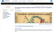
The Alaska Purchase: Debating the Sale from Russian and U.S. Perspectives
Seward's Folly or brilliant strategic move? Class members investigate primary source documents from each country to determine the rationales behind the sale and purchase of Alaska, and then stage a debate.
Civil War
Civil War Medicine: Fact or Fiction
Young historians compare the presentation of medical care during the Civil War in passages from fictional and nonfictional texts. They examine passages from Gone with the Wind by Margaret Mitchell and Soldier's Heart by Gary Paulsen, and...
Curated OER
Geography Skills
Young scholars practice their geography skills. In this geography skills lesson, students locate, plot, and label places on maps and globes.
Curated OER
What is the Population Distribution of Cartoon Characters Living On the Pages of Your Newspaper?
Students read various cartoons in their local newspaper and calculate the population demographics, spatial distribution and grouping of the characters. Using this information, they create a population distribution map and share them with...
Curated OER
Creating Life Maps (Elementary, Reading/Writing)
Students create a personal life timeline to better explain how a historical timeline is effective in studying history. They also write a poem about themselves.
Curated OER
The Gold Rush
Young scholars identify the routes involved in the Gold Rush on a map. In this map skills instructional activity, students use a United States map to locate the routes used to travel to California during the Gold Rush. Young scholars...
Curated OER
An American Legacy-Lewis and Clark’s Corps of Discovery Study
Fifth graders travel with the Corps of Discovery. In this ancient civilizations lesson, 5th graders research print and Internet sources about the Lewis and Clark expedition. Students prepare PowerPoint presentations to share their...
Curated OER
Globe Lesson- The Revolutionary War
Students discover using globes. For this geography lesson, students use a globe to outline the original 13 colonies. Students also use a globe to measure the distance from London to New York City and determine how many days it would have...
Curated OER
No Friends but the Mountains: A Simulation on Kurdistan
Students read background information on the people of Kurdistan and explore the geographical, political and ethnic history of the region. They participate in a debate where they role-play various points of view in the conflict.
Curated OER
An Early American Culture
Students identify the locations of the Hopewell culture. In this map skills lesson, students use a globe to mark several locations of the Hopewell culture.
Curated OER
Island Inquiry: Based on the Northern Mariana Islands Quarter
Students research two physical and/or human characteristic topics of the Northern Mariana Islands in groups of four students. In this social studies instructional activity, students analyze how to write magazine articles and research the...
Curated OER
Globe Lesson- Early Spanish Settlements
Students use a globe. In this geography and early settlements lesson, students learn about the settlement of missions and haciendas in New Mexico. Students locate Mexico City and San Francisco on the globe and determine the distance...
Curated OER
Social Studies For Elementary School
Fourth graders become familar with maps and work in groups to get an overview of what Europe is like. The real assignment is in the form of students creating their own trip if it could really be taken.
Curated OER
Adventures With Maps And Globes
First graders examine the differences between a map and a globe. They discuss and identify the symbols on maps and globes, then in small groups complete a worksheet. Students then complete a Venn Diagram comparing maps and globes.
Curated OER
Geography With Dr. Seuss
Students read the book, The King's Stilts by Dr. Seuss and discuss the geographical information given in the book. Then they discuss and locate on a map the physical features that make up the continent of Africa. They create an original...
Curated OER
The Nez Perce War
A lesson which combines the skills of notetaking with a history of the Nez Perce War against the United States Cavalry is here for you. Learners take notes while their instructor lectures them on the information. A quiz is given as a...
Curated OER
Politics and Religion in 17th Century Dutch Art
Seventh graders examine different pieces of Dutch Art. They identify its social and political meanings by using cultural and historical information. They examine maps of the time period as well.
Curated OER
What's For Dinner?
Eighth graders discover how the location of restaurants affects the future location of different restaurants. Using a fictionous town, they map the locations of all current restaurants and analyze the data to determine what type of...
Curated OER
Adinkra Cloth
Students locate Ghana on a map of Africa and discover features of Ghana culture. They synthesize the importance of Adinkra symbols and cloth to the people of West Africa and design an Adinkra cloth.
Curated OER
Weather Forecasting
Students examine cold, warm, and stationary fronts. They also examine the roles of relative humidity and the way air masses move. They are to create forecasts based on the information they collect. Tapes are shared with the class.
Curated OER
Where is ? ? ? ?
Students explain and explain the concept of a grid system. They define absolute and relative location and develop an imaginary city on graph paper using a grid system.
Curated OER
Iraq, Where's That?
Students identify the Middle Eastern countries on the map and the oil-producing countries of OPEC in the region. They examine whether the presence of important producing oil fields qualifies as a characteristic of this region.
Curated OER
Beyond Demographics
Students study the culture of the Dominican Republic. In this Peace Corps lesson, students watch, "Destination: Dominican Republic." Students also examine primary source materials on the nation and discuss their findings.
Curated OER
Where Life Is Too Short
Students predict how a pandemic would affect aspects of South Africa's society. In this world issues and geography lesson plan, students read a letter outlining the problems affecting South Africa. Students discuss and analyze how...


