Roy Rosenzweig Center for History and New Media
Continental Differences
Middle schoolers break into groups and closely investigate primary sources associated with the seven different continents. After deciding which continent their primary sources relate to, representatives from each group present their...
Curated OER
Pennsylvania Colony
Learners research the main reasons for the colonists moving to the Pennsylvania colony. They analyze maps, label a bubble map, list similarities/differences of immigrants then and now, and create a colonial newspaper advertisement.
Curated OER
Thirteen Original Colonies
Students use maps, the Internet, graphic organizers and discussion to explore the history of the Middle American Colonies. They consider how the colonies were founded and the ideas of religious freedom and self-government they embodied.
Curated OER
Map Making
Students draw continents and oceans on a handmade globe and transfer their globe onto a flat map. For this maps lesson plan, students use paper and a tennis ball to make their globes.
Curated OER
On the Road Again
Students examine migration patterns in Africa and China. They watch excerpts from a documentary, define key vocabulary words, complete various student organizers, and create a poster.
Curated OER
Thematic Unit: Beginning Holocaust Studies
Fifth graders discuss concepts of diversity, culture, and prejudice, gain understanding of harm caused by prejudice, and demonstrate ability to think critically and a desire to act morally.
Curated OER
Winter Holidays Around the World
How much do you know about the holidays around the world? Second graders put their knowledge to the test with a 14-day activity about global celebrations. They read informational text, employ KWL charts, and compare and contrast the many...
Curated OER
The Importance of Site Maps in Archaeology
Students consider the importance of site maps in archeology. They interpret site maps, draw site maps of their classroom and home and then participate in simulated Paleolithic archeological camp activity.
Curated OER
South Carolina Voices: Lessons from the Holocaust
Students examine the location of the Holocaust. In this mapping lesson plan, students analyze two maps identifying the area in which the Holocaust took place. Students familiarize themselves with the symbols used during this time period...
Curated OER
The Global Grapefruit - Representing a 3-Dimensional Globe on a 2-Dimensional Map
Learners compare and contrast world maps and globes. They convert a 3-dimensional globe to a 2-dimensional map. They are introduced to the Mercator map projection. They observe map distortions of shape, area, distance, directions and angle.
Curated OER
Mapping the Many Underground Railroads
Students determine the beginning and the end points of the enslaved person's journey to freedom, noting landmarks mentioned along the way such as cities, towns, rivers, mountains, and other geographic features.
Curated OER
Hotel Development on a Greek Island
Pupils investigate various locations on Greek Island of Santorini, and create hotel development to encourage tourism on island. They consider importance of balancing economic development with historic site preservation.
Curated OER
Map Projections: The Grapefruit Activity
Students partcipate in activities in which they examine different map projections. They discover the positives and negatives of each type. They use grapefruits to help them with the different types of map projections.
Curated OER
Map Work About the Korean War
Young scholars use an interactive website that chronicles the occupation of the Korean peninsula by each year and complete a worksheet. This helps them to research the causes of the Korean War.
Curated OER
Map Readng And Giving Directions
Students read a story to create the context for the lesson. Then they are given or create a community map. Then students use the scenario of being lost in order to role play giving directions to a partner to find a destination. The...
Curated OER
United States Map- Rivers
Students identify major rivers on a map of the United States. In this geography instructional activity, students discuss what a river is and use a map marker to identify the symbol of a river on a map.
Curated OER
United States Map- Land Elevation
Pupils explore a physical map. In this map skills lesson, students discuss examples of elevation and investigate the symbols used to identify elevation on a map. Pupils use the map to identify various land elevations.
Curated OER
Oregon Trail Maps
Fourth graders explore the Oregon Trail. In this Oregon Trail lesson, 4th graders collaborate to conduct Internet research regarding states along the Oregon trail route. Students present their findings to their peers.
Curated OER
Tasty Mapping
Students create an edible map. In this civics and geography lesson, students research their town's features and local government. Students work in groups to design and create a physical map of their town based on research.
Curated OER
Geography - Mapping the Holocaust
Eighth graders map the important locations of the Holocaust. In this Holocaust lesson, 8th graders research the location of countries involved in the Holocaust as well as the location of concentration camps. Students mark the locations...
Curated OER
Journey on the Underground Railroad
Young scholars use Indiana and Michigan state road maps to trace a route to Canada from Madison, IN. with the many possible stops along the way. They make a picture book that depicts a runaway slave's journey on UCR.
Curated OER
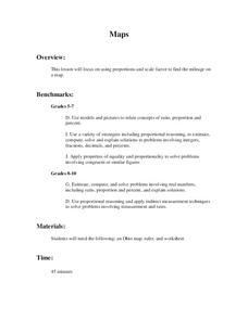
Maps
Learners figure out the mileage from one state to another using a map. In this map lesson, students look at the scale factor and turn it into a fraction. They measure the distance between two cities and use the proportion to find the...
Curated OER
Maps: U.S, Time Zones
Students perform various activities to demonstrate knowledge of time zones. They connect with an interactive map to discover what time zone they are in. They create clocks out of paper plates and simulate different time zones.
Curated OER
Mapping Crime
Students use data on break and enter crime incidents to make a map that prompt discussion about the spatial location of crime in the city, why it would occur in those places, and how residents may reduce crime.


