Curated OER
Dos mapas de Florida, el Caribe y parte de Sur America
What can maps tell us about the past? Find out with a Spanish lesson that incorporates geography. After examining maps individually, comparing two old maps of Spanish Florida and writing notes in the provided Venn diagram, pupils pair up...
Syracuse University
Erie Canal
While canals are not the way to travel today, in the first half of the nineteenth century, they were sometimes the best way to move goods and people. Scholars examine primary sources, including maps and pictures, to investigate the role...
University of California
Decolonization
The ripple effect from one small event can impact many others. Young historians research the ripple effect World War II had on decolonization in the second installment of an eight-part series. Through primary and secondary documents as...
US Holocaust Museum
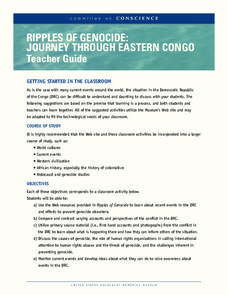
Ripples of Genocide: Journey through Eastern Congo
Could you locate the Democratic Republic of Congo on a map? Scholars investigate the genocide taking place in Eastern Congo. Groups explore web-based evidence as well as the Ripples in Genocide source to take a closer look at the issue....
Curated OER
Tears of Joy Theatre Presents Anansi the Spider
Accompany the African folktale, Anansi the Spider, with a collection of five lessons, each equipped with supplemental activities. Lessons offer multidisciplinary reinforcement in English language arts, social studies, science, and arts...
Curated OER
Places We Live
With a wonderful bibliography to support this lesson on Illinois, President Lincoln, and rural vs. urban settings, this activity is a motivating experience. The lesson begins with pupils exploring books, such as The Little House by...
Channel Islands Film
Cache: Lesson Plan 2 - Grades 4-6
Class members will dig this activity that has them trying their hand at recovering artifacts. Groups are assigned a section of a sandbox, carefully uncover the artifacts in their section, and then develop theories about who might have...
Huntington Library
The Corps of Discovery: The Lewis and Clark Expedition
Don't miss this fantastic comprehensive lesson plan on the Lewis and Clark Expedition, packed with instructional guidance, worksheets, map work, informational texts, and secondary source materials.
Global Oneness Project
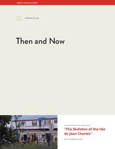
Then and Now
The devastating changes happening to the Native American inhabitants of an island off the coast of Louisiana are the topic of an informational lesson. After scholars break into groups to explore particular topics, they come back together...
Space Awareness
How To Travel On Earth Without Getting Lost
Have you ever wanted to travel the world? Take a virtual trip with a geography lesson that uses longitude and latitude, the position of the sun, an astronomy app, and a classroom globe.
Peace Corps
Family
Family traditions are the focus of a instructional activity that explores the lives of children in India and those in your classroom. Scholars examine their own family roles and traditions, then respond to an informative text detailing a...
Council for Economic Education
Banks and Credit Unions (Part 1)
Imagine you have money you want to save ... where do you put it? Pupils investigate the similarities and differences of banks and credit unions as they determine where exactly to place their hard-earned money. Through a WebQuest, they...
Global Oneness Project
Architectural Wonders
Angkor Wat, a UNESCO World Heritage Site located in Cambodia, is the focus of a lesson that asks class members to consider factors that could result in the destruction of these archeological treasures. Pupils listen to a lecture on the...
US Mint
Rename That State!
As Shakespeare famously wrote, "A rose by any other name would smell as sweet," but can the same be said for a state? In this elementary geography lesson, students are assigned specific states to research using the information they find...
Speak Truth to Power
Marina Pisklakova: Domestic Violence
After reading Article 3 of the Universal Declaration of Human Rights and discussing background material about domestic violence, class members create a map showing where in their community survivors of domestic violence can get help and...
University of Pennsylvania
Decoding Propaganda: J’Accuse…! vs. J’Accuse…!
Reading snail mail is a great way to go back into history and to understand others' points of view. The resource, the second in a five-part unit, covers the Dreyfus Affair. Scholars, working in two different groups, read one letter and...
Pace University
Urban Communities
Urban communities are the focus of a series of lessons created to meet specific needs using differentiated instruction. A pre-assessment designates scholars into three groups based on their ability level. Small groups take part in...
Curated OER
Where Am I: How to Read a Map
Third graders develop an understanding of maps. They explore what a map is, who uses maps, and how to use maps. Students investigate the compas rose. They create a compose rose which illustrates the cardinal directions. Students practice...
Curated OER
Where I Live…
Second graders explore their community. For this social studies lesson plan, 2nd graders use Internet tools to locate their community on a map and then locate where they live.
Curated OER
Maps
Maps, globes, and computer software aid young explorers as they locate state capitols, major cities, geographic features, and attractions for states they are researching. They then use desktop publishing software to create a map to share...
Smithsonian Institution
A Ticket to Philly—In 1769: Thinking about Cities, Then and Now
While cities had only a small fraction of the population in colonial America, they played a significant role in pre-revolutionary years, and this was certainly true for the largest city in the North American colonies: Philadelphia. Your...
Curated OER
Reading distance on maps
Eighth graders complete worksheets on reading the distance on maps in miles or kilometers. In this maps lesson plan, 8th graders use a calculator and ruler.
Curated OER
Africa: Introduction, Geography and Mapping
Young scholars study the geography of Africa through the use of maps. They locate, distinguish, and describe the relationships among varying regional and global patterns of geographic phenomena such as landforms, climate, and natural...
Curated OER
Mapping Out the Story
Discuss the reading comprehension strategy of summarization with your elementary schoolers! They read a chapter from their social studies textbook, Regions Near and Far, and create a map, or word web, for the chapter. They identify...


