Curated OER
Europe Mountain Ranges Map Quiz
For this online interactive geography quiz worksheet, students respond to 6 identification questions regarding the mountain ranges of Europe.
Curated OER
Canada Capitals Map Quiz
In this online interactive geography quiz worksheet, students respond to 14 identification questions regarding the Canadian capital cities.
Curated OER
Western Civilizations, Chapter 2: Gods and Empires in the Ancient Near East
Ancient Hebrew history comes to life through this online western civilizations tool, which follows history in detail from ancient origins to modern-day. Chapter two covers ancient eastern cultures, including beginnings of Hebrew...
Curated OER
Geography Application: The Cuban Missile Crisis
A complete activity! The class reads the provided text, then answers the 7 critical-thinking questions. Topics covered are interpreting informational text, reading comprehension, the Cuban Missile Crisis, and US Policy.
Curated OER
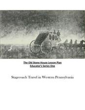
Old Stone House Lesson Plan
From stagecoach to railroad tracks, your class will discover how advancements in travel in the United States during the nineteenth century played an integral role in the industrialization and development of American society. The main...
Curated OER
Europe Discovers the Riches of India
Interpreting text is vital. Middle schoolers read a 1 page passage describing why Europe was so interested in colonizing India. After reading, they answer 8 comprehension questions.
Curated OER
Finding Your Way Around Wookey Hole Caves and Papermill
In this social studies worksheet, students examine a detailed map of a place called Wookey Hole Caves and Papermill. Students answer 8 questions about the map. It is not clear if the place on the map is real.
Curated OER
Rhode Island State Map
In this geography of Rhode Island worksheet, students color and label a map with the major cities and physical features. Students also study a U.S. map to learn the location of the state of Rhode Island.
Curated OER
Poland
In this Poland maps worksheet, 6th graders research, study and label the regions, states and landmarks on a map of Poland. Students hang their maps up on the wall.
Curated OER
Travel in Europe
In this European travel worksheet, students respond to 11 short answer questions that require them to research travel throughout the countries in Europe.
Curated OER
Globe Lesson 6 - Longitude - Grade 6+
In this longitude worksheet, learners read a 3-paragraph review of longitude and respond to 13 short answer questions.
Curated OER
Oceans and Seas Map Quiz
In this online interactive geography quiz worksheet, students respond to 15 identification questions about oceans and seas of the world.
Curated OER
Asia Crossword
In this geography worksheet, students complete a crossword puzzle on the continent of Asia. They answer 21 questions related to the type of government systems found, capital cities, deepest lake, and lowest population density.
Curated OER
Globe Lesson 5 - Latitude - Grade 6+
For this latitude worksheet, students read a 3-paragraph review of latitude and respond to 12 short answer questions.
Curated OER
Asia Lakes Map Quiz
In this online interactive geography quiz worksheet, students respond to 6 identification questions regarding specific lakes located in Asia.
Curated OER
River Clyde, Scotland Pictoral Map
In this River Clyde, Scotland geography worksheet, students study a detailed pictorial map. Students learn that the river is used for work and pleasure as they study locations on a labeled map. There are no questions.
Curated OER
The River Forth-- Pictorial Map of Scotland
In this River Forth in Scotland geography worksheet, students learn of important industries and settlements by studying the pictorial map. There are no questions to answer.
Curated OER
Historical Map - United States: The Changing Frontier
In these United States frontier worksheets, students study the map of the United States frontier for various sections of time in the history of the United States. Students then finish a crossword puzzle using the various parts of the...
Curated OER
Physical World Map
In this world map worksheet, students practice their geography skills as they label the 7 continents and 5 oceans. Teachers may use this physical map for various classroom activities
Curated OER
The UK and the Republic of Ireland
For this maps worksheet, students label the cities and countries of the United Kingdom and the Republic of Ireland and answer a short answer questions. Students complete 4 activities.
Curated OER
Partition of Africa Questions
In this colonial Africa worksheet, students study a map of Africa from 1885-1914. Students then respond to 9 short answer questions based on the information presented in the map.
Curated OER
U.S. geography for Children: New York
In this geography worksheet, 5th graders study the state of New York. Students follow the given directions to complete 5 tasks on the state map that is given.
Curated OER
Manifest Destiny Lesson Plan
Learners examine how Americans justified Westward Expansion. In this American history lesson, your historians will watch a Manifest Destiny Powerpoint presentation and discuss each slide then participate in a class...
Curated OER
Explorers
In this Explorers study guide worksheet, students respond to 3 questions regarding Prince Henry the Navigator, Vasco da Gama, Columbus, Magellan, Cortez, Pizarro, Drake, and Cartier. Answers are included.


